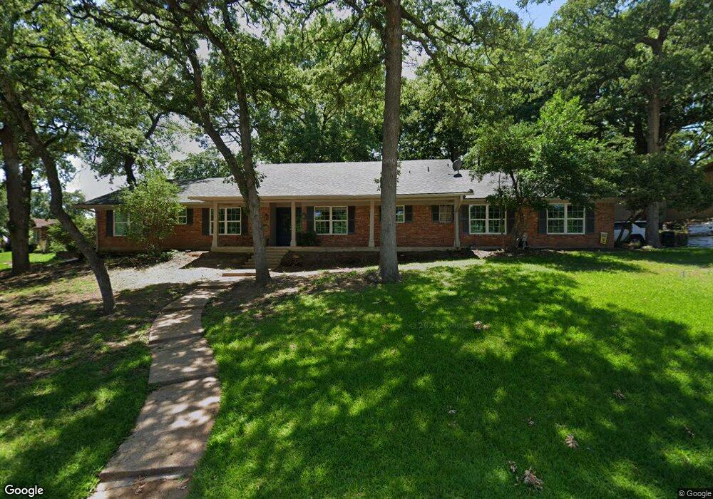
609 Royal Ridge Dr Denison, TX 75020
Estimated Value: $313,669 - $319,000
--
Bed
--
Bath
2,634
Sq Ft
$120/Sq Ft
Est. Value
About This Home
This home is located at 609 Royal Ridge Dr, Denison, TX 75020 and is currently estimated at $316,335, approximately $120 per square foot. 609 Royal Ridge Dr is a home located in Grayson County with nearby schools including Mayes Elementary School, Scott Middle School, and Denison High School.
Ownership History
Date
Name
Owned For
Owner Type
Purchase Details
Closed on
Oct 15, 2021
Sold by
Estate Of Ralph J Hagood Jr
Bought by
Means Patricia and Means Charles
Current Estimated Value
Home Financials for this Owner
Home Financials are based on the most recent Mortgage that was taken out on this home.
Original Mortgage
$166,250
Outstanding Balance
$151,604
Interest Rate
2.8%
Mortgage Type
New Conventional
Estimated Equity
$164,731
Create a Home Valuation Report for This Property
The Home Valuation Report is an in-depth analysis detailing your home's value as well as a comparison with similar homes in the area
Home Values in the Area
Average Home Value in this Area
Purchase History
| Date | Buyer | Sale Price | Title Company |
|---|---|---|---|
| Means Patricia | -- | None Available |
Source: Public Records
Mortgage History
| Date | Status | Borrower | Loan Amount |
|---|---|---|---|
| Open | Means Patricia | $166,250 |
Source: Public Records
Tax History Compared to Growth
Tax History
| Year | Tax Paid | Tax Assessment Tax Assessment Total Assessment is a certain percentage of the fair market value that is determined by local assessors to be the total taxable value of land and additions on the property. | Land | Improvement |
|---|---|---|---|---|
| 2025 | $5,844 | $315,743 | $89,429 | $226,314 |
| 2024 | $7,193 | $309,592 | $74,493 | $235,099 |
| 2023 | $5,561 | $305,182 | $0 | $0 |
| 2022 | $6,592 | $277,438 | $56,976 | $220,462 |
| 2021 | $6,069 | $240,616 | $47,572 | $193,044 |
| 2020 | $6,034 | $228,770 | $28,211 | $200,559 |
| 2019 | $6,173 | $224,344 | $28,211 | $196,133 |
| 2018 | $5,979 | $217,367 | $23,417 | $193,950 |
| 2017 | $5,481 | $203,483 | $18,254 | $185,229 |
| 2016 | $4,983 | $187,265 | $16,964 | $170,301 |
| 2015 | $3,313 | $162,764 | $14,382 | $148,382 |
| 2014 | $3,348 | $147,208 | $14,382 | $132,826 |
Source: Public Records
Map
Nearby Homes
- 600 Ambassador St
- 612 Ambassador St
- 1731 W Crawford St
- 901 Old State Ln
- 2105 W Crawford St
- 12 Ambassador Ct
- 1508 W Shepherd St
- TBD W Crawford St
- 1730 W Hull St
- 2107 Rivercrest Cir
- 1531 W Main St
- 901 Waterloo Lake Dr
- 931 Waterloo Lake Dr
- 1609 W Woodard St
- 2521 Brookhaven Dr
- 1319 W Morgan St
- 509 Bryan Dr
- 1326 W Crawford St
- 501 S Eddy Ave
- 2603 Brookhaven Dr
- 607 Royal Ridge Dr
- 600 Queens Rd
- 618 Royal Ridge Dr
- 616 Royal Ridge Dr
- 604 Queens Rd
- 612 Royal Ridge Dr
- 605 Royal Ridge Dr
- 610 Royal Ridge Dr
- 608 Royal Ridge Dr
- 606 Queens Rd
- 620 Royal Ridge Dr
- 604 Ambassador St
- 603 Queens Rd
- 603 Royal Ridge Dr
- 605 Queens Rd
- 604 Royal Ridge Dr
- 601 Queens Rd
- 608 Queens Rd
- 607 Queens Rd
- 602 Royal Ridge Dr