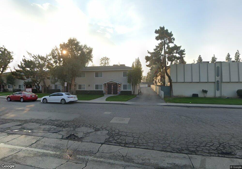
609 Taylor St Unit 26 Bakersfield, CA 93309
Southwest Bakersfield NeighborhoodEstimated Value: $173,994 - $209,000
2
Beds
2
Baths
884
Sq Ft
$215/Sq Ft
Est. Value
About This Home
This home is located at 609 Taylor St Unit 26, Bakersfield, CA 93309 and is currently estimated at $189,999, approximately $214 per square foot. 609 Taylor St Unit 26 is a home located in Kern County with nearby schools including Wayne Van Horn Elementary School, Fred L. Thompson Junior High School, and West High School.
Ownership History
Date
Name
Owned For
Owner Type
Purchase Details
Closed on
Apr 15, 2024
Sold by
Treasurer And Tax Collector Of Kern Coun
Bought by
Malih Fadi
Current Estimated Value
Purchase Details
Closed on
Jan 24, 2011
Sold by
Federal Home Loan Mortgage Corporation
Bought by
Yokoyama Larry P and Yokoyama Kimberly D
Purchase Details
Closed on
Sep 8, 2010
Sold by
Donaldson Charles W and Donaldson Mary K
Bought by
Federal Home Loan Mortgage Corporation
Purchase Details
Closed on
Mar 12, 2007
Sold by
Taylor Street Condos
Bought by
Donaldson Charles W and Donaldson Mary K
Home Financials for this Owner
Home Financials are based on the most recent Mortgage that was taken out on this home.
Original Mortgage
$105,000
Interest Rate
6.29%
Mortgage Type
Purchase Money Mortgage
Create a Home Valuation Report for This Property
The Home Valuation Report is an in-depth analysis detailing your home's value as well as a comparison with similar homes in the area
Home Values in the Area
Average Home Value in this Area
Purchase History
| Date | Buyer | Sale Price | Title Company |
|---|---|---|---|
| Malih Fadi | $165,600 | None Listed On Document | |
| Yokoyama Larry P | $30,000 | Ticor Title Riverside | |
| Federal Home Loan Mortgage Corporation | $37,910 | Accommodation | |
| Donaldson Charles W | $140,000 | Chicago Title Company |
Source: Public Records
Mortgage History
| Date | Status | Borrower | Loan Amount |
|---|---|---|---|
| Previous Owner | Donaldson Charles W | $105,000 |
Source: Public Records
Tax History Compared to Growth
Tax History
| Year | Tax Paid | Tax Assessment Tax Assessment Total Assessment is a certain percentage of the fair market value that is determined by local assessors to be the total taxable value of land and additions on the property. | Land | Improvement |
|---|---|---|---|---|
| 2025 | $867 | $168,912 | $51,000 | $117,912 |
| 2024 | $846 | $37,671 | $6,275 | $31,396 |
| 2023 | $846 | $36,933 | $6,152 | $30,781 |
| 2022 | $809 | $36,210 | $6,032 | $30,178 |
| 2021 | $742 | $35,501 | $5,914 | $29,587 |
| 2020 | $740 | $35,138 | $5,854 | $29,284 |
| 2019 | $731 | $35,138 | $5,854 | $29,284 |
| 2018 | $708 | $33,776 | $5,628 | $28,148 |
| 2017 | $686 | $33,115 | $5,518 | $27,597 |
| 2016 | $654 | $32,466 | $5,410 | $27,056 |
| 2015 | $647 | $31,979 | $5,329 | $26,650 |
| 2014 | $635 | $31,353 | $5,225 | $26,128 |
Source: Public Records
Map
Nearby Homes
- 5101 Hunter Ave Unit 2
- 613 Fiorito St
- 609 Bermuda St
- 4900 Nordic Dr Unit 6
- 924 Bermuda St
- 409 Bermuda St
- 3812 Biancnhi Way
- 4801 Belle Terrace Unit C
- 4700 Nordic Dr Unit I
- 704 Cherry Hills Dr
- 5705 Burke Way
- 900 Cherry Hills Dr
- 504 Cherry Hills Dr
- 917 Cherry Hills Dr
- 409 Cherry Hills Dr
- 5812 Burke Way
- 4408 Fishering Dr
- 400 Cherry Hills Dr
- 507 McDonald Way
- 800 Pebble Beach Dr
- 609 Taylor St Unit 6
- 609 Taylor St Unit 21
- 609 Taylor St Unit 1
- 609 Taylor St Unit 9
- 609 Taylor St Unit 25
- 609 Taylor St Unit 2
- 609 Taylor St Unit 10
- 609 Taylor St Unit 5
- 609 Taylor St Unit 23
- 609 Taylor St
- 609 Taylor St
- 609 Taylor St
- 609 Taylor St
- 609 Taylor St
- 609 Taylor St
- 609 Taylor St
- 609 Taylor St
- 609 Taylor St
- 609 Taylor St
- 609 Taylor St