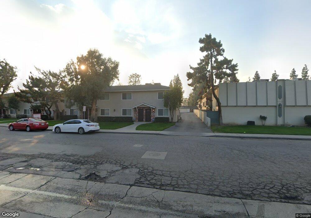
609 Taylor St Bakersfield, CA 93309
Southwest Bakersfield NeighborhoodEstimated Value: $223,248 - $228,000
2
Beds
2
Baths
442
Sq Ft
$510/Sq Ft
Est. Value
About This Home
This home is located at 609 Taylor St, Bakersfield, CA 93309 and is currently estimated at $225,624, approximately $510 per square foot. 609 Taylor St is a home located in Kern County with nearby schools including Wayne Van Horn Elementary School, Fred L. Thompson Junior High School, and West High School.
Ownership History
Date
Name
Owned For
Owner Type
Purchase Details
Closed on
Oct 9, 2024
Sold by
Breckenridge Property Fund 2016 Llc
Bought by
Ceron Carlos Roberto and Araque Ana Careny
Current Estimated Value
Home Financials for this Owner
Home Financials are based on the most recent Mortgage that was taken out on this home.
Original Mortgage
$180,000
Outstanding Balance
$178,108
Interest Rate
6.35%
Mortgage Type
New Conventional
Estimated Equity
$47,516
Purchase Details
Closed on
Jun 11, 2024
Sold by
Lebeau Thelen Llp
Bought by
Breckenridge Property Fund 2016 Llc
Purchase Details
Closed on
Sep 27, 2008
Sold by
Taylor Street Condos Llc
Bought by
Lott Terrail and Lott Mashay
Create a Home Valuation Report for This Property
The Home Valuation Report is an in-depth analysis detailing your home's value as well as a comparison with similar homes in the area
Home Values in the Area
Average Home Value in this Area
Purchase History
| Date | Buyer | Sale Price | Title Company |
|---|---|---|---|
| Ceron Carlos Roberto | $225,000 | Fidelity National Title | |
| Breckenridge Property Fund 2016 Llc | $147,200 | None Listed On Document | |
| Lott Terrail | $84,000 | Chicago Title Company |
Source: Public Records
Mortgage History
| Date | Status | Borrower | Loan Amount |
|---|---|---|---|
| Open | Ceron Carlos Roberto | $180,000 | |
| Closed | Lott Terrail | $0 |
Source: Public Records
Tax History
| Year | Tax Paid | Tax Assessment Tax Assessment Total Assessment is a certain percentage of the fair market value that is determined by local assessors to be the total taxable value of land and additions on the property. | Land | Improvement |
|---|---|---|---|---|
| 2025 | $1,155 | $225,000 | $50,000 | $175,000 |
| 2024 | $1,146 | $68,500 | $15,000 | $53,500 |
| 2023 | $1,146 | $68,500 | $15,000 | $53,500 |
| 2022 | $1,113 | $68,500 | $15,000 | $53,500 |
| 2021 | $1,057 | $68,500 | $15,000 | $53,500 |
| 2020 | $1,060 | $68,500 | $15,000 | $53,500 |
| 2019 | $1,062 | $68,500 | $15,000 | $53,500 |
| 2018 | $1,036 | $68,500 | $15,000 | $53,500 |
| 2017 | $1,024 | $68,500 | $15,000 | $53,500 |
| 2016 | $828 | $55,000 | $10,000 | $45,000 |
| 2015 | $659 | $40,000 | $10,000 | $30,000 |
| 2014 | $620 | $37,000 | $10,000 | $27,000 |
Source: Public Records
Map
Nearby Homes
- 700 New Stine Rd Unit 14
- 705 New Stine Rd
- 5401 Burning Tree Ct
- 517 New Stine Rd
- 705 Bermuda St
- 513 Bermuda St
- 600 Lansing Dr Unit 10
- 416 Bermuda St
- 5000 Nordic Dr Unit 15
- 4900 Nordic Dr Unit 6
- 708 Cherry Hills Dr
- 704 Cherry Hills Dr
- 4629 Fishering Dr
- 5705 Burke Way
- 409 Bermuda St
- 4801 Belle Terrace Unit C
- 917 Cherry Hills Dr
- 504 Cherry Hills Dr
- 409 Cherry Hills Dr
- 912 Valhalla Dr
- 609 Taylor St Unit 6
- 609 Taylor St Unit 21
- 609 Taylor St Unit 1
- 609 Taylor St Unit 9
- 609 Taylor St Unit 25
- 609 Taylor St Unit 26
- 609 Taylor St Unit 2
- 609 Taylor St Unit 10
- 609 Taylor St Unit 5
- 609 Taylor St Unit 23
- 609 Taylor St
- 609 Taylor St
- 609 Taylor St
- 609 Taylor St
- 609 Taylor St
- 609 Taylor St
- 609 Taylor St
- 609 Taylor St
- 609 Taylor St
- 609 Taylor St
Your Personal Tour Guide
Ask me questions while you tour the home.