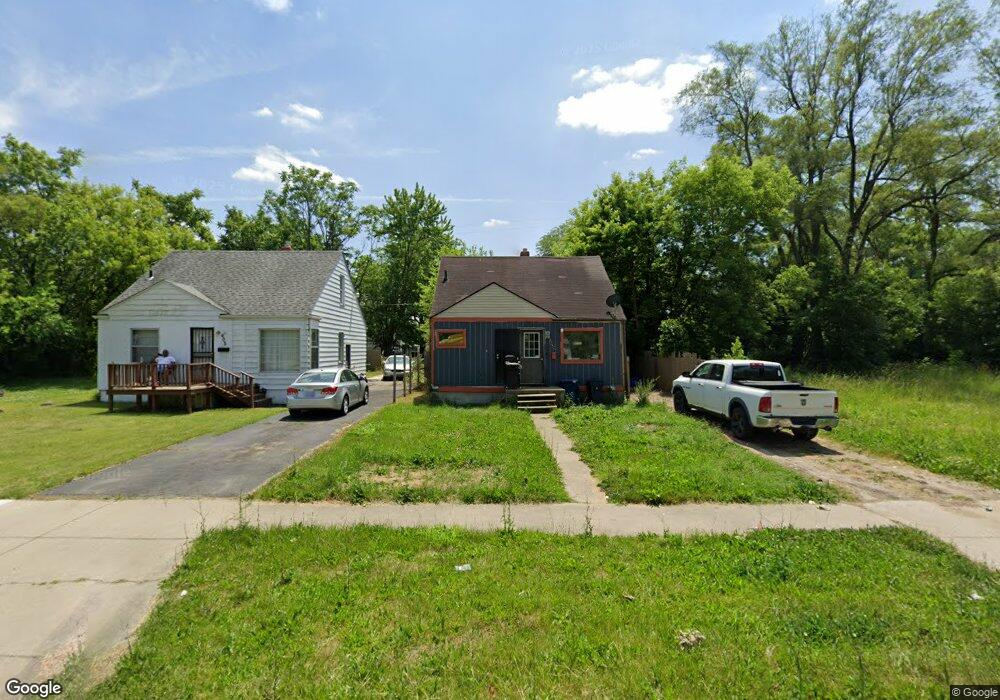
609 W Pierson Rd Flint, MI 48505
King Avenue Plus NeighborhoodEstimated Value: $39,000 - $63,630
3
Beds
1
Bath
870
Sq Ft
$62/Sq Ft
Est. Value
About This Home
This home is located at 609 W Pierson Rd, Flint, MI 48505 and is currently estimated at $53,908, approximately $61 per square foot. 609 W Pierson Rd is a home located in Genesee County with nearby schools including Brownell STEM Academy, The New Standard Academy, and Eagle's Nest Academy.
Ownership History
Date
Name
Owned For
Owner Type
Purchase Details
Closed on
Jan 29, 2019
Sold by
Litricia Courch
Bought by
Grayer Deon Ponte
Current Estimated Value
Purchase Details
Closed on
Nov 13, 2015
Sold by
Marsh Dymitrius T
Bought by
Couch Liticia
Purchase Details
Closed on
Feb 15, 2011
Sold by
Claypol Bruce W
Bought by
Marsh Dymetrius S
Purchase Details
Closed on
Feb 22, 2008
Sold by
Cruz Amada
Bought by
Claypool Bruce Wendall
Purchase Details
Closed on
Nov 30, 2007
Sold by
Kildee Daniel T and Genesee County Treasurer
Bought by
Cruz Amada
Create a Home Valuation Report for This Property
The Home Valuation Report is an in-depth analysis detailing your home's value as well as a comparison with similar homes in the area
Home Values in the Area
Average Home Value in this Area
Purchase History
| Date | Buyer | Sale Price | Title Company |
|---|---|---|---|
| Grayer Deon Ponte | -- | None Available | |
| Couch Liticia | -- | Attorney | |
| Marsh Dymetrius S | $6,000 | None Available | |
| Claypool Bruce Wendall | $3,400 | None Available | |
| Cruz Amada | $500 | None Available |
Source: Public Records
Tax History
| Year | Tax Paid | Tax Assessment Tax Assessment Total Assessment is a certain percentage of the fair market value that is determined by local assessors to be the total taxable value of land and additions on the property. | Land | Improvement |
|---|---|---|---|---|
| 2025 | $862 | $11,300 | $0 | $0 |
| 2024 | $586 | $11,200 | $0 | $0 |
| 2023 | $583 | $8,700 | $0 | $0 |
| 2022 | $0 | $7,200 | $0 | $0 |
| 2021 | $598 | $6,900 | $0 | $0 |
| 2020 | $552 | $6,000 | $0 | $0 |
| 2019 | $574 | $6,500 | $0 | $0 |
| 2018 | $588 | $7,100 | $0 | $0 |
| 2017 | $589 | $0 | $0 | $0 |
| 2016 | $717 | $0 | $0 | $0 |
| 2015 | -- | $0 | $0 | $0 |
| 2014 | -- | $0 | $0 | $0 |
| 2012 | -- | $9,000 | $0 | $0 |
Source: Public Records
Map
Nearby Homes
- 525 W Pulaski Ave
- 5416 Dupont St
- 4808 Edwards Ave
- 510 W Bishop Ave
- 329 W Baltimore Blvd
- 5714 Suburban Ct
- 5610 Baldwin Blvd
- 702/718 W Flint Park Blvd
- 5518 Winthrop Blvd
- 5502 Susan St
- 606 W Stewart Ave
- 124 W Flint Park Blvd
- 536 W Home Ave
- 4310 Berger Dr
- 4306 Berger Dr
- 610 W Austin Ave
- 618 W Austin Ave
- 5413 Fleming Rd
- 1518 Randy Ct
- 518 W Ruth Ave
- 613 W Pierson Rd
- 605 W Pierson Rd
- 617 W Pierson Rd
- 601 W Pierson Rd
- 610 W Pulaski Ave
- 606 W Pulaski Ave
- 618 W Pulaski Ave
- 621 W Pierson Rd
- 602 W Pulaski Ave
- 549 W Pierson Rd
- 550 W Pulaski Ave
- 622 W Pulaski Ave
- 625 W Pierson Rd
- 546 W Pulaski Ave
- 626 W Pulaski Ave
- 629 W Pierson Rd
- 608 W Pierson Rd
- 602 W Pierson Rd
- 630 W Pulaski Ave
- 612 W Pierson Rd
Your Personal Tour Guide
Ask me questions while you tour the home.