Estimated Value: $133,235 - $163,000
Studio
--
Bath
912
Sq Ft
$162/Sq Ft
Est. Value
About This Home
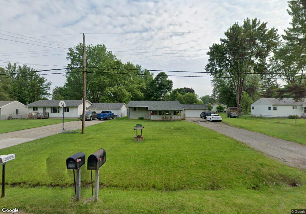
This home is located at 6091 E Pierson Rd, Flint, MI 48506 and is currently estimated at $147,309, approximately $161 per square foot. 6091 E Pierson Rd is a home located in Genesee County with nearby schools including Weston Elementary School, Kate Dowdall Elementary School, and Leota Fiedler Elementary School.
Ownership History
Date
Name
Owned For
Owner Type
Purchase Details
Closed on
Jul 22, 2024
Sold by
Scott Brenda
Bought by
Scott Brenda and Guldi Erika
Current Estimated Value
Purchase Details
Closed on
Jul 14, 2015
Sold by
Defoy Craig
Bought by
Scott Brenda and Defoy Brenda
Purchase Details
Closed on
Jan 28, 2002
Sold by
Rutherford Brenda Louise
Bought by
Rutherford Brenda Louise and Defoy Craig L
Purchase Details
Closed on
Apr 6, 1999
Sold by
Titmus Shirley A and Titmus Richard W
Bought by
Rutherford Brenda Louise
Create a Home Valuation Report for This Property
The Home Valuation Report is an in-depth analysis detailing your home's value as well as a comparison with similar homes in the area
Home Values in the Area
Average Home Value in this Area
Purchase History
| Date | Buyer | Sale Price | Title Company |
|---|---|---|---|
| Scott Brenda | -- | None Listed On Document | |
| Scott Brenda | -- | Attorney | |
| Rutherford Brenda Louise | -- | Lawyers Title Insurance Corp | |
| Rutherford Brenda Louise | $39,000 | Lawyers Title |
Source: Public Records
Tax History
| Year | Tax Paid | Tax Assessment Tax Assessment Total Assessment is a certain percentage of the fair market value that is determined by local assessors to be the total taxable value of land and additions on the property. | Land | Improvement |
|---|---|---|---|---|
| 2025 | $1,643 | $61,400 | $0 | $0 |
| 2024 | $292 | $56,600 | $0 | $0 |
| 2023 | $278 | $50,700 | $0 | $0 |
| 2022 | $979 | $47,700 | $0 | $0 |
| 2021 | $971 | $43,300 | $0 | $0 |
| 2020 | $255 | $40,000 | $0 | $0 |
| 2019 | $250 | $35,600 | $0 | $0 |
| 2018 | $922 | $32,400 | $0 | $0 |
| 2017 | $895 | $31,300 | $0 | $0 |
| 2016 | $892 | $30,200 | $0 | $0 |
| 2015 | $692 | $28,600 | $0 | $0 |
| 2014 | $231 | $25,600 | $0 | $0 |
| 2012 | -- | $19,300 | $19,300 | $0 |
Source: Public Records
Map
Nearby Homes
- 6054 E Pierson Rd
- 4062 N Belsay Rd
- 3365 Eastdale Dr
- 6161 Finch Ln
- 6443 Richfield Rd
- 3296 Mills Acres St
- 3485 N Vassar Rd
- 3179 Gehring Dr
- 3148 Gehring Dr
- 3267 Mills Acres St
- 6363 Bluejay Dr
- 5067 Paro Dr
- 0 Whisper Ridge Ct
- 4435 Meadowbrook Dr
- 4413 Esta Dr
- 6099 Brookwood Dr
- 3246 Comer Dr
- 6076 E Carpenter Rd
- 0 Sugar Maple Farms Unit 50195365
- 4455 N Genesee Rd
- 6085 E Pierson Rd
- 6101 E Pierson Rd
- 4027 Independence Dr
- 6077 E Pierson Rd
- 6084 Freedom Ln
- 6067 E Pierson Rd
- 6078 Freedom Ln
- 4037 Independence Dr
- 6115 E Pierson Rd
- 6070 Freedom Ln
- 4036 Independence Dr
- 6059 E Pierson Rd
- 4028 Independence Dr
- 6078 E Pierson Rd
- 4042 Independence Dr
- 6123 E Pierson Rd
- 6114 E Pierson Rd
- 6064 Freedom Ln
- 6051 E Pierson Rd
- 4052 Independence Dr
Your Personal Tour Guide
Ask me questions while you tour the home.