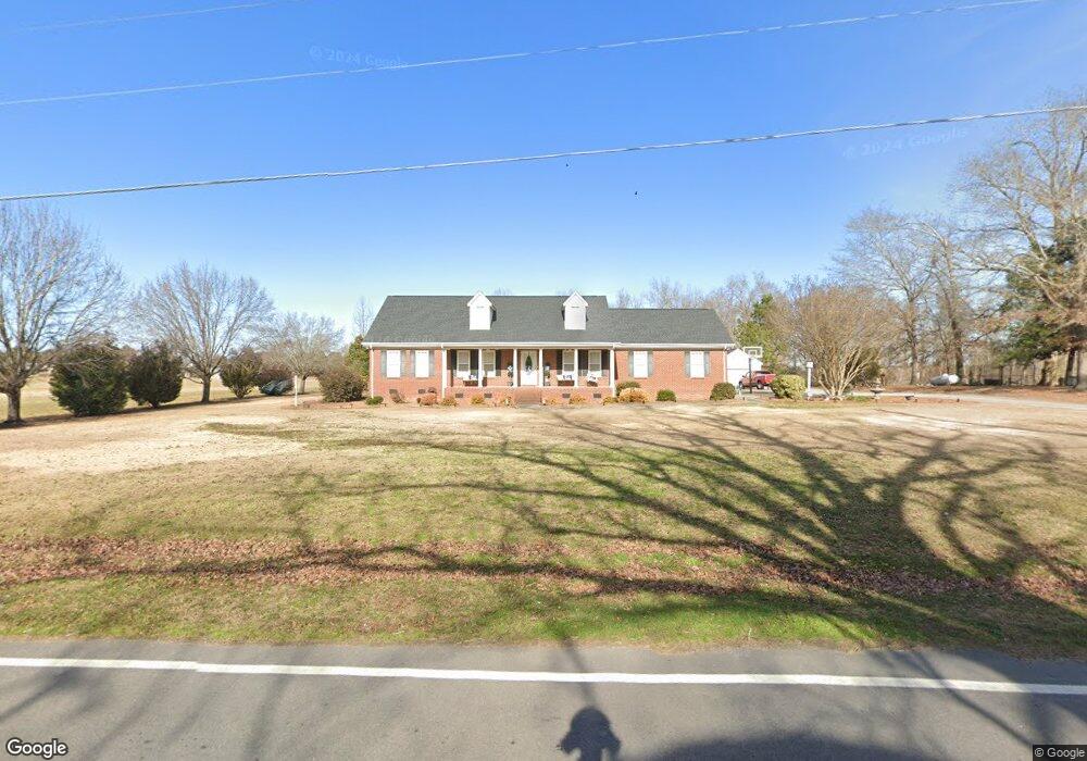
6092 Benson Hardee Rd Benson, NC 27504
Pleasant Grove NeighborhoodEstimated Value: $339,000 - $394,379
3
Beds
2
Baths
2,269
Sq Ft
$160/Sq Ft
Est. Value
About This Home
This home is located at 6092 Benson Hardee Rd, Benson, NC 27504 and is currently estimated at $362,095, approximately $159 per square foot. 6092 Benson Hardee Rd is a home located in Johnston County with nearby schools including Benson Elementary School, Benson Middle School, and West Johnston High School.
Ownership History
Date
Name
Owned For
Owner Type
Purchase Details
Closed on
Sep 16, 2025
Sold by
Honeycutt Stevie R and Honeycutt Amy H
Bought by
Honeycutt Kevin A and Honeycutt Janie M
Current Estimated Value
Purchase Details
Closed on
Jan 25, 2011
Sold by
Honeycutt Stevie R and Honeycutt Amy Hardee
Bought by
Honeycutt Stevie R and Honeycutt Amy Hardee
Create a Home Valuation Report for This Property
The Home Valuation Report is an in-depth analysis detailing your home's value as well as a comparison with similar homes in the area
Home Values in the Area
Average Home Value in this Area
Purchase History
| Date | Buyer | Sale Price | Title Company |
|---|---|---|---|
| Honeycutt Kevin A | -- | None Listed On Document | |
| Honeycutt Stevie R | -- | None Available |
Source: Public Records
Tax History
| Year | Tax Paid | Tax Assessment Tax Assessment Total Assessment is a certain percentage of the fair market value that is determined by local assessors to be the total taxable value of land and additions on the property. | Land | Improvement |
|---|---|---|---|---|
| 2025 | $2,105 | $331,360 | $96,920 | $234,440 |
| 2024 | $1,605 | $198,000 | $46,040 | $151,960 |
| 2023 | $1,545 | $198,000 | $46,040 | $151,960 |
| 2022 | $1,624 | $198,000 | $46,040 | $151,960 |
| 2021 | $1,585 | $198,000 | $46,040 | $151,960 |
| 2020 | $1,645 | $198,000 | $46,040 | $151,960 |
| 2019 | $1,645 | $198,000 | $46,040 | $151,960 |
| 2018 | $1,673 | $196,530 | $36,350 | $160,180 |
| 2017 | $1,673 | $196,530 | $36,350 | $160,180 |
| 2016 | $1,673 | $196,530 | $36,350 | $160,180 |
| 2015 | $1,671 | $196,530 | $36,350 | $160,180 |
| 2014 | $1,671 | $196,530 | $36,350 | $160,180 |
Source: Public Records
Map
Nearby Homes
- 18 Cedar Run Ct Unit 11
- 285 Trail
- 24 Sue Dr
- 50 Trail Ridge Dr
- 4221 Zacks Mill Rd
- 69 Andorra Place
- 57 Andorra Place
- 81 Pinon Dr
- 821 Penny Rd
- 526 Aquilla Rd
- 28 Stellars Sea
- 28 Sea Stellars Ct
- 94 Starry Sky Dr
- 139 Bounty Cir
- 35 Evalice Ct
- 1471 Aquilla Rd
- 299 Starry Sky Dr
- 323 Aquilla Rd Unit Z
- 0 Massengill Pond Rd
- 206 West Rd
- 6064 Benson Hardee Rd
- 6093 Benson Hardee Rd
- 6033 Benson Hardee Rd
- 6011 Benson Hardee Rd
- 5992 Benson Hardee Rd
- 6186 Benson Hardee Rd
- 6061 Old Fairground Rd
- 5855 Old Fairground Rd
- 6040 Old Fairground Rd
- 5811 Old Fairground Rd
- 6088 Old Fairground Rd
- 5771 Old Fairground Rd
- 5892 Benson Hardee Rd
- 6210 Benson Hardee Rd
- 5800 Old Fairground Rd
- 6235 Benson Hardee Rd
- 5755 Old Fairground Rd
- 6237 Benson Hardee Rd
- 5734 Old Fairground Rd
- 5734 Old Fairground Rd Unit Lot 1
Your Personal Tour Guide
Ask me questions while you tour the home.