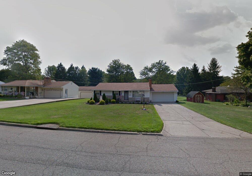
6095 Frontier Dr Youngstown, OH 44514
Estimated Value: $192,127 - $252,000
3
Beds
1
Bath
1,232
Sq Ft
$182/Sq Ft
Est. Value
About This Home
This home is located at 6095 Frontier Dr, Youngstown, OH 44514 and is currently estimated at $224,782, approximately $182 per square foot. 6095 Frontier Dr is a home located in Mahoning County with nearby schools including Poland Union Elementary School, Poland Middle School, and Poland Seminary High School.
Ownership History
Date
Name
Owned For
Owner Type
Purchase Details
Closed on
Mar 26, 2003
Sold by
Joseph Mark A and Joseph Jana
Bought by
Mrofchak George E and Bucci Jo Ellen M
Current Estimated Value
Home Financials for this Owner
Home Financials are based on the most recent Mortgage that was taken out on this home.
Original Mortgage
$104,500
Outstanding Balance
$43,545
Interest Rate
5.95%
Estimated Equity
$181,237
Purchase Details
Closed on
Jun 15, 1989
Bought by
Joseph Mark and Joseph Jeffrey
Create a Home Valuation Report for This Property
The Home Valuation Report is an in-depth analysis detailing your home's value as well as a comparison with similar homes in the area
Purchase History
| Date | Buyer | Sale Price | Title Company |
|---|---|---|---|
| Mrofchak George E | $110,000 | -- | |
| Joseph Mark | -- | -- |
Source: Public Records
Mortgage History
| Date | Status | Borrower | Loan Amount |
|---|---|---|---|
| Open | Mrofchak George E | $104,500 |
Source: Public Records
Tax History
| Year | Tax Paid | Tax Assessment Tax Assessment Total Assessment is a certain percentage of the fair market value that is determined by local assessors to be the total taxable value of land and additions on the property. | Land | Improvement |
|---|---|---|---|---|
| 2025 | $2,638 | $55,400 | $10,210 | $45,190 |
| 2024 | $2,717 | $55,400 | $10,210 | $45,190 |
| 2023 | $2,654 | $55,400 | $10,210 | $45,190 |
| 2022 | $2,265 | $39,510 | $10,210 | $29,300 |
| 2021 | $2,160 | $39,510 | $10,210 | $29,300 |
| 2020 | $2,170 | $39,510 | $10,210 | $29,300 |
| 2019 | $1,954 | $33,100 | $10,210 | $22,890 |
| 2018 | $1,831 | $33,100 | $10,210 | $22,890 |
| 2017 | $1,909 | $33,100 | $10,210 | $22,890 |
| 2016 | $1,991 | $34,260 | $10,210 | $24,050 |
| 2015 | $1,948 | $34,260 | $10,210 | $24,050 |
| 2014 | $1,955 | $34,260 | $10,210 | $24,050 |
| 2013 | $1,930 | $34,260 | $10,210 | $24,050 |
Source: Public Records
Map
Nearby Homes
- 6074 Frontier Dr
- 2751 Saginaw Dr
- 172 Lakeshore Dr
- 6534 Diana Dr
- 0 Clingan Rd Unit 4461196
- 3081 Heatherbrae Dr
- 6137 Acatello Place
- 2350 Hamilton Ave
- 118 N Main St
- 2301 Lyon Blvd
- 2370 Lyon Blvd
- 232 Edna St
- 50 College St
- 2035 Woodward Ave
- 6695 Clingan Rd Unit 24
- 6695 Clingan Rd Unit 10
- 6695 Clingan Rd Unit 32
- 6695 Clingan Rd Unit 4
- 43 Greystone
- 112 N Lima Rd
- 6079 Frontier Dr
- 6105 Circle Dr
- 6161 Circle Dr
- 6179 Circle Dr
- 6088 Frontier Dr
- 6104 Circle Dr
- 6189 Circle Dr
- 6047 Frontier Dr
- 6130 Circle Dr
- 6120 Circle Dr
- 6116 Circle Dr
- 6142 Circle Dr
- 6112 Circle Dr
- 6108 Circle Dr
- 6058 Frontier Dr
- 6033 Frontier Dr
- 6199 Circle Dr
- 6042 Frontier Dr
- 6174 Circle Dr
- 6162 Circle Dr
Your Personal Tour Guide
Ask me questions while you tour the home.