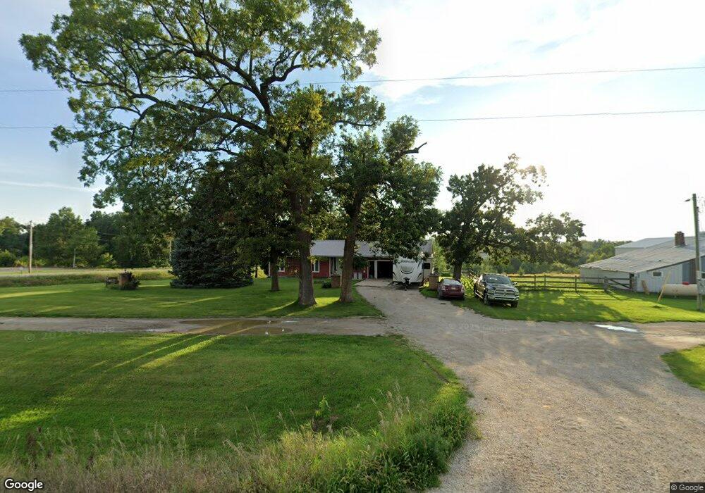
6099 32nd Ave Shellsburg, IA 52332
Estimated Value: $368,000 - $494,943
4
Beds
3
Baths
1,610
Sq Ft
$255/Sq Ft
Est. Value
About This Home
This home is located at 6099 32nd Ave, Shellsburg, IA 52332 and is currently estimated at $410,986, approximately $255 per square foot. 6099 32nd Ave is a home located in Benton County with nearby schools including Shellsburg Elementary School, Vinton-Shellsburg Middle School, and Vinton-Shellsburg High School.
Ownership History
Date
Name
Owned For
Owner Type
Purchase Details
Closed on
Sep 1, 2017
Sold by
Voss James T and Estate Of Daniel T Voss
Bought by
Voss James T and Vosss Kari L
Current Estimated Value
Home Financials for this Owner
Home Financials are based on the most recent Mortgage that was taken out on this home.
Original Mortgage
$150,000
Interest Rate
3.93%
Mortgage Type
New Conventional
Create a Home Valuation Report for This Property
The Home Valuation Report is an in-depth analysis detailing your home's value as well as a comparison with similar homes in the area
Purchase History
| Date | Buyer | Sale Price | Title Company |
|---|---|---|---|
| Voss James T | -- | None Available |
Source: Public Records
Mortgage History
| Date | Status | Borrower | Loan Amount |
|---|---|---|---|
| Closed | Voss James T | $150,000 |
Source: Public Records
Tax History
| Year | Tax Paid | Tax Assessment Tax Assessment Total Assessment is a certain percentage of the fair market value that is determined by local assessors to be the total taxable value of land and additions on the property. | Land | Improvement |
|---|---|---|---|---|
| 2025 | $5,036 | $425,400 | $113,600 | $311,800 |
| 2024 | $5,036 | $395,300 | $106,700 | $288,600 |
| 2023 | $4,492 | $395,300 | $106,700 | $288,600 |
| 2022 | $4,438 | $302,800 | $85,400 | $217,400 |
| 2021 | $4,438 | $302,800 | $85,400 | $217,400 |
| 2020 | $4,356 | $308,500 | $54,700 | $253,800 |
| 2019 | $3,602 | $308,500 | $54,700 | $253,800 |
| 2018 | $3,308 | $289,300 | $49,100 | $240,200 |
| 2017 | $3,102 | $239,900 | $49,100 | $190,800 |
| 2016 | $3,018 | $217,900 | $44,600 | $173,300 |
| 2015 | $3,018 | $217,900 | $44,600 | $173,300 |
| 2014 | $2,976 | $215,000 | $0 | $0 |
Source: Public Records
Map
Nearby Homes
- 2541 61st Street Ln Unit Lot 9
- 0 31st Ave
- 3090 59th Saint Trail
- 6240 33rd Avenue Dr
- 3299 58th Street Dr
- 208 Northgate St NW
- 201 Grove St NW
- 401 Main St NW
- 101 Meadow Dr
- 103 Meadow Dr
- 105 Meadow Dr
- 804 Fairway Dr
- 700 Sunset Blvd
- 301 Wildcat Ct
- 4260 Indian Boundary Rd
- 2740 61st Street Ln
- 2713 61st Street Ln
- 4505 Urbana Rd Unit 41.2 ac.
- 4505 Urbana Rd Unit 76.2 ac.
- 0 Palo Rd
- 6086 32nd Ave
- 3176 61st Street Ln
- 3176 61st St
- 3175 61st Street Ln
- 3207 61st Street Ln
- 6081 32nd Ave
- 3160 61st Street Ln
- 6105 32nd Ave
- 3167 61st Street Ln
- 3162 61st Street Ln
- 6080 32nd Ave
- 3219 61st Street Ln
- 6079 32nd Ave
- 3221 61st Street Ln
- 3156 61st Street Ln
- 6111 32nd Ave
- 6074 32nd Ave
- 6075 32nd Ave
- 6121 32nd Ave
- 3149 61st Street Ln
Your Personal Tour Guide
Ask me questions while you tour the home.