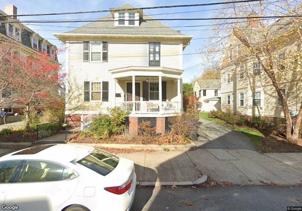
60A E Manning St Providence, RI 02906
Wayland NeighborhoodEstimated Value: $915,306 - $1,028,000
4
Beds
4
Baths
3,336
Sq Ft
$291/Sq Ft
Est. Value
About This Home
This home is located at 60A E Manning St, Providence, RI 02906 and is currently estimated at $971,653, approximately $291 per square foot. 60A E Manning St is a home located in Providence County with nearby schools including Wheeler School, French-American School of Rhode Island, and Moses Brown School.
Ownership History
Date
Name
Owned For
Owner Type
Purchase Details
Closed on
Jul 21, 2015
Sold by
Scotti Francesco M
Bought by
Declippel Geoffroy B and Rozen Kareen
Current Estimated Value
Home Financials for this Owner
Home Financials are based on the most recent Mortgage that was taken out on this home.
Original Mortgage
$417,000
Outstanding Balance
$161,567
Interest Rate
3.88%
Mortgage Type
New Conventional
Estimated Equity
$810,086
Create a Home Valuation Report for This Property
The Home Valuation Report is an in-depth analysis detailing your home's value as well as a comparison with similar homes in the area
Home Values in the Area
Average Home Value in this Area
Purchase History
| Date | Buyer | Sale Price | Title Company |
|---|---|---|---|
| Declippel Geoffroy B | $660,000 | -- | |
| Declippel Geoffroy B | $660,000 | -- |
Source: Public Records
Mortgage History
| Date | Status | Borrower | Loan Amount |
|---|---|---|---|
| Open | Declippel Geoffroy B | $417,000 | |
| Closed | Declippel Geoffroy B | $417,000 |
Source: Public Records
Tax History
| Year | Tax Paid | Tax Assessment Tax Assessment Total Assessment is a certain percentage of the fair market value that is determined by local assessors to be the total taxable value of land and additions on the property. | Land | Improvement |
|---|---|---|---|---|
| 2025 | $14,546 | $996,300 | $0 | $996,300 |
| 2024 | $14,001 | $763,000 | $0 | $763,000 |
| 2023 | $14,001 | $763,000 | $0 | $763,000 |
| 2022 | $13,581 | $763,000 | $0 | $763,000 |
| 2021 | $19,289 | $785,400 | $0 | $785,400 |
| 2020 | $19,289 | $785,400 | $0 | $785,400 |
| 2019 | $19,289 | $785,400 | $0 | $785,400 |
| 2018 | $20,895 | $653,800 | $0 | $653,800 |
| 2017 | $20,895 | $653,800 | $0 | $653,800 |
| 2016 | $20,895 | $653,800 | $0 | $653,800 |
| 2014 | $19,130 | $566,800 | $0 | $566,800 |
Source: Public Records
Map
Nearby Homes
- 63 Pitman St Unit 5
- 63 Pitman St Unit 4
- 165 Waterman St Unit 2
- 355 Angell St Unit 7
- 400 Angell St
- 45 E George St
- 18 Amy St
- 14 Amy St
- 20 Taber Ave
- 7 Angell Ct
- 15 Humboldt Ave
- 164 Butler Ave Unit B
- 42 Fremont St
- 228 Medway St
- 42 E Transit St
- 125 Taber Ave
- 10 East St Unit 2
- 325 Wayland Ave
- 73 Trenton St
- 172 Williams St
- 60 E Manning St
- 60 E Manning St Unit 60 A
- 54 E Manning St
- 193 Waterman St
- 193 Waterman St Unit A
- 195 Waterman St
- 50 E Manning St
- 68 E Manning St
- 68 E Manning St Unit 1
- 68 E Manning St Unit 3
- 68 E Manning St Unit 2
- 189 Waterman St
- 197 Waterman St
- 72 E Manning St
- 238 Gano St Unit St
- 238 Gano St Unit 3
- 238 Gano St Unit 6
- 238 Gano St
- 48 E Manning St Unit 2
- 187 Waterman St
Your Personal Tour Guide
Ask me questions while you tour the home.