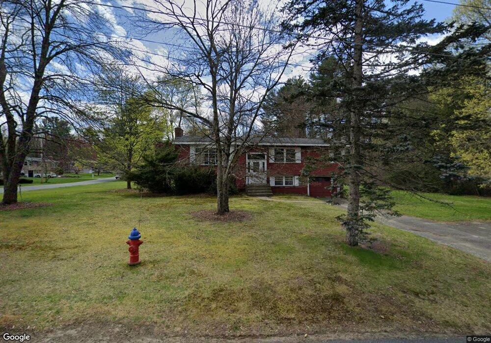
61 Ames Rd Sudbury, MA 01776
Estimated Value: $712,011 - $960,000
3
Beds
2
Baths
1,248
Sq Ft
$660/Sq Ft
Est. Value
About This Home
This home is located at 61 Ames Rd, Sudbury, MA 01776 and is currently estimated at $823,253, approximately $659 per square foot. 61 Ames Rd is a home located in Middlesex County with nearby schools including Israel Loring Elementary School, Ephraim Curtis Middle School, and Lincoln-Sudbury Regional High School.
Ownership History
Date
Name
Owned For
Owner Type
Purchase Details
Closed on
Sep 7, 1995
Sold by
Est Colpitts Joan A and Marcello Faith D
Bought by
Colpitts Brian D
Current Estimated Value
Home Financials for this Owner
Home Financials are based on the most recent Mortgage that was taken out on this home.
Original Mortgage
$140,000
Interest Rate
7.8%
Mortgage Type
Purchase Money Mortgage
Create a Home Valuation Report for This Property
The Home Valuation Report is an in-depth analysis detailing your home's value as well as a comparison with similar homes in the area
Home Values in the Area
Average Home Value in this Area
Purchase History
| Date | Buyer | Sale Price | Title Company |
|---|---|---|---|
| Colpitts Brian D | $200,000 | -- |
Source: Public Records
Mortgage History
| Date | Status | Borrower | Loan Amount |
|---|---|---|---|
| Closed | Colpitts Brian D | $140,000 |
Source: Public Records
Tax History Compared to Growth
Tax History
| Year | Tax Paid | Tax Assessment Tax Assessment Total Assessment is a certain percentage of the fair market value that is determined by local assessors to be the total taxable value of land and additions on the property. | Land | Improvement |
|---|---|---|---|---|
| 2025 | $10,118 | $691,100 | $417,900 | $273,200 |
| 2024 | $9,799 | $670,700 | $405,700 | $265,000 |
| 2023 | $9,700 | $615,100 | $375,700 | $239,400 |
| 2022 | $9,144 | $506,600 | $344,800 | $161,800 |
| 2021 | $9,091 | $482,800 | $344,800 | $138,000 |
| 2020 | $8,908 | $482,800 | $344,800 | $138,000 |
| 2019 | $8,647 | $482,800 | $344,800 | $138,000 |
| 2018 | $8,617 | $480,600 | $367,600 | $113,000 |
| 2017 | $8,073 | $455,100 | $349,700 | $105,400 |
| 2016 | $7,775 | $436,800 | $336,400 | $100,400 |
| 2015 | $7,466 | $424,200 | $323,500 | $100,700 |
| 2014 | $7,448 | $413,100 | $313,900 | $99,200 |
Source: Public Records
Map
Nearby Homes
- 84 Hopestill Brown Rd
- 0 Wagonwheel Rd
- 63 Landham Rd
- 30 Edith Rd
- 216 Landham Rd
- 14 Eisenhower Rd
- 8 Clara Rd
- 14 Francine Rd
- 27 Sloane Dr
- 24 Pinewood Dr
- 91 Eaton Rd W
- 81 Nicholas Rd Unit B
- 19 Nob Hill Dr
- 71 Nicholas Rd Unit H
- 19 Park Ave
- 32 Eaton Rd W
- 163 Water St
- 53 Davidson Rd
- 82 Joseph Rd
- 40 Gregory Rd