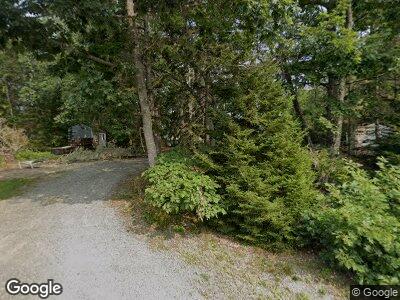
61 Bay View Ave Sorrento, ME 04677
Estimated Value: $976,266 - $1,199,000
5
Beds
3
Baths
3,988
Sq Ft
$274/Sq Ft
Est. Value
About This Home
This home is located at 61 Bay View Ave, Sorrento, ME 04677 and is currently estimated at $1,093,317, approximately $274 per square foot. 61 Bay View Ave is a home with nearby schools including Mountain View School and Sumner Memorial High School.
Ownership History
Date
Name
Owned For
Owner Type
Purchase Details
Closed on
Oct 26, 2021
Sold by
Tigger J H and Tigger T
Bought by
Beaton David J and Beaton Rebecca W
Current Estimated Value
Home Financials for this Owner
Home Financials are based on the most recent Mortgage that was taken out on this home.
Original Mortgage
$1,200,000
Outstanding Balance
$1,108,437
Interest Rate
2.8%
Mortgage Type
Purchase Money Mortgage
Create a Home Valuation Report for This Property
The Home Valuation Report is an in-depth analysis detailing your home's value as well as a comparison with similar homes in the area
Home Values in the Area
Average Home Value in this Area
Purchase History
| Date | Buyer | Sale Price | Title Company |
|---|---|---|---|
| Beaton David J | -- | None Available |
Source: Public Records
Mortgage History
| Date | Status | Borrower | Loan Amount |
|---|---|---|---|
| Open | Beaton David J | $1,200,000 | |
| Previous Owner | James James H | $100,000 | |
| Previous Owner | James James H | $100,000 |
Source: Public Records
Tax History Compared to Growth
Tax History
| Year | Tax Paid | Tax Assessment Tax Assessment Total Assessment is a certain percentage of the fair market value that is determined by local assessors to be the total taxable value of land and additions on the property. | Land | Improvement |
|---|---|---|---|---|
| 2023 | $8,006 | $672,800 | $194,300 | $478,500 |
| 2022 | $7,468 | $672,800 | $194,300 | $478,500 |
| 2021 | $6,728 | $672,800 | $194,300 | $478,500 |
| 2020 | $6,122 | $672,800 | $194,300 | $478,500 |
| 2019 | $6,122 | $672,800 | $194,300 | $478,500 |
| 2018 | $5,652 | $672,800 | $194,300 | $478,500 |
| 2017 | $5,719 | $672,800 | $194,300 | $478,500 |
| 2016 | $5,450 | $672,800 | $194,300 | $478,500 |
| 2015 | $5,517 | $672,800 | $194,300 | $478,500 |
| 2014 | $4,844 | $672,800 | $194,300 | $478,500 |
| 2013 | $4,440 | $672,800 | $194,300 | $478,500 |
Source: Public Records
Map
Nearby Homes
- 353 E Side Rd
- Lot 066 E Side Rd
- 490 E Side Rd
- 490 Eastside Rd
- 65 Grange Hall Rd
- 2126 Us Hwy 1
- 2094 U S 1
- 560 Point Rd
- 38-1 N Shore of Center Pond
- 0 Solarina Ave Unit 1615308
- 217 Tunk Lake Rd
- 133 Eastside Rd
- 1920 Us Highway 1
- 148 Fire Road Route 1
- 98 Meadow Point Rd
- 45 Milliken Rd
- 1723 U S 1
- 218 State Highway 3
- 8 Mariners Reach
- 681 S Gouldsboro Rd
- 61 Bay View Ave
- 51 Bay View Ave
- 89 Bay View Ave
- 63 Bay View Ave
- 43 Bay View Ave
- 87 Bay View Ave
- 113 Waukeag Ave
- 30 Mount Desert St
- 18 Mount Desert St
- 17 Mount Desert St
- 11 Forest St
- 98 Waukeag Ave
- 33 Bayview Ave
- 83 Waukeag Ave
- 73 Bay View Ave
- 23 Beech St
- 12 Mount Desert St
- 14 Forest St
- 122 Waukeag Ave
- 127 Waukeag Ave
