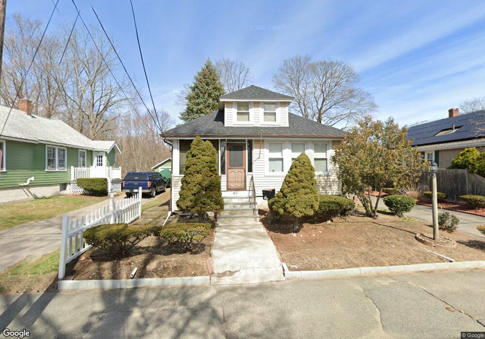
61 Brookside Ave Brockton, MA 02301
Campello NeighborhoodEstimated Value: $430,000 - $474,000
2
Beds
2
Baths
1,102
Sq Ft
$411/Sq Ft
Est. Value
About This Home
This home is located at 61 Brookside Ave, Brockton, MA 02301 and is currently estimated at $453,043, approximately $411 per square foot. 61 Brookside Ave is a home located in Plymouth County with nearby schools including Davis K-8 School, John F. Kennedy Elementary School, and South Middle School.
Ownership History
Date
Name
Owned For
Owner Type
Purchase Details
Closed on
Sep 1, 2006
Sold by
Martin Lynda J
Bought by
Johnson Alexander
Current Estimated Value
Home Financials for this Owner
Home Financials are based on the most recent Mortgage that was taken out on this home.
Original Mortgage
$204,000
Outstanding Balance
$123,574
Interest Rate
6.83%
Mortgage Type
Purchase Money Mortgage
Estimated Equity
$329,469
Purchase Details
Closed on
Aug 28, 1998
Sold by
Murphy Lucille S Est
Bought by
Martin Lynda J
Create a Home Valuation Report for This Property
The Home Valuation Report is an in-depth analysis detailing your home's value as well as a comparison with similar homes in the area
Home Values in the Area
Average Home Value in this Area
Purchase History
| Date | Buyer | Sale Price | Title Company |
|---|---|---|---|
| Johnson Alexander | $255,000 | -- | |
| Martin Lynda J | $80,000 | -- |
Source: Public Records
Mortgage History
| Date | Status | Borrower | Loan Amount |
|---|---|---|---|
| Open | Martin Lynda J | $204,000 | |
| Closed | Martin Lynda J | $51,000 | |
| Previous Owner | Martin Lynda J | $10,000 | |
| Previous Owner | Martin Lynda J | $1,506 |
Source: Public Records
Tax History Compared to Growth
Tax History
| Year | Tax Paid | Tax Assessment Tax Assessment Total Assessment is a certain percentage of the fair market value that is determined by local assessors to be the total taxable value of land and additions on the property. | Land | Improvement |
|---|---|---|---|---|
| 2025 | $4,322 | $356,900 | $136,400 | $220,500 |
| 2024 | $4,134 | $343,900 | $136,400 | $207,500 |
| 2023 | $3,972 | $306,000 | $102,000 | $204,000 |
| 2022 | $4,085 | $292,400 | $92,600 | $199,800 |
| 2021 | $3,769 | $259,900 | $76,500 | $183,400 |
| 2020 | $3,592 | $237,100 | $72,100 | $165,000 |
| 2019 | $3,346 | $215,300 | $69,800 | $145,500 |
| 2018 | $2,913 | $181,400 | $69,800 | $111,600 |
| 2017 | $2,797 | $173,700 | $69,800 | $103,900 |
| 2016 | $2,774 | $159,800 | $67,600 | $92,200 |
| 2015 | $2,612 | $143,900 | $67,600 | $76,300 |
| 2014 | $2,433 | $134,200 | $67,600 | $66,600 |
Source: Public Records
Map
Nearby Homes
- 35 Longworth Ave Unit 17
- 15 Longworth Ave Unit 231
- 57 Copeland St
- 47 Southworth St
- 115 Market St
- 115 Leach Ave
- 358 Copeland St
- 163 S Leyden St
- 223 Clinton St Unit 10
- 223 Clinton St Unit 3
- 65 Tremont St
- 58 Calmar St
- 977 Warren Ave
- 13 Finny's Way
- 936 Warren Ave
- 15 Fieldstone Dr
- 137 Channing Ave
- 103 Clinton St
- 1 Fairway Dr
- 44 Baker St
- 67 Brookside Ave
- 57 Brookside Ave
- 45 Irvington St
- 71 Brookside Ave
- 60 Brookside Ave
- 47 Brookside Ave
- 39 Irvington St
- 75 Brookside Ave
- 28 Kenwood St
- 45 Brookside Ave
- 33 Irvington St
- 70 Brookside Ave
- 70 Brookside Ave
- 22 Kenwood St
- 44 Brookside Ave
- 0 Irvington St
- 41 Brookside Ave
- 27 Irvington St
- 16 Kenwood St
- 16 Kenwood St Unit 2