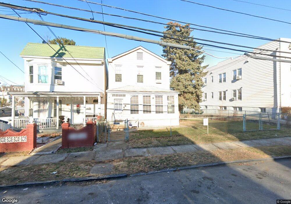
61 Colin St Yonkers, NY 10701
Bryn Mawr Park NeighborhoodEstimated Value: $617,000 - $813,000
6
Beds
2
Baths
1,960
Sq Ft
$370/Sq Ft
Est. Value
About This Home
This home is located at 61 Colin St, Yonkers, NY 10701 and is currently estimated at $725,933, approximately $370 per square foot. 61 Colin St is a home located in Westchester County with nearby schools including Sacred Heart Grade School and Sacred Heart High School.
Ownership History
Date
Name
Owned For
Owner Type
Purchase Details
Closed on
Feb 25, 2020
Sold by
Telyczka Roman S and Telyczka Kathleen M
Bought by
Dronzek David John
Current Estimated Value
Home Financials for this Owner
Home Financials are based on the most recent Mortgage that was taken out on this home.
Original Mortgage
$382,500
Outstanding Balance
$339,398
Interest Rate
3.6%
Mortgage Type
New Conventional
Estimated Equity
$386,535
Purchase Details
Closed on
Dec 17, 2001
Sold by
Swyst Paraska
Bought by
Telyczka Roman S and Telyczka Kathleen M
Create a Home Valuation Report for This Property
The Home Valuation Report is an in-depth analysis detailing your home's value as well as a comparison with similar homes in the area
Home Values in the Area
Average Home Value in this Area
Purchase History
| Date | Buyer | Sale Price | Title Company |
|---|---|---|---|
| Dronzek David John | $425,000 | Benchmark Title Agency | |
| Telyczka Roman S | -- | -- |
Source: Public Records
Mortgage History
| Date | Status | Borrower | Loan Amount |
|---|---|---|---|
| Open | Dronzek David John | $382,500 |
Source: Public Records
Tax History Compared to Growth
Tax History
| Year | Tax Paid | Tax Assessment Tax Assessment Total Assessment is a certain percentage of the fair market value that is determined by local assessors to be the total taxable value of land and additions on the property. | Land | Improvement |
|---|---|---|---|---|
| 2024 | $1,675 | $9,300 | $3,500 | $5,800 |
| 2023 | $1,680 | $9,300 | $3,500 | $5,800 |
| 2022 | $1,653 | $9,300 | $3,500 | $5,800 |
| 2021 | $8,000 | $9,300 | $3,500 | $5,800 |
| 2020 | $8,001 | $9,300 | $3,500 | $5,800 |
| 2019 | $9,224 | $9,300 | $3,500 | $5,800 |
| 2018 | $7,566 | $9,300 | $3,500 | $5,800 |
| 2017 | $0 | $9,300 | $3,500 | $5,800 |
| 2016 | $8,907 | $10,000 | $3,500 | $6,500 |
| 2015 | -- | $10,000 | $3,500 | $6,500 |
| 2014 | -- | $10,000 | $3,500 | $6,500 |
| 2013 | -- | $10,000 | $3,500 | $6,500 |
Source: Public Records
Map
Nearby Homes
- 82 Burhans Ave
- 53 Lockwood Ave
- 34 Lockwood Ave
- 116 Gavin St
- 62 Fortfield Ave
- 136 Buckingham Rd
- 127 -133 Frederic St
- 175 Frederic St
- 1 Lowell St
- 166 Lockwood Ave
- 372 Sommerville Place
- 55 Ramsey Ave
- 331 Sommerville Place
- 70 Normandy Rd
- 54 Albemarle Place
- 261 Edwards Place
- 11 aka 15 Bobolink Rd
- 64 Woodycrest Ave
- 10-13-75 Dickinson Ave
- 279 Mary Lou Ave