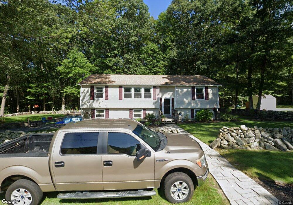
61 Conlin Rd Oxford, MA 01540
Estimated Value: $432,248 - $555,000
3
Beds
2
Baths
1,344
Sq Ft
$362/Sq Ft
Est. Value
About This Home
This home is located at 61 Conlin Rd, Oxford, MA 01540 and is currently estimated at $486,312, approximately $361 per square foot. 61 Conlin Rd is a home located in Worcester County with nearby schools including Alfred M Chaffee, Oxford High School, and Clara Barton Elementary School.
Ownership History
Date
Name
Owned For
Owner Type
Purchase Details
Closed on
Jul 1, 2015
Sold by
Sullivan Michael J and Sullivan Kathleen
Bought by
Sullivan Lt
Current Estimated Value
Create a Home Valuation Report for This Property
The Home Valuation Report is an in-depth analysis detailing your home's value as well as a comparison with similar homes in the area
Home Values in the Area
Average Home Value in this Area
Purchase History
| Date | Buyer | Sale Price | Title Company |
|---|---|---|---|
| Sullivan Lt | -- | -- |
Source: Public Records
Tax History
| Year | Tax Paid | Tax Assessment Tax Assessment Total Assessment is a certain percentage of the fair market value that is determined by local assessors to be the total taxable value of land and additions on the property. | Land | Improvement |
|---|---|---|---|---|
| 2025 | $51 | $404,000 | $84,500 | $319,500 |
| 2024 | $4,893 | $363,000 | $80,600 | $282,400 |
| 2023 | $4,904 | $359,500 | $77,100 | $282,400 |
| 2022 | $4,454 | $275,600 | $75,900 | $199,700 |
| 2021 | $4,333 | $262,100 | $72,000 | $190,100 |
| 2020 | $4,162 | $249,800 | $72,000 | $177,800 |
| 2019 | $3,978 | $233,600 | $72,100 | $161,500 |
| 2018 | $3,782 | $219,000 | $72,100 | $146,900 |
| 2017 | $3,729 | $221,300 | $69,100 | $152,200 |
| 2016 | $3,747 | $221,300 | $69,100 | $152,200 |
| 2015 | $3,494 | $221,300 | $69,100 | $152,200 |
| 2014 | -- | $226,800 | $67,300 | $159,500 |
Source: Public Records
Map
Nearby Homes
- Lot 8 Coughlin Rd
- 8 Wamsutta Ridge Rd
- 164 Oxford Rd
- 13 Dolge Ct
- 2 Melissa Ln
- 4 Toria Heights Rd
- 35 Pine Ridge Dr
- 9 Howarth Rd
- 0 Oxbow Rd
- 4 History Dr
- L0T 3 History Dr
- 71 Charlton St
- 399 Main St
- L2 Partridge Hill Rd
- L3 Partridge Hill Rd
- 29 Charlton St
- 30 Bond Rd
- 0 Old Southbridge Rd
- 47 Main St
- 39 Fairlawn Ave
Your Personal Tour Guide
Ask me questions while you tour the home.