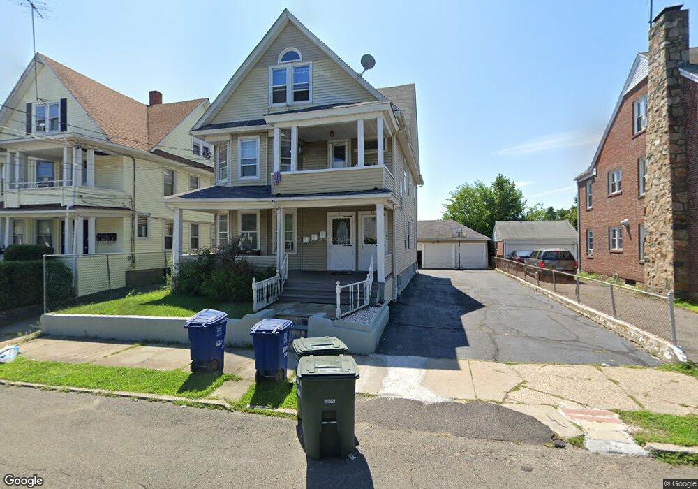
61 Hillside Ave Unit 63 Bridgeport, CT 06604
Brooklawn-Saint Vincent NeighborhoodEstimated Value: $618,020 - $741,000
6
Beds
3
Baths
3,107
Sq Ft
$218/Sq Ft
Est. Value
About This Home
This home is located at 61 Hillside Ave Unit 63, Bridgeport, CT 06604 and is currently estimated at $676,755, approximately $217 per square foot. 61 Hillside Ave Unit 63 is a home located in Fairfield County with nearby schools including Blackham School, Central High School, and Assumption Catholic School.
Ownership History
Date
Name
Owned For
Owner Type
Purchase Details
Closed on
Apr 27, 2004
Sold by
Mergoni Walter and Mergoni Estrella
Bought by
Choudhury Atique and Choudhury Habibur
Current Estimated Value
Home Financials for this Owner
Home Financials are based on the most recent Mortgage that was taken out on this home.
Original Mortgage
$333,000
Interest Rate
5.99%
Purchase Details
Closed on
Oct 9, 1996
Sold by
Pizarro Andrres and Pizzaro Diana
Bought by
Mergoni Walter A and Mergoni Estrella
Create a Home Valuation Report for This Property
The Home Valuation Report is an in-depth analysis detailing your home's value as well as a comparison with similar homes in the area
Home Values in the Area
Average Home Value in this Area
Purchase History
| Date | Buyer | Sale Price | Title Company |
|---|---|---|---|
| Choudhury Atique | $370,000 | -- | |
| Choudhury Atique | $370,000 | -- | |
| Mergoni Walter A | $145,000 | -- | |
| Mergoni Walter A | $145,000 | -- |
Source: Public Records
Mortgage History
| Date | Status | Borrower | Loan Amount |
|---|---|---|---|
| Open | Mergoni Walter A | $301,413 | |
| Closed | Mergoni Walter A | $330,000 | |
| Closed | Mergoni Walter A | $333,000 |
Source: Public Records
Tax History
| Year | Tax Paid | Tax Assessment Tax Assessment Total Assessment is a certain percentage of the fair market value that is determined by local assessors to be the total taxable value of land and additions on the property. | Land | Improvement |
|---|---|---|---|---|
| 2025 | $9,345 | $215,080 | $77,910 | $137,170 |
| 2024 | $9,345 | $215,080 | $77,910 | $137,170 |
| 2023 | $9,345 | $215,080 | $77,910 | $137,170 |
| 2022 | $9,345 | $215,080 | $77,910 | $137,170 |
| 2021 | $9,345 | $215,080 | $77,910 | $137,170 |
| 2020 | $8,736 | $161,810 | $47,210 | $114,600 |
| 2019 | $8,736 | $161,810 | $47,210 | $114,600 |
| 2018 | $8,798 | $161,810 | $47,210 | $114,600 |
| 2017 | $8,798 | $161,810 | $47,210 | $114,600 |
| 2016 | $8,798 | $161,810 | $47,210 | $114,600 |
| 2015 | $8,859 | $209,940 | $52,360 | $157,580 |
| 2014 | $8,859 | $209,940 | $52,360 | $157,580 |
Source: Public Records
Map
Nearby Homes
- 1440 Wood Ave
- 35 Querida St
- 2625 Park Ave Unit 9R
- 2675 Park Ave Unit 3
- 2675 Park Ave Unit 22
- 1275 Capitol Ave
- 85 Alexander Dr
- 1156 Capitol Ave
- 125 Alexander Dr
- 366 Brooklawn Ave
- 241 Sampson St
- 95 Alexander Ave
- 125 Garden Dr
- 31 Taft Ave
- 156 Garden Dr Unit 158
- 155 Brooklawn Ave
- 20 Amsterdam Ave Unit 2E
- 687 Wood Ave
- 3200 Park Ave Unit 11E2
- 3200 Park Ave Unit 5F1
- 49 Hillside Ave Unit 51
- 45 Hillside Ave
- 71 Hillside Ave
- 71 Hillside Ave Unit 2
- 71 Hillside Ave Unit 3
- 54 Hillside Ave
- 52 Hillside Ave Unit 54
- 64 Hillside Ave
- 41 Hillside Ave
- 1372 Wood Ave
- 44 Hillside Ave
- 74 Hillside Ave
- 1392 Wood Ave
- 39 Hillside Ave
- 40 Hillside Ave
- 84 Hillside Ave
- 1402 Wood Ave
- 1348 Wood Ave
- 99 Hillside Ave
- 38 Hillside Ave
Your Personal Tour Guide
Ask me questions while you tour the home.