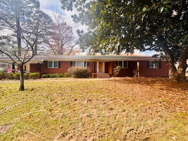
61 N Allen St Eupora, MS 39744
Estimated payment $1,212/month
Total Views
4,724
3
Beds
3
Baths
2,571
Sq Ft
$74
Price per Sq Ft
Highlights
- Deck
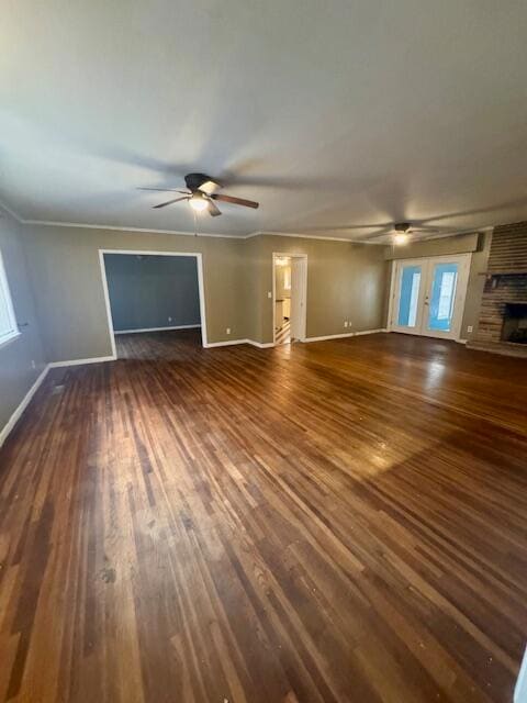
- Wood Flooring
- Fireplace
- Traditional Architecture
- No HOA
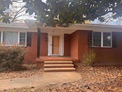
- Front Porch
About This Home
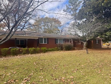
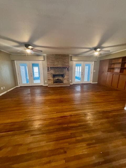
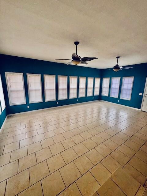
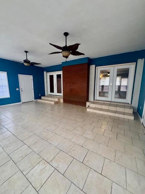
This charming home has character and all the extras. Situated on a shaded corner lot, this 3 bedroom 3 bath home has beautifully updated appliances, new paint throughout and a sunroom where you can soak in natural light all year around. The spacious living room features built in bookcases and cozy gas logs, perfect for family gatherings and guest. Outside, a newly constructed deck that opens to a fenced yard and a building complete with electricity, perfect as a workshop. Don't miss this home conveniently located to all amenities.
Home Details
Home Type
- Single Family
Est. Annual Taxes
- $2,838
Year Built
- Built in 1962
Lot Details
- 1 Acre Lot
- Back Yard Fenced
- Chain Link Fence
Parking
- 2 Car Garage
- Attached Carport
Home Design
- Traditional Architecture
- Brick Exterior Construction
- Slab Foundation
- Composition Roof
- Wood Siding
- Vinyl Siding
Interior Spaces
- 2,571 Sq Ft Home
- Ceiling Fan
- Fireplace
- Insulated Windows
Kitchen
- Stove
- Microwave
Flooring
- Wood
- Laminate
- Tile
Bedrooms and Bathrooms
- 3 Bedrooms
- 3 Full Bathrooms
Outdoor Features
- Deck
- Front Porch
Utilities
- Central Heating and Cooling System
- Electric Water Heater
Community Details
- No Home Owners Association
Listing and Financial Details
- Assessor Parcel Number 073B100507.00
Map
Create a Home Valuation Report for This Property
The Home Valuation Report is an in-depth analysis detailing your home's value as well as a comparison with similar homes in the area
Tax History
| Year | Tax Paid | Tax Assessment Tax Assessment Total Assessment is a certain percentage of the fair market value that is determined by local assessors to be the total taxable value of land and additions on the property. | Land | Improvement |
|---|---|---|---|---|
| 2025 | $2,838 | $25,121 | $2,250 | $22,871 |
| 2024 | $1,738 | $18,039 | $1,500 | $16,539 |
| 2023 | $1,764 | $18,039 | $1,500 | $16,539 |
| 2022 | $2,183 | $18,039 | $1,500 | $16,539 |
| 2021 | $1,978 | $16,626 | $950 | $15,676 |
| 2020 | $1,983 | $16,626 | $950 | $15,676 |
| 2019 | $1,941 | $16,626 | $950 | $15,676 |
| 2018 | $1,928 | $16,626 | $950 | $15,676 |
| 2017 | $1,265 | $13,804 | $950 | $12,854 |
| 2016 | $1,268 | $13,804 | $950 | $12,854 |
| 2015 | -- | $13,804 | $950 | $12,854 |
| 2014 | -- | $13,804 | $950 | $12,854 |
| 2013 | -- | $13,272 | $950 | $12,322 |
Source: Public Records
Property History
| Date | Event | Price | List to Sale | Price per Sq Ft |
|---|---|---|---|---|
| 01/09/2026 01/09/26 | Price Changed | $189,900 | -11.7% | $74 / Sq Ft |
| 11/20/2025 11/20/25 | For Sale | $215,000 | -- | $84 / Sq Ft |
Source: Golden Triangle Association of REALTORS®
Purchase History
| Date | Type | Sale Price | Title Company |
|---|---|---|---|
| Special Warranty Deed | -- | None Listed On Document | |
| Trustee Deed | $134,414 | None Listed On Document | |
| Warranty Deed | -- | -- |
Source: Public Records
Mortgage History
| Date | Status | Loan Amount | Loan Type |
|---|---|---|---|
| Previous Owner | $132,478 | FHA |
Source: Public Records
Source: Golden Triangle Association of REALTORS®
MLS Number: 25-2389
APN: 073B100507.00
Nearby Homes
- 2395 W Roane Ave
- 2510 W Roane Ave
- 55 S Joliff St
- 55 Gold St
- 95 S Allen St
- 589 S Dunn St
- 310 Old Walthall Rd
- 395 Old Walthall Rd
- Westwood Dr
- 2589 Veterans Memorial Blvd N
- 63 E Gum Ave
- 113 E Pecan Ave
- 61 McCain Estate Dr S
- 1711 Highway 82
- 4011 Mississippi 182
- 0 Willingham Bottom Rd
- 536 Sibley Rd
- 0 Green Door Rd Unit Eupora MS 39744
- 0 Green Door Rd
- 364 Whitt Rd

Your Personal Tour Guide
Ask me questions while you tour the home.