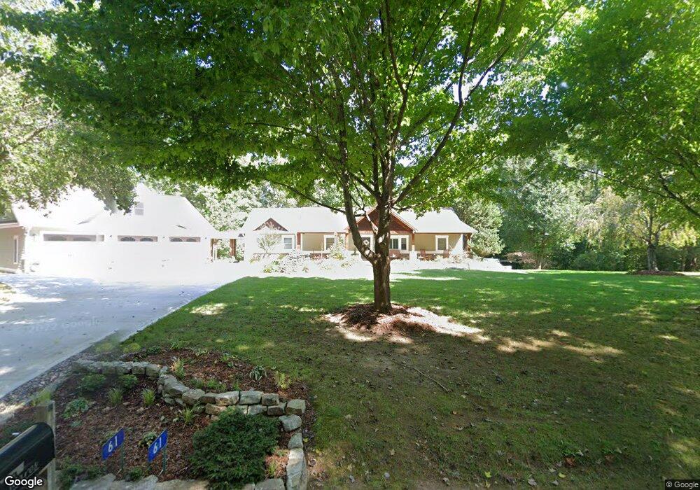
61 New Liberty Rd Mineral Bluff, GA 30559
Estimated Value: $401,000 - $1,105,000
--
Bed
2
Baths
3,504
Sq Ft
$199/Sq Ft
Est. Value
About This Home
This home is located at 61 New Liberty Rd, Mineral Bluff, GA 30559 and is currently estimated at $695,895, approximately $198 per square foot. 61 New Liberty Rd is a home located in Fannin County with nearby schools including Fannin County High School.
Ownership History
Date
Name
Owned For
Owner Type
Purchase Details
Closed on
Apr 15, 2010
Sold by
Ware Melissa R
Bought by
Ware Kevin A
Current Estimated Value
Purchase Details
Closed on
Jun 8, 2009
Sold by
Ware Etheridge C and Ware Linda S
Bought by
New Liberty Baptist Church
Purchase Details
Closed on
Oct 1, 1993
Bought by
Ware Kevin A and Ware
Create a Home Valuation Report for This Property
The Home Valuation Report is an in-depth analysis detailing your home's value as well as a comparison with similar homes in the area
Home Values in the Area
Average Home Value in this Area
Purchase History
| Date | Buyer | Sale Price | Title Company |
|---|---|---|---|
| Ware Kevin A | -- | -- | |
| New Liberty Baptist Church | -- | -- | |
| Ware Kevin A | -- | -- |
Source: Public Records
Tax History Compared to Growth
Tax History
| Year | Tax Paid | Tax Assessment Tax Assessment Total Assessment is a certain percentage of the fair market value that is determined by local assessors to be the total taxable value of land and additions on the property. | Land | Improvement |
|---|---|---|---|---|
| 2024 | $1,378 | $189,219 | $10,457 | $178,762 |
| 2023 | $1,327 | $161,640 | $10,457 | $151,183 |
| 2022 | $1,344 | $163,954 | $10,457 | $153,497 |
| 2021 | $1,372 | $117,547 | $10,457 | $107,090 |
| 2020 | $1,398 | $117,547 | $10,457 | $107,090 |
| 2019 | $915 | $70,007 | $10,457 | $59,550 |
| 2018 | $967 | $69,715 | $10,457 | $59,258 |
| 2017 | $1,249 | $70,606 | $10,457 | $60,149 |
| 2016 | $902 | $57,057 | $10,457 | $46,600 |
| 2015 | $955 | $57,881 | $10,457 | $47,424 |
| 2014 | $1,199 | $79,058 | $16,350 | $62,709 |
| 2013 | -- | $57,122 | $16,349 | $40,772 |
Source: Public Records
Map
Nearby Homes
- 94 Rhinas Trail
- 2 Watson Gap Rd
- 5491 Hardscrabble Rd
- 469 Mountain High Dr
- 56 Kennebec Dr
- 287 Bell Ln
- Lot # 33 Mahoosec Trail
- Lot 13 Rocking Chair Ridge
- Lot 11 Rocking Chair Ridge
- Lot 12 Rocking Chair Ridge
- Lot 5 Rocking Chair Ridge
- Lot 14 Rocking Chair Ridge
- Lot 15 Rocking Chair Ridge
- Lot 4 Rocking Chair Ridge
- Lot 7 Rocking Chair Ridge
- 671 Happy Trails Ln
- 00 Coker Rd
- 641 Watson Gap Rd
- 134 Happy Trails Ln
- 242 New Liberty Rd
- 50 Simpson Mountain Rd
- 1745 Orton Rd
- 450 Waston Gap Rd
- 215 Simpson Mountain Rd
- 766 Watson Gap Rd
- 407 Simpson Mountain Rd
- 407 Simpson Mountain Rd
- 10.42 AC Watson Gap Rd
- 00 Watson Gap Rd
- TBD Simpson Mountain Rd
- 571 Watson Gap Rd
- 1666 Orton Rd
- 76 Sheltie Ridge Ln
- 187 Sheltie Ridge Ln
- 357 Simpson Mountain Rd