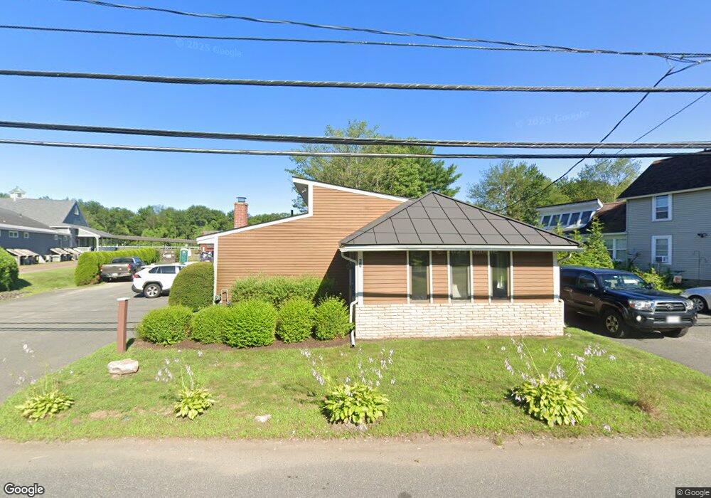
61 Old State Rd Whately, MA 01373
Estimated Value: $700,624
Studio
4
Baths
--
Sq Ft
0.69
Acres
About This Home
This home is located at 61 Old State Rd, Whately, MA 01373 and is currently estimated at $700,624. 61 Old State Rd is a home located in Franklin County with nearby schools including Whately Elementary School and Frontier Regional School.
Ownership History
Date
Name
Owned For
Owner Type
Purchase Details
Closed on
Dec 22, 2022
Sold by
Niemiec 2014 Ret
Bought by
Ruchi Grover Llc
Current Estimated Value
Home Financials for this Owner
Home Financials are based on the most recent Mortgage that was taken out on this home.
Original Mortgage
$427,500
Outstanding Balance
$414,975
Interest Rate
7.08%
Mortgage Type
Commercial
Estimated Equity
$285,650
Purchase Details
Closed on
Nov 16, 1977
Bought by
Niemiec Ret
Create a Home Valuation Report for This Property
The Home Valuation Report is an in-depth analysis detailing your home's value as well as a comparison with similar homes in the area
Home Values in the Area
Average Home Value in this Area
Purchase History
| Date | Buyer | Sale Price | Title Company |
|---|---|---|---|
| Ruchi Grover Llc | $570,000 | None Available | |
| Niemiec Ret | -- | -- |
Source: Public Records
Mortgage History
| Date | Status | Borrower | Loan Amount |
|---|---|---|---|
| Open | Ruchi Grover Llc | $427,500 |
Source: Public Records
Tax History Compared to Growth
Tax History
| Year | Tax Paid | Tax Assessment Tax Assessment Total Assessment is a certain percentage of the fair market value that is determined by local assessors to be the total taxable value of land and additions on the property. | Land | Improvement |
|---|---|---|---|---|
| 2025 | $6,469 | $484,900 | $120,900 | $364,000 |
| 2024 | $6,130 | $447,800 | $120,900 | $326,900 |
| 2023 | $5,988 | $421,700 | $115,200 | $306,500 |
| 2022 | $5,782 | $421,700 | $115,200 | $306,500 |
| 2021 | $5,786 | $387,800 | $115,200 | $272,600 |
| 2020 | $5,958 | $380,200 | $112,100 | $268,100 |
| 2019 | $5,896 | $379,900 | $112,100 | $267,800 |
| 2018 | $5,828 | $379,900 | $112,100 | $267,800 |
| 2017 | $5,926 | $379,900 | $112,100 | $267,800 |
| 2016 | $5,366 | $358,700 | $112,100 | $246,600 |
| 2015 | $5,714 | $353,400 | $106,800 | $246,600 |
| 2014 | $5,573 | $353,400 | $106,800 | $246,600 |
Source: Public Records
Map
Nearby Homes
- 0 Greenfield Rd Unit 73467449
- 24 Elm St
- 24 Graves St
- 33 Eastern Ave
- 15 Crestview Dr
- 13 Capt Lathrop Dr
- 116 Christian Ln
- 208 Greenfield Rd
- 0 North St Unit 73407299
- 110 Old Amherst Rd
- 0 Pocumtuck Dr Unit 73379330
- 30 Lee Rd
- 71 Mathews Rd
- 15 S Plain Rd
- 38 S Plain Rd
- 320 West St
- 6 Shattuck Rd
- 151 Pantry Rd
- 10 Depot Rd
- 14 River St
- 63 Old State Rd
- 63 Old State Rd Unit 63A
- 64 Old State Rd
- 65 Old State Rd
- 70 Old State Rd
- - Greenfield Rd
- 0 Greenfield Rd L:b2 Unit 72953169
- 4 Greenfield Rd
- 1 Greenfield Rd
- 48 Old State Rd
- 0 Greenfield Rd Unit 72392995
- 0 Greenfield Rd Unit 72235508
- 0 Greenfield Rd Unit 71508352
- 0 Greenfield Rd Unit 72167215
- 0 Greenfield Rd Unit 73270263
- 0 Greenfield Rd Unit 30802040
- 0 Greenfield Rd Unit 30292223
- 0 Greenfield Rd Unit 30015369
- 0 Greenfield Rd Unit 72927864
- 0 Greenfield Rd Unit 72898358