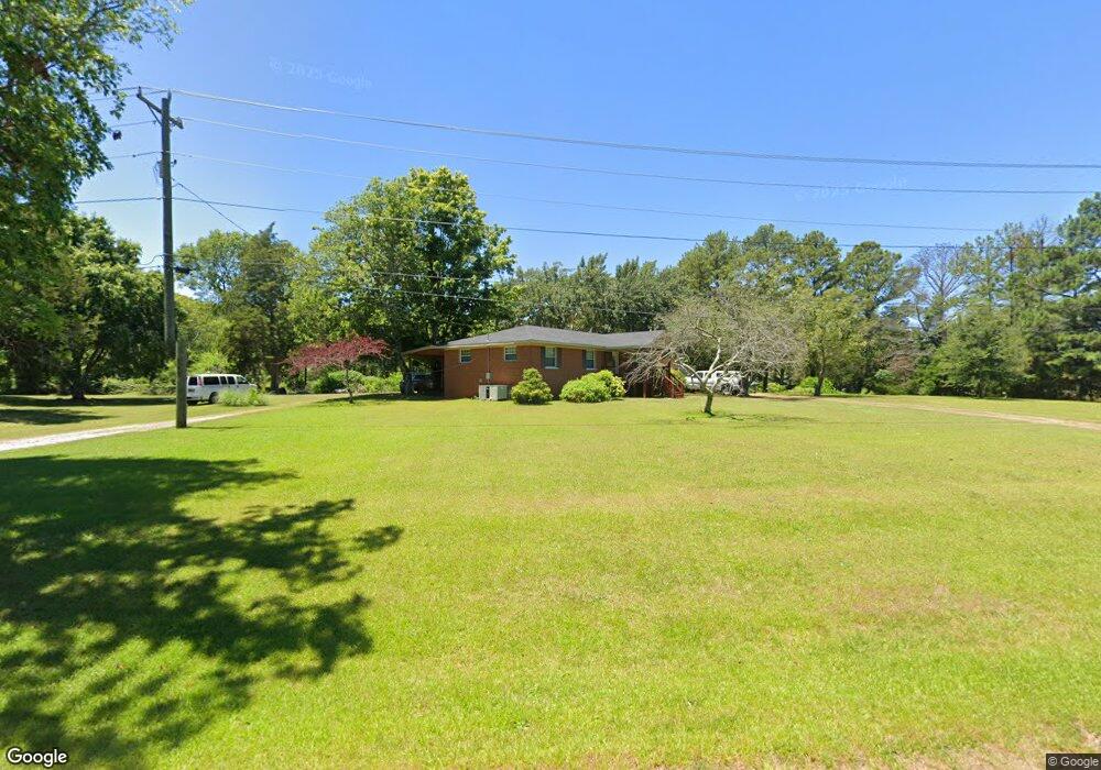
61 Ransom Rd Laceys Spring, AL 35754
Estimated Value: $204,000 - $335,000
3
Beds
2
Baths
1,300
Sq Ft
$209/Sq Ft
Est. Value
About This Home
This home is located at 61 Ransom Rd, Laceys Spring, AL 35754 and is currently estimated at $271,685, approximately $208 per square foot. 61 Ransom Rd is a home located in Morgan County with nearby schools including Laceys Spring Elementary School and Albert P. Brewer High School.
Ownership History
Date
Name
Owned For
Owner Type
Purchase Details
Closed on
Apr 29, 2024
Sold by
Barrier Amy and Barrier Amy L
Bought by
Barrier Mark and Barrier Amy
Current Estimated Value
Home Financials for this Owner
Home Financials are based on the most recent Mortgage that was taken out on this home.
Original Mortgage
$204,517
Outstanding Balance
$199,459
Interest Rate
6.62%
Mortgage Type
FHA
Estimated Equity
$72,226
Purchase Details
Closed on
May 30, 2007
Sold by
Fannie Mae
Bought by
Barrier Amy L
Home Financials for this Owner
Home Financials are based on the most recent Mortgage that was taken out on this home.
Original Mortgage
$95,000
Interest Rate
5.62%
Mortgage Type
Adjustable Rate Mortgage/ARM
Create a Home Valuation Report for This Property
The Home Valuation Report is an in-depth analysis detailing your home's value as well as a comparison with similar homes in the area
Purchase History
| Date | Buyer | Sale Price | Title Company |
|---|---|---|---|
| Barrier Mark | -- | None Listed On Document | |
| Barrier Mark | -- | None Listed On Document | |
| Barrier Amy L | -- | None Available |
Source: Public Records
Mortgage History
| Date | Status | Borrower | Loan Amount |
|---|---|---|---|
| Open | Barrier Mark | $204,517 | |
| Closed | Barrier Mark | $204,517 | |
| Previous Owner | Barrier Amy L | $95,000 |
Source: Public Records
Tax History
| Year | Tax Paid | Tax Assessment Tax Assessment Total Assessment is a certain percentage of the fair market value that is determined by local assessors to be the total taxable value of land and additions on the property. | Land | Improvement |
|---|---|---|---|---|
| 2024 | $747 | $21,390 | $9,900 | $11,490 |
| 2023 | $747 | $20,240 | $9,150 | $11,090 |
| 2022 | $646 | $18,690 | $8,320 | $10,370 |
| 2021 | $1,065 | $14,580 | $5,920 | $8,660 |
| 2020 | $1,065 | $22,560 | $5,920 | $16,640 |
| 2019 | $1,065 | $28,480 | $0 | $0 |
| 2015 | $986 | $26,360 | $0 | $0 |
| 2014 | $986 | $26,360 | $0 | $0 |
| 2013 | -- | $24,960 | $0 | $0 |
Source: Public Records
Map
Nearby Homes
- 583 Bell Point Rd
- 194 Bartee Rd
- 108 Lang Rd
- 9 Acres Hough Rd
- 46 Dogwood Dr
- 2 acres +/- Highway 231
- 01 Highway 231
- 1155 Lower Dry Creek Rd
- 1.24 Highway 231
- 145 Dogwood Dr
- 174 Heather St
- 144 Bess Thompson Rd
- 14 Acres Beaver Creek Rd
- 803 McCutcheon Loop Rd
- 1193 McCutcheon Loop Rd
- 1056 McCutcheon Loop Rd
- 1026 McCutcheon Loop Rd
- 1263 McCutcheon Loop Rd
- 1100 McCutcheon Loop Rd
- 715 McCutcheon Loop Rd
- 10043 Highway 36 E
- 10039 Highway 36 E
- 123 Ransom Rd
- 114 Ransom Rd
- 128 Ransom Rd
- 16 Kay Rd
- 0 Ransom Rd Unit 1087492
- 141 Ransom Rd
- 165 Ransom Rd
- 10034 Highway 36 E
- 65 Summerhill Place
- 182 Ransom Rd
- 9976 Highway 36 E
- 63 Kay Rd
- 9953 Highway 36 E
- 0 Tucker Ln Unit 1811334
- 93 Kay Rd
- 12 Lani Cir
- 144 Kay Rd
- 52 Lani Cir
Your Personal Tour Guide
Ask me questions while you tour the home.