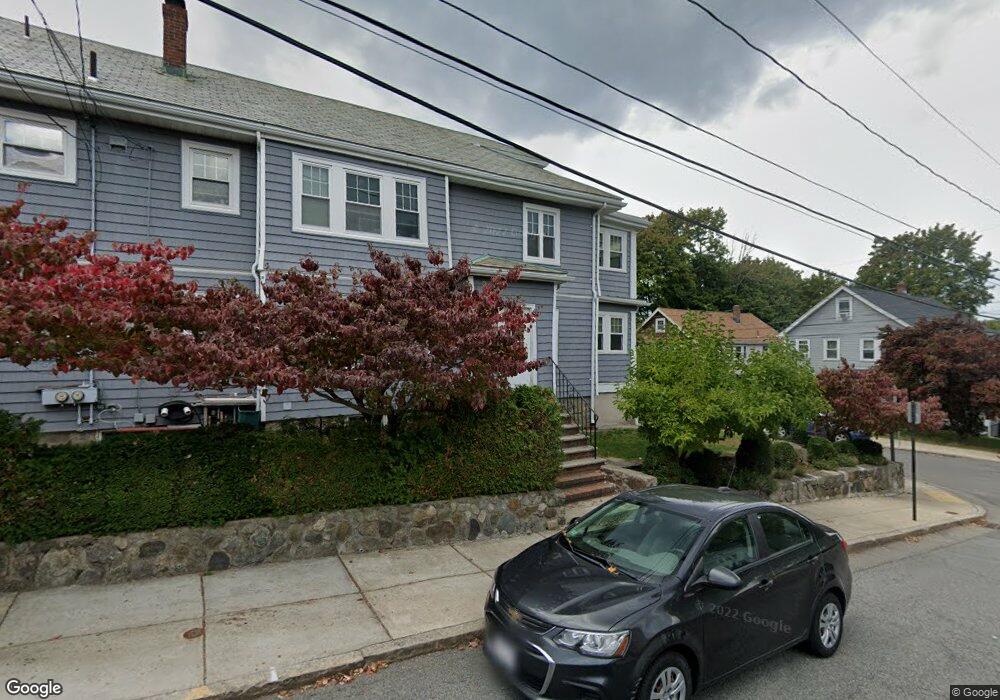
61 S Hobart St Unit 1 Brighton, MA 02135
Brighton NeighborhoodEstimated Value: $1,250,000 - $1,432,000
3
Beds
1
Bath
--
Sq Ft
5,358
Sq Ft Lot
About This Home
This home is located at 61 S Hobart St Unit 1, Brighton, MA 02135 and is currently estimated at $1,315,050. 61 S Hobart St Unit 1 is a home located in Suffolk County with nearby schools including St Columbkille Partnership School, Shaloh House Jewish Day School, and Mesivta High School of Greater Boston.
Ownership History
Date
Name
Owned For
Owner Type
Purchase Details
Closed on
Mar 20, 2015
Sold by
Gilmore Richard A
Bought by
Greene Daniel C and Greene Christina
Current Estimated Value
Home Financials for this Owner
Home Financials are based on the most recent Mortgage that was taken out on this home.
Original Mortgage
$360,000
Outstanding Balance
$274,907
Interest Rate
3.6%
Mortgage Type
New Conventional
Estimated Equity
$1,040,143
Create a Home Valuation Report for This Property
The Home Valuation Report is an in-depth analysis detailing your home's value as well as a comparison with similar homes in the area
Home Values in the Area
Average Home Value in this Area
Purchase History
| Date | Buyer | Sale Price | Title Company |
|---|---|---|---|
| Greene Daniel C | $355,000 | -- |
Source: Public Records
Mortgage History
| Date | Status | Borrower | Loan Amount |
|---|---|---|---|
| Open | Greene Daniel C | $360,000 |
Source: Public Records
Tax History Compared to Growth
Tax History
| Year | Tax Paid | Tax Assessment Tax Assessment Total Assessment is a certain percentage of the fair market value that is determined by local assessors to be the total taxable value of land and additions on the property. | Land | Improvement |
|---|---|---|---|---|
| 2025 | $13,085 | $1,130,000 | $377,300 | $752,700 |
| 2024 | $11,913 | $1,092,900 | $296,600 | $796,300 |
| 2023 | $10,865 | $1,011,600 | $274,600 | $737,000 |
| 2022 | $10,286 | $945,400 | $256,600 | $688,800 |
| 2021 | $10,087 | $945,400 | $256,600 | $688,800 |
| 2020 | $9,925 | $939,900 | $228,300 | $711,600 |
| 2019 | $9,423 | $894,000 | $188,500 | $705,500 |
| 2018 | $8,836 | $843,100 | $188,500 | $654,600 |
| 2017 | $8,756 | $826,800 | $188,500 | $638,300 |
| 2016 | $8,120 | $738,200 | $188,500 | $549,700 |
| 2015 | $8,298 | $685,200 | $193,000 | $492,200 |
| 2014 | $7,366 | $585,500 | $193,000 | $392,500 |
Source: Public Records
Map
Nearby Homes
- 77 Bennett St Unit 2
- 83-85 Surrey St
- 461 Washington St Unit 301
- 30 Dighton St Unit 3
- 30 Dighton St
- 71 Brooks St
- 21 Upcrest Rd
- 10 Waldo Terrace
- 59 Riverview Rd
- 365 Faneuil St Unit 2
- 21 Glenmont Rd
- 11 Faneuil St
- 2 Westminster Terrace
- 12 Mina Way
- 10 Mina Way
- 87 Etna St
- 35 Glencoe St Unit 43
- 200-202 Market St
- 22 Bigelow St
- 84-86 Etna St
- 94 Bennett St
- 94 Bennett St Unit 1
- 98 Bennett St
- 98 Bennett St Unit 2
- 88 Bennett St Unit 90
- 90 Bennett St Unit 2
- 88 Bennett St Unit 2
- 88 Bennett St Unit 1
- 90 Bennett St Unit 1
- 102 Bennett St
- 102 Bennett St Unit 1
- 102 Bennett St
- 102 Bennett St Unit 2
- 95 Bennett St
- 57 S Hobart St Unit B
- 95 Bennett St Unit 1
- 57 S Hobart St Unit 1
- 57 S Hobart St
- 84 Bennett St
- 84 Bennett St Unit 1