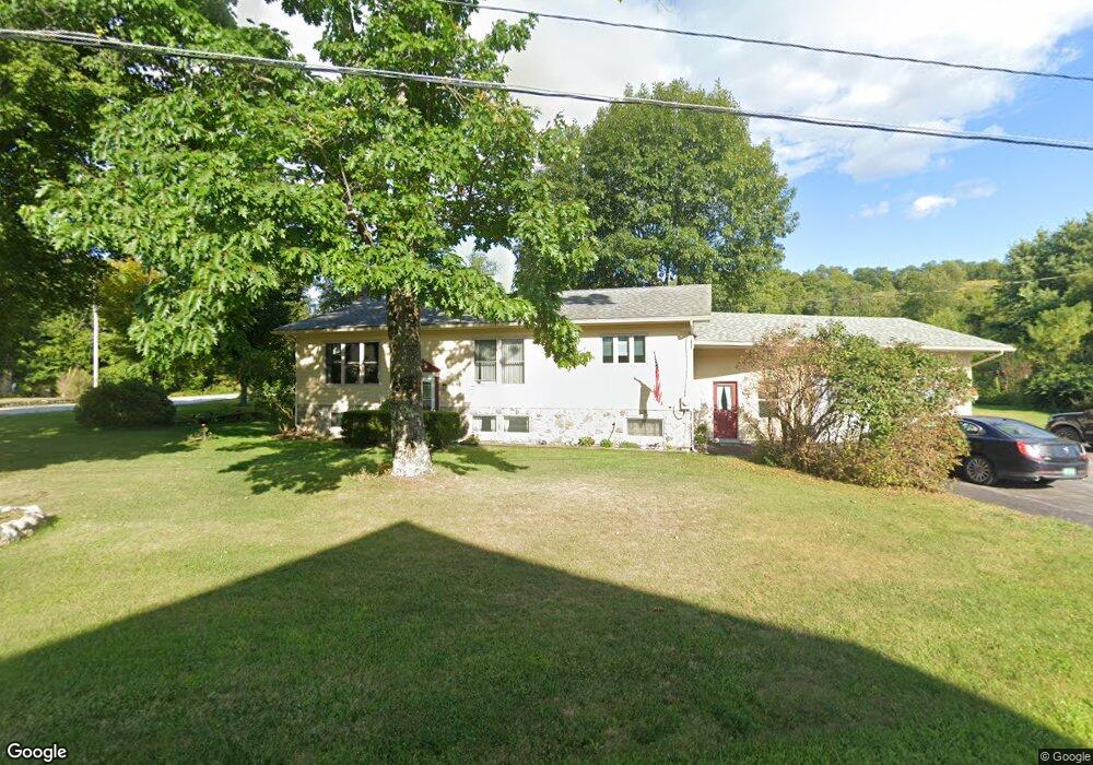
61 S Main St Montgomery Center, VT 05471
Estimated Value: $856,000 - $975,762
--
Bed
--
Bath
--
Sq Ft
334.31
Acres
About This Home
This home is located at 61 S Main St, Montgomery Center, VT 05471 and is currently estimated at $915,881. 61 S Main St is a home with nearby schools including Montgomery Center School.
Ownership History
Date
Name
Owned For
Owner Type
Purchase Details
Closed on
Oct 26, 2022
Sold by
Begnoche Armand
Bought by
Trout River Farm Land Llc
Current Estimated Value
Purchase Details
Closed on
Oct 12, 2022
Sold by
Begnoche Therese
Bought by
Begnoche Armand
Purchase Details
Closed on
Feb 23, 2022
Sold by
Gaston R Begnoche Revocable Trust
Bought by
Begnoche Therese A
Purchase Details
Closed on
Feb 18, 2022
Sold by
Begnoche Estate Gaston R
Purchase Details
Closed on
Mar 8, 2007
Sold by
Begnoche Gaston and Begnoche Theresa
Bought by
Barnes John E and Barnes Theresa L
Create a Home Valuation Report for This Property
The Home Valuation Report is an in-depth analysis detailing your home's value as well as a comparison with similar homes in the area
Home Values in the Area
Average Home Value in this Area
Purchase History
| Date | Buyer | Sale Price | Title Company |
|---|---|---|---|
| Trout River Farm Land Llc | -- | -- | |
| Trout River Farm Land Llc | -- | -- | |
| Trout River Farm Land Llc | -- | -- | |
| Begnoche Armand | -- | -- | |
| Begnoche Armand | -- | -- | |
| Begnoche Armand | -- | -- | |
| Begnoche Therese A | -- | -- | |
| Begnoche Therese A | -- | -- | |
| -- | -- | -- | |
| -- | -- | -- | |
| Barnes John E | $70,000 | -- | |
| Barnes John E | $70,000 | -- |
Source: Public Records
Tax History Compared to Growth
Tax History
| Year | Tax Paid | Tax Assessment Tax Assessment Total Assessment is a certain percentage of the fair market value that is determined by local assessors to be the total taxable value of land and additions on the property. | Land | Improvement |
|---|---|---|---|---|
| 2024 | -- | $962,800 | $497,600 | $465,200 |
| 2023 | -- | $962,800 | $497,600 | $465,200 |
| 2022 | $20,416 | $1,087,000 | $593,300 | $493,700 |
| 2021 | $21,221 | $1,087,000 | $593,300 | $493,700 |
| 2020 | $23,332 | $1,087,000 | $593,300 | $493,700 |
| 2019 | $20,203 | $1,087,000 | $593,300 | $493,700 |
| 2018 | $18,337 | $1,087,000 | $593,300 | $493,700 |
| 2017 | $19,268 | $1,087,000 | $593,300 | $493,700 |
| 2016 | $18,384 | $1,087,000 | $593,300 | $493,700 |
Source: Public Records
Map
Nearby Homes
- 84 Hazens Notch Rd
- 92 River St
- 1205 Hazens Notch Rd
- 13 S Brook Rd
- 367 Lower Ring Rd
- 00 Creamery Bridge Rd
- 32 Fuller Bridge Rd
- 00 Brook Rd
- 135 W Hill Rd
- 2709 Amidon Rd
- 00 W Hill Rd
- 967 Amidon Rd
- 0 Amidon Rd
- 4106 W Hill Rd
- 1585 Amidon Rd
- 1585 Amidon Rd Unit 2
- 1585 Amidon Rd Unit 1,2,3
- 00 Thomas Dr
- 00 Highland Dr
- 0 Rushford Valley Rd
- 0 Hazens N Rd
- 00 Hazens Notch Rd
- 93 S Main St
- 21 Hazens Notch Rd
- 46 Hazens Notch Rd
- 22 Begnoche Farm Rd
- 56 Hazens Notch Rd
- 4 Mountain Rd
- 68 Hazens Notch Rd
- 0 Main St Unit 2780669
- 0 Main St
- 0 Route 242
- 0 Route 242 Unit 4991415
- 0 Route 242 Unit 3059914
- 46 Begnoche Farm Rd
- 22 Mountain Rd
- 118 S Main St
- 42 Mountain Rd
- 82 Begnoche Farm Rd
- 46 Main St