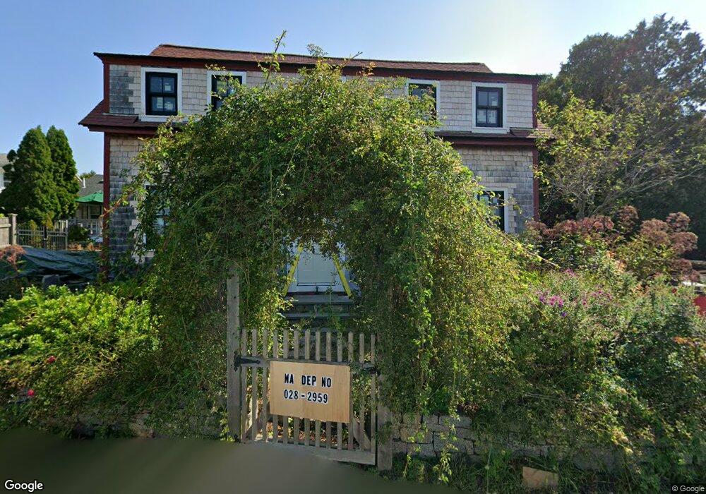
61 Shore Rd Unit 1 Gloucester, MA 01930
Magnolia NeighborhoodEstimated Value: $285,000 - $703,000
1
Bed
1
Bath
649
Sq Ft
$808/Sq Ft
Est. Value
About This Home
This home is located at 61 Shore Rd Unit 1, Gloucester, MA 01930 and is currently estimated at $524,419, approximately $808 per square foot. 61 Shore Rd Unit 1 is a home located in Essex County with nearby schools including West Parish, Ralph B O'maley Middle School, and Gloucester High School.
Ownership History
Date
Name
Owned For
Owner Type
Purchase Details
Closed on
Dec 30, 1994
Sold by
Becker-Jones Clive
Bought by
Noga James W and Noga Marcia
Current Estimated Value
Purchase Details
Closed on
Jun 10, 1991
Sold by
Edmonds William E
Bought by
Becker Jones Clive
Home Financials for this Owner
Home Financials are based on the most recent Mortgage that was taken out on this home.
Original Mortgage
$120,000
Interest Rate
9.42%
Mortgage Type
Purchase Money Mortgage
Create a Home Valuation Report for This Property
The Home Valuation Report is an in-depth analysis detailing your home's value as well as a comparison with similar homes in the area
Home Values in the Area
Average Home Value in this Area
Purchase History
| Date | Buyer | Sale Price | Title Company |
|---|---|---|---|
| Noga James W | $117,072 | -- | |
| Becker Jones Clive | $135,000 | -- |
Source: Public Records
Mortgage History
| Date | Status | Borrower | Loan Amount |
|---|---|---|---|
| Open | Becker Jones Clive | $127,500 | |
| Previous Owner | Becker Jones Clive | $120,000 |
Source: Public Records
Tax History
| Year | Tax Paid | Tax Assessment Tax Assessment Total Assessment is a certain percentage of the fair market value that is determined by local assessors to be the total taxable value of land and additions on the property. | Land | Improvement |
|---|---|---|---|---|
| 2025 | $6,146 | $632,300 | $0 | $632,300 |
| 2024 | $5,768 | $592,800 | $0 | $592,800 |
| 2023 | $5,539 | $523,000 | $0 | $523,000 |
| 2022 | $5,305 | $452,300 | $0 | $452,300 |
| 2021 | $5,296 | $425,700 | $0 | $425,700 |
| 2020 | $5,249 | $425,700 | $0 | $425,700 |
| 2019 | $4,995 | $393,600 | $0 | $393,600 |
| 2018 | $4,717 | $364,800 | $0 | $364,800 |
| 2017 | $4,461 | $338,200 | $0 | $338,200 |
| 2016 | $4,241 | $311,600 | $0 | $311,600 |
| 2015 | $4,163 | $305,000 | $0 | $305,000 |
Source: Public Records
Map
Nearby Homes
- 53 Raymond St
- 2 Ocean Ave Unit 2K
- 24 Flume Rd
- 468 Summer St
- 450 Summer St
- 239 Summer St
- 8 Forest St
- 4 Cobb Ave
- 6 Smith Ln Unit 6
- 25 Masconomo St
- 45 School St
- 8 Flatley Ave
- 100 Eastern Point Blvd
- 368 Essex Ave
- 5 Marshfield St
- 26 Central St
- 5 Lepage Ln
- 24 Cobblestone Ln Unit 603
- 21 Pine St Unit 5
- 5 Samoset Rd Unit B
- 61 Shore Rd Unit 3
- 61 Shore Rd Unit 2
- 63 Shore Rd
- 22 Fuller St
- 67 Shore Rd
- 20 Fuller St Unit 9
- 20 Fuller St Unit 8
- 20 Fuller St Unit 7
- 20 Fuller St Unit 6
- 20 Fuller St Unit 5
- 20 Fuller St Unit 4
- 20 Fuller St Unit 3
- 20 Fuller St Unit 2
- 20 Fuller St Unit 1
- 20 Fuller St
- 24 Fuller St
- 26 Fuller St
- 16 Fuller St
- 28 Fuller St
- 58 Shore Rd
Your Personal Tour Guide
Ask me questions while you tour the home.