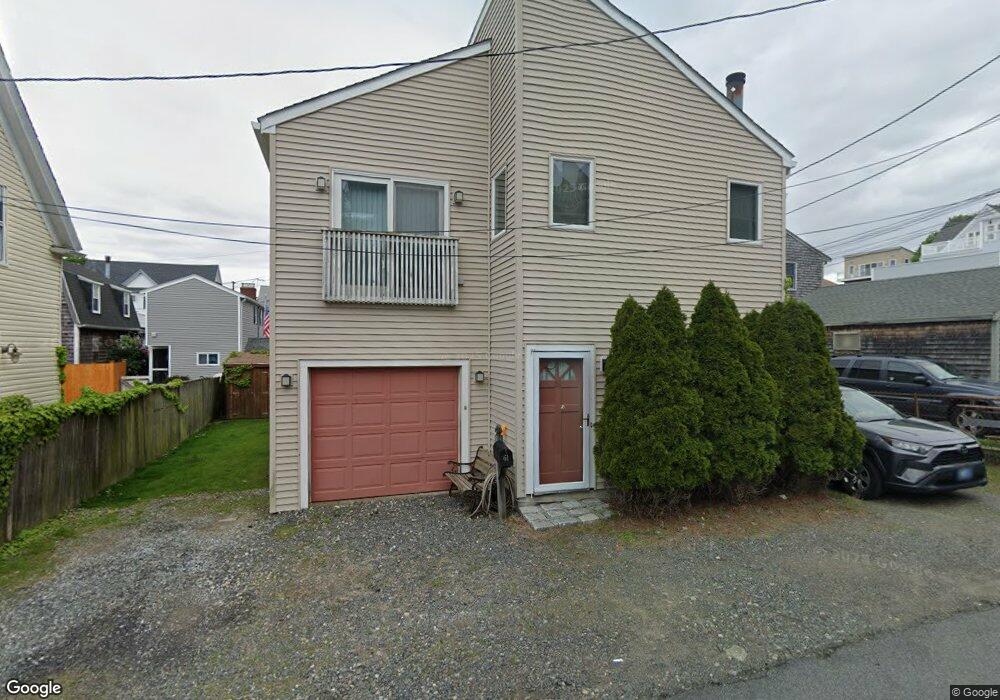
61 Spinney Path Nahant, MA 01908
Estimated Value: $655,443 - $735,000
2
Beds
2
Baths
1,154
Sq Ft
$616/Sq Ft
Est. Value
About This Home
This home is located at 61 Spinney Path, Nahant, MA 01908 and is currently estimated at $710,611, approximately $615 per square foot. 61 Spinney Path is a home located in Essex County with nearby schools including Johnson Elementary School, Swampscott Middle School, and Swampscott High School.
Ownership History
Date
Name
Owned For
Owner Type
Purchase Details
Closed on
Jul 17, 1998
Sold by
Goodell Edwin D and Goodell Phyllis A
Bought by
Luepongsak Niyom
Current Estimated Value
Home Financials for this Owner
Home Financials are based on the most recent Mortgage that was taken out on this home.
Original Mortgage
$170,350
Interest Rate
6.98%
Mortgage Type
Purchase Money Mortgage
Create a Home Valuation Report for This Property
The Home Valuation Report is an in-depth analysis detailing your home's value as well as a comparison with similar homes in the area
Home Values in the Area
Average Home Value in this Area
Purchase History
| Date | Buyer | Sale Price | Title Company |
|---|---|---|---|
| Luepongsak Niyom | $182,500 | -- | |
| Luepongsak Niyom | $182,500 | -- |
Source: Public Records
Mortgage History
| Date | Status | Borrower | Loan Amount |
|---|---|---|---|
| Open | Luepongsak Niyom | $156,000 | |
| Closed | Luepongsak Niyom | $170,350 | |
| Previous Owner | Luepongsak Niyom | $81,300 |
Source: Public Records
Tax History
| Year | Tax Paid | Tax Assessment Tax Assessment Total Assessment is a certain percentage of the fair market value that is determined by local assessors to be the total taxable value of land and additions on the property. | Land | Improvement |
|---|---|---|---|---|
| 2025 | $5,464 | $597,200 | $316,000 | $281,200 |
| 2024 | $5,058 | $557,700 | $276,500 | $281,200 |
| 2023 | $4,746 | $522,100 | $260,700 | $261,400 |
| 2022 | $4,789 | $489,200 | $252,800 | $236,400 |
| 2021 | $4,830 | $459,600 | $237,000 | $222,600 |
| 2020 | $4,539 | $413,800 | $221,200 | $192,600 |
| 2019 | $4,137 | $379,200 | $205,400 | $173,800 |
| 2018 | $3,606 | $351,800 | $181,700 | $170,100 |
| 2017 | $3,722 | $355,500 | $181,700 | $173,800 |
| 2016 | $3,108 | $295,400 | $134,300 | $161,100 |
| 2015 | $3,153 | $288,700 | $127,600 | $161,100 |
| 2014 | $3,237 | $293,500 | $127,600 | $165,900 |
Source: Public Records
Map
Nearby Homes
- 183 Bass Point Rd
- 1 Goddard Dr
- 30 Sherman Ave
- 162 Willow Rd Unit 11
- 66 Ocean St
- 51 Cliff St
- 9 Little Nahant Rd
- 1 Carey Cir Unit 409
- 191 N Shore Rd
- 11 Archer Ave
- 123 Mills Ave
- 31 Mills Ave
- 510 Revere Beach Blvd Unit 1205
- 510 Revere Beach Blvd Unit 905
- 505 Revere Beach Blvd Unit 303
- 474 Revere Beach Blvd Unit 501
- 474 Revere Beach Blvd Unit 903
- 474 Revere Beach Blvd Unit 302
- 474 Revere Beach Blvd Unit 403
- 350 Revere Beach Blvd Unit P2-13I
- 54 Irving Way
- 52 Irving Way
- 56 Irving Way
- 63 Spinney Path
- 65 Spinney Path To Be Built
- 56 Spinney Path
- 60 Irving Way
- 65 Spinney Path
- 65 Spinney Path Unit AS IS
- 62 Spinney Path
- 64 Irving Way
- 48 Spinney Path Unit 2
- 48 Spinney Path Unit 1
- 118 Bass Point Rd Unit 120
- 118 Bass Point Rd
- 38 Irving Way Unit 1
- 38 Irving Way
- 38 Irving Way
- 100 Bass Point Rd
- 118-120 Bass Point Rd
Your Personal Tour Guide
Ask me questions while you tour the home.