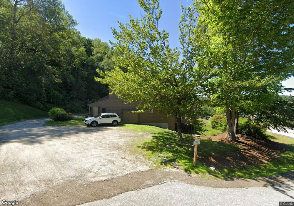
61 Woodbury Dr Unit 42 Bristol, NH 03222
Estimated Value: $595,685 - $746,000
2
Beds
2
Baths
1,982
Sq Ft
$346/Sq Ft
Est. Value
About This Home
This home is located at 61 Woodbury Dr Unit 42, Bristol, NH 03222 and is currently estimated at $685,421, approximately $345 per square foot. 61 Woodbury Dr Unit 42 is a home located in Grafton County with nearby schools including Bristol Elementary School.
Ownership History
Date
Name
Owned For
Owner Type
Purchase Details
Closed on
Aug 30, 2018
Sold by
Traumuller Bruce M and Trumuler Peggy A
Bought by
Bruce M Traumuller Ret
Current Estimated Value
Purchase Details
Closed on
May 29, 2001
Sold by
Walsh James Demitra and Walsh Christopher
Bought by
Traumuller Bruce M and Traumuller Peggy A
Home Financials for this Owner
Home Financials are based on the most recent Mortgage that was taken out on this home.
Original Mortgage
$147,900
Interest Rate
7.05%
Create a Home Valuation Report for This Property
The Home Valuation Report is an in-depth analysis detailing your home's value as well as a comparison with similar homes in the area
Home Values in the Area
Average Home Value in this Area
Purchase History
| Date | Buyer | Sale Price | Title Company |
|---|---|---|---|
| Bruce M Traumuller Ret | -- | -- | |
| Traumuller Bruce M | $184,900 | -- |
Source: Public Records
Mortgage History
| Date | Status | Borrower | Loan Amount |
|---|---|---|---|
| Previous Owner | Traumuller Bruce M | $133,125 | |
| Previous Owner | Traumuller Bruce M | $147,900 |
Source: Public Records
Tax History Compared to Growth
Tax History
| Year | Tax Paid | Tax Assessment Tax Assessment Total Assessment is a certain percentage of the fair market value that is determined by local assessors to be the total taxable value of land and additions on the property. | Land | Improvement |
|---|---|---|---|---|
| 2024 | $7,733 | $327,400 | $0 | $327,400 |
| 2023 | $7,448 | $327,400 | $0 | $327,400 |
| 2022 | $6,881 | $327,800 | $0 | $327,800 |
| 2021 | $6,625 | $327,800 | $0 | $327,800 |
| 2020 | $7,299 | $352,800 | $0 | $352,800 |
| 2019 | $2,241 | $240,500 | $0 | $240,500 |
| 2018 | $2,177 | $240,500 | $0 | $240,500 |
| 2017 | $2,209 | $240,500 | $0 | $240,500 |
| 2016 | $2,165 | $240,500 | $0 | $240,500 |
| 2015 | $5,681 | $282,200 | $0 | $282,200 |
| 2014 | $5,681 | $282,200 | $0 | $282,200 |
| 2013 | $7,309 | $362,200 | $0 | $362,200 |
Source: Public Records
Map
Nearby Homes
- 26 Don Gerry Rd
- 383 Wulamat Rd
- 199 Cottage City Rd
- 40 Adams Rd
- 94 Mandi Ln
- Lot 7 Hall Rd
- 29 Daniels Rd
- 333 Lake St
- 114 Ledgewood Terrace
- 862 Mayhew Turnpike Unit 1
- 135 Pleasant St
- 30 Beech St Unit 4B
- 30 Beech St Unit 4C
- 125 Verrill Rd
- 00 Peaked Hill Rd Unit 7.1, 7.2, 7.3, 7.4,
- 80 Patten Rd
- 4 Birchwood Dr Unit A
- 301 Perkins Hill Rd
- 497 W Shore Rd
- 00 Ledgewood Cir Unit 7
- 61 Woodbury Dr Unit 43
- 61 Woodbury Dr Unit 44
- 61 Woodbury Dr Unit 45
- 61 Woodbury Dr Unit 46
- 18 Rent Rd
- 41 Woodbury Dr Unit 36
- 41 Woodbury Dr Unit 35
- 41 Woodbury Dr Unit 34
- 41 Woodbury Dr Unit 33
- 41 Woodbury Dr Unit 32
- 41 Woodbury Dr
- 13 Rent Rd
- 209 W Shore Rd
- 21 Woodbury Dr Unit 27
- 21 Woodbury Dr Unit 28
- 21 Woodbury Dr Unit 29
- 21 Woodbury Dr Unit 30
- 21 Woodbury Dr Unit 31
- 23 Rent Rd
- 207 W Shore Rd