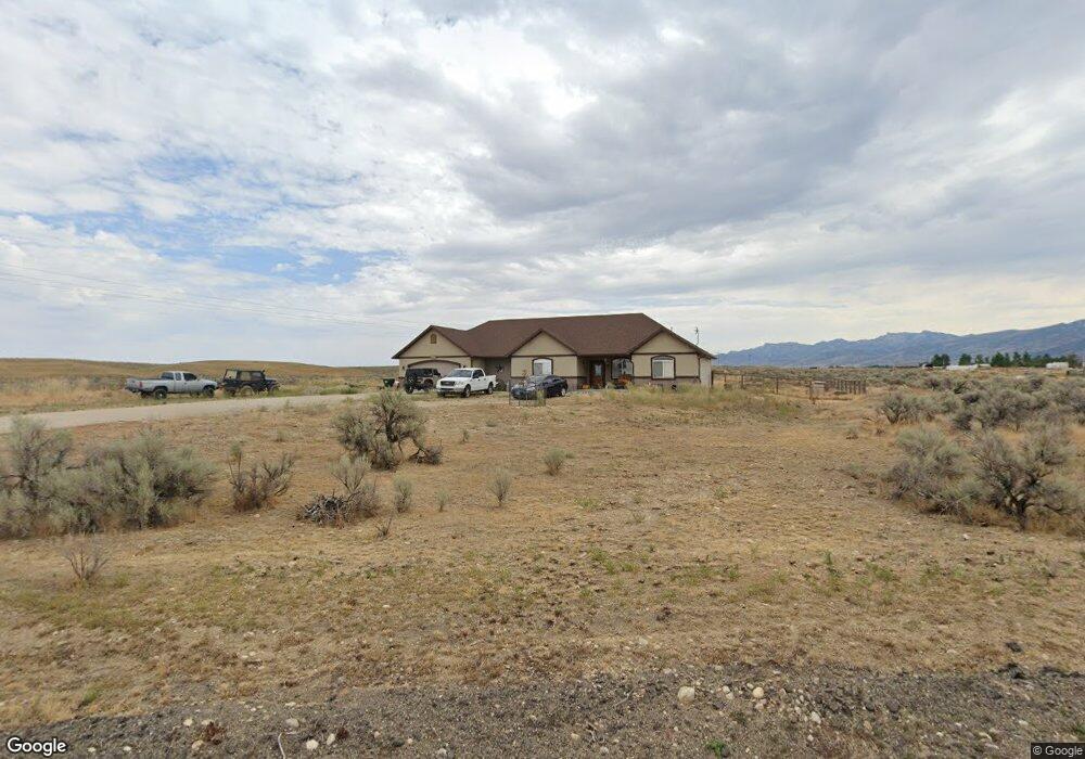
610 Aesop Dr Spring Creek, NV 89815
Estimated Value: $394,000 - $428,000
3
Beds
2
Baths
1,796
Sq Ft
$229/Sq Ft
Est. Value
About This Home
This home is located at 610 Aesop Dr, Spring Creek, NV 89815 and is currently estimated at $411,452, approximately $229 per square foot. 610 Aesop Dr is a home located in Elko County with nearby schools including Spring Creek Elementary School, Spring Creek Middle School, and Spring Creek High School.
Ownership History
Date
Name
Owned For
Owner Type
Purchase Details
Closed on
Mar 20, 2026
Sold by
Dawn Wytcherley
Bought by
Wytcherley Kevin
Current Estimated Value
Home Financials for this Owner
Home Financials are based on the most recent Mortgage that was taken out on this home.
Original Mortgage
$80,000
Outstanding Balance
$80,000
Interest Rate
5.44%
Mortgage Type
New Conventional
Estimated Equity
$331,452
Purchase Details
Closed on
May 29, 2020
Sold by
Peck Daniel Callis and Peck Shannon
Bought by
Wytcherley Kevin
Home Financials for this Owner
Home Financials are based on the most recent Mortgage that was taken out on this home.
Original Mortgage
$252,200
Interest Rate
3.3%
Mortgage Type
New Conventional
Purchase Details
Closed on
May 29, 2014
Sold by
Arnold Beck Construction Inc
Bought by
Peck Daniel Callis and Peck Shannon
Home Financials for this Owner
Home Financials are based on the most recent Mortgage that was taken out on this home.
Original Mortgage
$254,251
Interest Rate
4.25%
Mortgage Type
VA
Purchase Details
Closed on
Jan 7, 2013
Sold by
Cruz Godofredo and Cruz Violeta
Bought by
Arnold Beck Construction Inc
Create a Home Valuation Report for This Property
The Home Valuation Report is an in-depth analysis detailing your home's value as well as a comparison with similar homes in the area
Purchase History
| Date | Buyer | Sale Price | Title Company |
|---|---|---|---|
| Wytcherley Kevin | -- | Stewart Title | |
| Wytcherley Kevin | $260,000 | Stewart Title Elko | |
| Peck Daniel Callis | $249,000 | First American Title | |
| Arnold Beck Construction Inc | $22,000 | First American Title Elko |
Source: Public Records
Mortgage History
| Date | Status | Borrower | Loan Amount |
|---|---|---|---|
| Open | Wytcherley Kevin | $80,000 | |
| Previous Owner | Wytcherley Kevin | $252,200 | |
| Previous Owner | Peck Daniel Callis | $254,251 |
Source: Public Records
Tax History
| Year | Tax Paid | Tax Assessment Tax Assessment Total Assessment is a certain percentage of the fair market value that is determined by local assessors to be the total taxable value of land and additions on the property. | Land | Improvement |
|---|---|---|---|---|
| 2025 | $2,943 | $124,798 | $21,000 | $103,798 |
| 2024 | $2,943 | $125,945 | $21,000 | $104,945 |
| 2023 | $2,613 | $109,119 | $11,200 | $97,919 |
| 2022 | $2,383 | $88,942 | $11,200 | $77,742 |
| 2021 | $2,480 | $86,803 | $11,200 | $75,603 |
| 2020 | $2,459 | $87,614 | $11,200 | $76,414 |
| 2019 | $2,387 | $85,690 | $8,750 | $76,940 |
| 2018 | $2,317 | $85,822 | $8,750 | $77,072 |
| 2017 | $2,051 | $84,073 | $8,750 | $75,323 |
| 2016 | $1,989 | $78,384 | $8,750 | $69,634 |
| 2015 | $1,931 | $77,182 | $8,750 | $68,432 |
| 2014 | $1,876 | $8,964 | $8,750 | $214 |
Source: Public Records
Map
Nearby Homes
- 611 Westcott Dr
- 613 Westcott Dr
- 715 Aesop Dr
- 787 Clover Dr
- 694 Bluegrass Dr
- 728 Parkridge Pkwy
- 751 Thistle Dr
- 515 Foxridge Dr
- 538 Balsam Dr
- 629 Palace Pkwy
- 539 Palace Pkwy
- 871 Willington Dr
- 472 Foxridge Dr
- 151 Sun Mountain Ln
- 535 Balsam Dr
- 457 Glen Haven Dr
- 899 Eastlake Dr
- 658 Spring Creek Pkwy
- 482 Frisco Dr
- 564 Frisco Dr
Your Personal Tour Guide
Ask me questions while you tour the home.