Estimated Value: $90,000 - $107,000
2
Beds
1
Bath
667
Sq Ft
$151/Sq Ft
Est. Value
About This Home
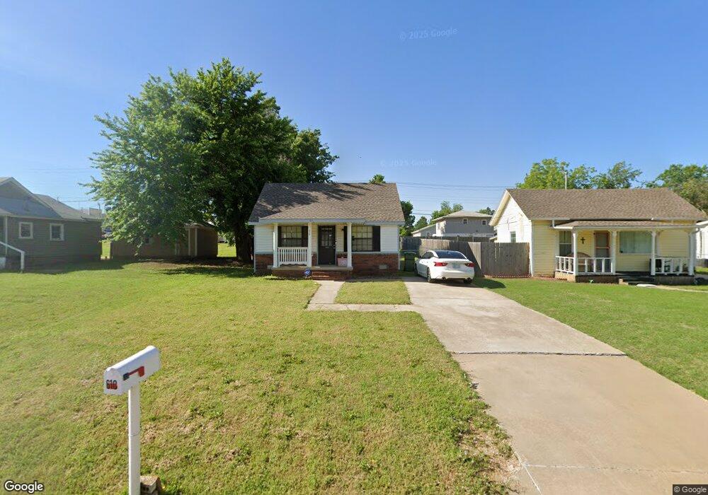
This home is located at 610 Cedar Ave, Yukon, OK 73099 and is currently estimated at $100,973, approximately $151 per square foot. 610 Cedar Ave is a home located in Canadian County with nearby schools including Central Elementary School, Redstone Intermediate School, and Yukon Middle School.
Ownership History
Date
Name
Owned For
Owner Type
Purchase Details
Closed on
Oct 10, 2025
Sold by
Mcmillin Betty J
Bought by
Mcmillin Betty J and Thatcher Brian
Current Estimated Value
Purchase Details
Closed on
Jul 25, 2025
Sold by
Carl Wright Trust and Nelva Wright Trust
Bought by
Mcmillin Betty J
Purchase Details
Closed on
Dec 30, 1999
Sold by
Wright Robert and Nelda Jean
Purchase Details
Closed on
Nov 30, 1999
Sold by
Wright Carl and Nelva Joy
Bought by
Wright,Carl Trustee Etal
Purchase Details
Closed on
Nov 29, 1999
Sold by
Wright Brothers Construction
Purchase Details
Closed on
Aug 29, 1997
Sold by
Mckinney,Glen & Zella Trustees
Purchase Details
Closed on
May 20, 1992
Sold by
Conversion
Create a Home Valuation Report for This Property
The Home Valuation Report is an in-depth analysis detailing your home's value as well as a comparison with similar homes in the area
Home Values in the Area
Average Home Value in this Area
Purchase History
| Date | Buyer | Sale Price | Title Company |
|---|---|---|---|
| Mcmillin Betty J | -- | None Listed On Document | |
| Carl Wright Trust | -- | First American Title | |
| Mcmillin Betty J | $103,000 | First American Title | |
| -- | -- | -- | |
| Wright,Carl Trustee Etal | -- | -- | |
| -- | -- | -- | |
| -- | $12,000 | -- | |
| -- | $5,500 | -- |
Source: Public Records
Tax History
| Year | Tax Paid | Tax Assessment Tax Assessment Total Assessment is a certain percentage of the fair market value that is determined by local assessors to be the total taxable value of land and additions on the property. | Land | Improvement |
|---|---|---|---|---|
| 2025 | $472 | $4,605 | $1,673 | $2,932 |
| 2024 | $453 | $4,386 | $1,593 | $2,793 |
| 2023 | $453 | $4,178 | $1,482 | $2,696 |
| 2022 | $433 | $3,979 | $1,369 | $2,610 |
| 2021 | $414 | $3,789 | $1,280 | $2,509 |
| 2020 | $389 | $3,609 | $1,251 | $2,358 |
| 2019 | $372 | $3,437 | $1,220 | $2,217 |
| 2018 | $355 | $3,273 | $1,185 | $2,088 |
| 2017 | $338 | $3,118 | $1,136 | $1,982 |
| 2016 | $322 | $3,118 | $1,144 | $1,974 |
| 2015 | -- | $2,827 | $1,020 | $1,807 |
| 2014 | -- | $2,693 | $928 | $1,765 |
Source: Public Records
Map
Nearby Homes
- 2117 Aminas Way
- 11036 NW 20th St
- 11017 NW 20th St
- 11032 NW 20th Terrace
- 308 S 6th St
- 4601 Grassland Dr Unit 1AL
- 12105 Birch Ave
- 12205 Birch Ave
- 12100 Birch Ave
- 1005 Cedar Ave
- 930 Maple St
- 1101 W Main St
- 1016 Maple Ave
- 121 Birch Ave
- 428 S 8th St
- 601 S 8th St
- 24 Cedar Ave
- 10516 NW 33rd Place
- 3521 Sawtooth Ridge Dr
- 401 Walnut Ave
Your Personal Tour Guide
Ask me questions while you tour the home.