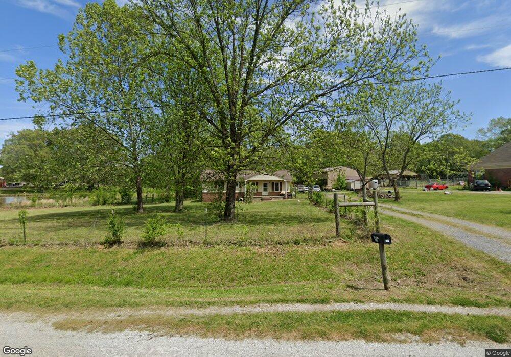
610 Emily Rd Oakland, TN 38060
Estimated Value: $123,000 - $201,844
--
Bed
2
Baths
903
Sq Ft
$190/Sq Ft
Est. Value
About This Home
This home is located at 610 Emily Rd, Oakland, TN 38060 and is currently estimated at $171,961, approximately $190 per square foot. 610 Emily Rd is a home located in Fayette County with nearby schools including Southwest Elementary School, West Junior High School, and Fayette Ware Comprehensive High School.
Ownership History
Date
Name
Owned For
Owner Type
Purchase Details
Closed on
May 5, 2015
Sold by
Meggs Ray Alfred
Bought by
Meggs Jeremy Andrew
Current Estimated Value
Home Financials for this Owner
Home Financials are based on the most recent Mortgage that was taken out on this home.
Original Mortgage
$72,904
Outstanding Balance
$55,818
Interest Rate
3.75%
Mortgage Type
New Conventional
Estimated Equity
$116,143
Purchase Details
Closed on
Feb 10, 2014
Sold by
Meggs Jewell Diane
Bought by
Meggs Ray Alfred
Purchase Details
Closed on
Mar 30, 1993
Purchase Details
Closed on
Jan 1, 1986
Bought by
Meggs Ray A and Meggs Cathy
Create a Home Valuation Report for This Property
The Home Valuation Report is an in-depth analysis detailing your home's value as well as a comparison with similar homes in the area
Home Values in the Area
Average Home Value in this Area
Purchase History
| Date | Buyer | Sale Price | Title Company |
|---|---|---|---|
| Meggs Jeremy Andrew | $70,000 | -- | |
| Meggs Ray Alfred | -- | -- | |
| -- | -- | -- | |
| Meggs Alfred | -- | -- | |
| Meggs Ray A | $22,500 | -- |
Source: Public Records
Mortgage History
| Date | Status | Borrower | Loan Amount |
|---|---|---|---|
| Open | Meggs Jeremy Andrew | $72,904 |
Source: Public Records
Tax History Compared to Growth
Tax History
| Year | Tax Paid | Tax Assessment Tax Assessment Total Assessment is a certain percentage of the fair market value that is determined by local assessors to be the total taxable value of land and additions on the property. | Land | Improvement |
|---|---|---|---|---|
| 2025 | $424 | $57,800 | $35,025 | $22,775 |
| 2024 | $424 | $32,850 | $16,050 | $16,800 |
| 2023 | $424 | $32,850 | $0 | $0 |
| 2022 | $424 | $32,850 | $16,050 | $16,800 |
| 2021 | $424 | $32,850 | $16,050 | $16,800 |
| 2020 | $463 | $32,850 | $16,050 | $16,800 |
| 2019 | $463 | $30,725 | $16,050 | $14,675 |
| 2018 | $463 | $30,725 | $16,050 | $14,675 |
| 2017 | $463 | $30,725 | $16,050 | $14,675 |
| 2016 | $542 | $33,750 | $19,675 | $14,075 |
| 2015 | $542 | $33,750 | $19,675 | $14,075 |
| 2014 | $542 | $33,750 | $19,675 | $14,075 |
Source: Public Records
Map
Nearby Homes
- 0 Sellers Dr Unit 10195078
- 0 Sellers Dr Unit LotWP001 19135269
- 395 Charlotte Dr
- 75 Briarfield Cove
- 65 Briarfield Cove
- 290 Sellers Dr
- 55 Cypress Point Rd
- 40 Chesnut Spring Cove
- 270 Whispering Ridge Dr
- 275 Misty Fields Cove
- 25 Whispering Ridge Cove
- 150 Misty Meadows Dr
- 230 Crooked Creek Dr
- 90 Hillside Dr
- 80 Misty Meadows Dr
- 330 Chestnut Ridge Cove
- 350 Chestnut Ridge Cove
- 355 Chestnut Ridge Cove
- 95 Dogwood Spring Dr
- 105 Downy Birch Cove