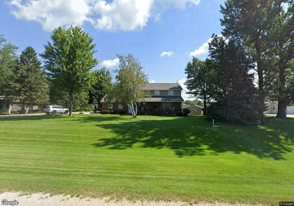
610 Highway 150 N West Union, IA 52175
Estimated Value: $250,803 - $290,000
4
Beds
3
Baths
2,052
Sq Ft
$132/Sq Ft
Est. Value
About This Home
This home is located at 610 Highway 150 N, West Union, IA 52175 and is currently estimated at $271,701, approximately $132 per square foot. 610 Highway 150 N is a home located in Fayette County with nearby schools including North Fayette Valley Middle School and North Fayette Valley H. School.
Ownership History
Date
Name
Owned For
Owner Type
Purchase Details
Closed on
Jun 2, 2014
Sold by
Halverson Dale D and Halverson Marjorie M
Bought by
Elliott Travis D and Elliott Kelly L
Current Estimated Value
Create a Home Valuation Report for This Property
The Home Valuation Report is an in-depth analysis detailing your home's value as well as a comparison with similar homes in the area
Home Values in the Area
Average Home Value in this Area
Purchase History
| Date | Buyer | Sale Price | Title Company |
|---|---|---|---|
| Elliott Travis D | $141,250 | None Available |
Source: Public Records
Tax History Compared to Growth
Tax History
| Year | Tax Paid | Tax Assessment Tax Assessment Total Assessment is a certain percentage of the fair market value that is determined by local assessors to be the total taxable value of land and additions on the property. | Land | Improvement |
|---|---|---|---|---|
| 2025 | $3,640 | $248,730 | $29,910 | $218,820 |
| 2024 | $3,640 | $222,630 | $29,910 | $192,720 |
| 2023 | $3,604 | $222,630 | $29,910 | $192,720 |
| 2022 | $3,242 | $178,370 | $24,930 | $153,440 |
| 2021 | $3,242 | $178,370 | $24,930 | $153,440 |
| 2020 | $3,624 | $193,210 | $24,900 | $168,310 |
| 2019 | $3,210 | $174,650 | $0 | $0 |
| 2018 | $3,148 | $174,650 | $0 | $0 |
| 2017 | $3,294 | $165,140 | $0 | $0 |
| 2016 | $3,210 | $165,140 | $0 | $0 |
| 2015 | $3,210 | $0 | $0 | $0 |
| 2014 | $3,190 | $0 | $0 | $0 |
Source: Public Records
Map
Nearby Homes
- 304 Auburn St
- 110 Lilac Ave
- 701 Northwestern Ave
- 601 Russell Ave
- 504 W Bradford St
- 106 Jones St
- 206 W Maple St
- 119 N Wells St
- 313 W Elm St
- 310 W Plum St
- 107 Union Ridge Dr
- 306 W Plum St
- TBD Lots 5&6 St
- 217 S Walnut St
- 326 E Elm St
- 705 Iowa 150
- 10290 Echo Valley Lot 2 Rd
- 14973 Nature Rd
- Highway 150
- 15453 200th St