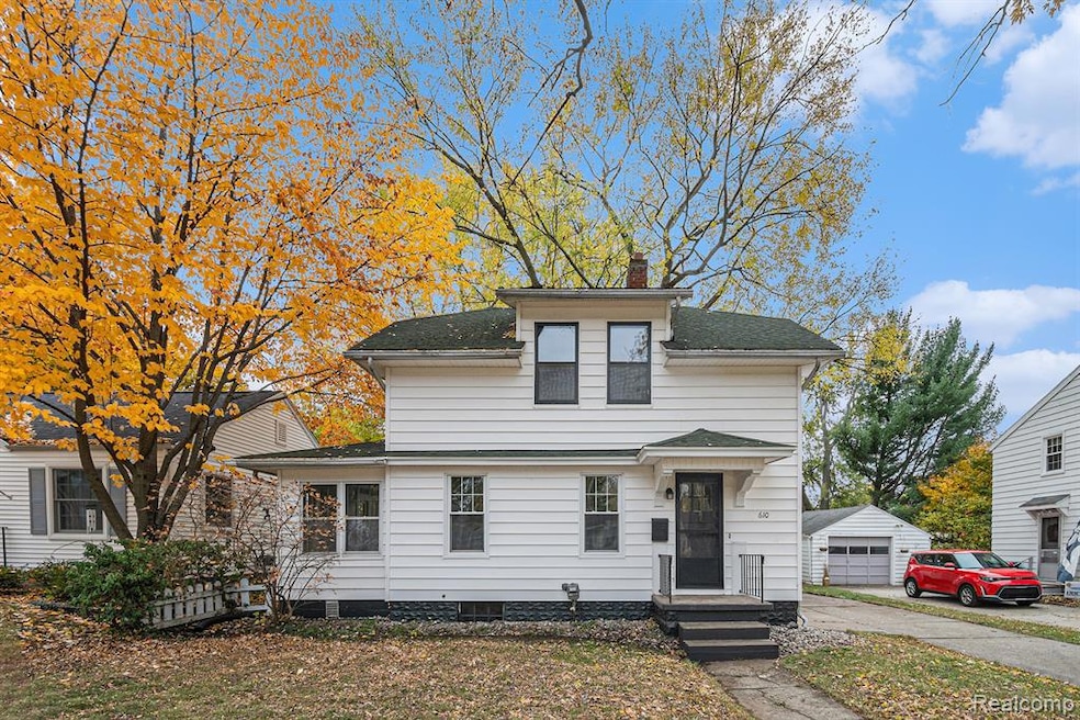
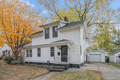
610 N Dexter Dr Lansing, MI 48910
Old Everett NeighborhoodEstimated payment $1,186/month
Highlights
- Colonial Architecture
- 1 Car Detached Garage
- Forced Air Heating System
- No HOA
About This Home
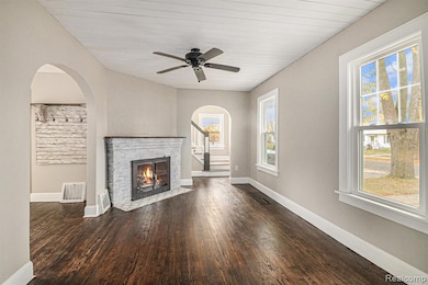
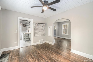
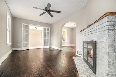
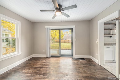
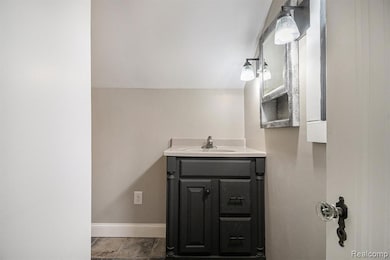
Built in 1929 this was the very first home in the neighborhood back when Lansing was much more rural than it is today. The Three bedroom 1.5 bathroom Mongomery Ward Kit home has only had Two owners up until today. Be a part of history and either make this your primary residence or use it as a rental. Recently renovated in 2025 this home features beautiful original hardwood floors a spacious yard, huge deck and a One car garage. This property is sold AS IS BATVAI.
Home Details
Home Type
- Single Family
Est. Annual Taxes
Year Built
- Built in 1929
Lot Details
- 6,970 Sq Ft Lot
- Lot Dimensions are 50x135
Parking
- 1 Car Detached Garage
Home Design
- Colonial Architecture
- Block Foundation
- Vinyl Construction Material
Interior Spaces
- 1,005 Sq Ft Home
- 2-Story Property
- Unfinished Basement
Bedrooms and Bathrooms
- 3 Bedrooms
Location
- Ground Level
Utilities
- Forced Air Heating System
- Heating System Uses Natural Gas
- Sewer in Street
Community Details
- No Home Owners Association
- Cedarbrook Subdivision
Listing and Financial Details
- Assessor Parcel Number 010128479231
Map
Home Values in the Area
Average Home Value in this Area
Tax History
| Year | Tax Paid | Tax Assessment Tax Assessment Total Assessment is a certain percentage of the fair market value that is determined by local assessors to be the total taxable value of land and additions on the property. | Land | Improvement |
|---|---|---|---|---|
| 2025 | $2,836 | $67,900 | $9,700 | $58,200 |
| 2024 | $22 | $61,800 | $9,700 | $52,100 |
| 2023 | $2,660 | $56,700 | $9,700 | $47,000 |
| 2022 | $2,398 | $50,700 | $9,300 | $41,400 |
| 2021 | $2,348 | $46,200 | $4,200 | $42,000 |
| 2020 | $2,334 | $44,000 | $4,200 | $39,800 |
| 2019 | $2,237 | $39,500 | $4,200 | $35,300 |
| 2018 | $2,097 | $37,800 | $4,200 | $33,600 |
| 2017 | $2,007 | $37,800 | $4,200 | $33,600 |
| 2016 | $1,920 | $36,400 | $4,200 | $32,200 |
| 2015 | $1,920 | $34,700 | $8,407 | $26,293 |
| 2014 | $1,920 | $33,900 | $8,407 | $25,493 |
Property History
| Date | Event | Price | List to Sale | Price per Sq Ft |
|---|---|---|---|---|
| 11/11/2025 11/11/25 | For Sale | $179,000 | -- | $178 / Sq Ft |
Purchase History
| Date | Type | Sale Price | Title Company |
|---|---|---|---|
| Interfamily Deed Transfer | -- | None Available | |
| Warranty Deed | $66,900 | -- |
Mortgage History
| Date | Status | Loan Amount | Loan Type |
|---|---|---|---|
| Open | $75,500 | New Conventional |
Source: Realcomp
MLS Number: 20251053293
APN: 01-01-28-479-231
Disclaimer: Certain information contained herein is derived from information provided by parties other than Homes.com. All information provided is deemed reliable, but is not guaranteed to be accurate and should be independently verified.
![]() IDX provided courtesy of Realcomp II Ltd. via Ten-X and MLS
IDX provided courtesy of Realcomp II Ltd. via Ten-X and MLS
Copyright 2025 Realcomp II Ltd. Shareholders
IDX information is provided exclusively for consumers' personal, noncommercial use and may not be used for any purpose other than to identify prospective properties consumers may be interested in purchasing. The accuracy of all information, regardless of source, is not guaranteed or warranted. All information should be independently verified.
Listing Information presented by local MLS brokerage: Ten-X, local REALTOR®- Arlene Richardson - (888)-952-6393
- 626 N Dexter Dr
- 3114 Alden Dr
- 3216 Ellen Ave
- 3145 S Cedar St
- 701 E Willard Ave
- 3101 Plymouth Dr
- 413 E Hodge Ave
- 637 S Park Blvd
- 3603 Parkway Dr
- 3611 Homewood Ave
- 3319 Jewell Ave
- 3725 Parkway Dr
- 626 Tisdale Ave
- 601 Tisdale Ave
- 701 Tisdale Ave
- 2345 Lyons Ave
- 3716 S Pennsylvania Ave
- 639 Maplehill Ave
- 100 Dunlap St
- 116 E Greenlawn Ave
- 224 Crest St
- 224 Crest St
- 224 Crest St
- 2420 Maplewood Ave
- 729 Jessop Ave
- 2305 S Pennsylvania Ave
- 2205 S Pennsylvania Ave
- 527 Florence St
- 4621 S Cedar St
- 4600 S Pennsylvania Ave
- 1610 S Cedar St
- 1610 S Cedar St
- 124 E Barnes Ave
- 124 E Barnes Ave
- 1016 Kelsey Ave
- 4512 Burchfield Ave
- 1856 S Rundle Ave
- 201 W Jolly Rd
- 5530 Kaynorth Rd
- 5531 Kaynorth Rd
