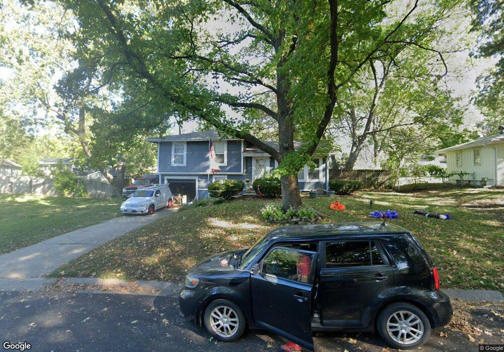
610 NW Falk Dr Lees Summit, MO 64063
Estimated Value: $245,347 - $255,000
3
Beds
1
Bath
1,030
Sq Ft
$244/Sq Ft
Est. Value
About This Home
This home is located at 610 NW Falk Dr, Lees Summit, MO 64063 and is currently estimated at $250,837, approximately $243 per square foot. 610 NW Falk Dr is a home located in Jackson County with nearby schools including Bernard C. Campbell Middle School, Westview Elementary School, and Lee's Summit North High School.
Ownership History
Date
Name
Owned For
Owner Type
Purchase Details
Closed on
Nov 21, 2014
Sold by
Cox Kevin and Cox Rachel L
Bought by
Cox Kevin and Cox Rachel L
Current Estimated Value
Home Financials for this Owner
Home Financials are based on the most recent Mortgage that was taken out on this home.
Original Mortgage
$67,626
Outstanding Balance
$22,139
Interest Rate
3.2%
Mortgage Type
New Conventional
Estimated Equity
$228,698
Purchase Details
Closed on
Sep 27, 2002
Sold by
Humphreys Kevin W and Humphreys Pamela S
Bought by
Cox Kevin
Home Financials for this Owner
Home Financials are based on the most recent Mortgage that was taken out on this home.
Original Mortgage
$70,900
Interest Rate
8.25%
Mortgage Type
Purchase Money Mortgage
Create a Home Valuation Report for This Property
The Home Valuation Report is an in-depth analysis detailing your home's value as well as a comparison with similar homes in the area
Home Values in the Area
Average Home Value in this Area
Purchase History
| Date | Buyer | Sale Price | Title Company |
|---|---|---|---|
| Cox Kevin | -- | None Available | |
| Cox Kevin | -- | Security Land Title Company |
Source: Public Records
Mortgage History
| Date | Status | Borrower | Loan Amount |
|---|---|---|---|
| Open | Cox Kevin | $67,626 | |
| Closed | Cox Kevin | $70,900 |
Source: Public Records
Tax History Compared to Growth
Tax History
| Year | Tax Paid | Tax Assessment Tax Assessment Total Assessment is a certain percentage of the fair market value that is determined by local assessors to be the total taxable value of land and additions on the property. | Land | Improvement |
|---|---|---|---|---|
| 2025 | $3,037 | $34,173 | $9,365 | $24,808 |
| 2024 | $3,015 | $42,055 | $9,217 | $32,838 |
| 2023 | $3,015 | $42,055 | $5,666 | $36,389 |
| 2022 | $2,086 | $25,840 | $4,672 | $21,168 |
| 2021 | $2,129 | $25,840 | $4,672 | $21,168 |
| 2020 | $2,054 | $24,685 | $4,672 | $20,013 |
| 2019 | $1,998 | $24,685 | $4,672 | $20,013 |
| 2018 | $1,874 | $21,484 | $4,066 | $17,418 |
| 2017 | $1,791 | $21,484 | $4,066 | $17,418 |
| 2016 | $1,791 | $20,330 | $3,154 | $17,176 |
| 2014 | $1,613 | $17,949 | $3,513 | $14,436 |
Source: Public Records
Map
Nearby Homes
- 614 NW Fair Ln
- 505 NW Watson Rd
- 407 NW Lincolnwood Dr
- 1410 SW Highway Ln
- 1003 NW Maple St
- 106 SW Donovan Rd
- 128 SW Hillcrest Ln
- 109 SW Pinnell Dr
- 134 SW Robin Rd
- 205-207 NW Orchard Ct
- 207 NW Orchard St
- 205 NW Orchard St
- 1416 SW 3rd St
- 27002 NW Olive St
- 27001 NW Olive St
- 306 SW Mil-Mar Ave
- 1508 SW 5th St
- 514 NW Main St
- 2055 NW O'Brien Rd
- 508 NW Main St
- 608 NW Falk Dr
- 609 NW Falk Dr
- 501 NW Village Dr
- 427 NW Village Dr
- 607 NW Falk Dr
- 503 NW Village Dr
- 607 NW Ward Ln
- 605 NW Ward Ln
- 604 NW Falk Dr
- 605 NW Falk Dr
- 609 NW Ward Ln
- 500 NW Village Dr
- 603 NW Ward Ln
- 502 NW Village Dr
- 425 NW Village Dr
- 601 NW Ward Ln
- 428 NW Village Dr
- 504 NW Village Dr
- 423 NW Village Dr
- 426 NW Village Dr