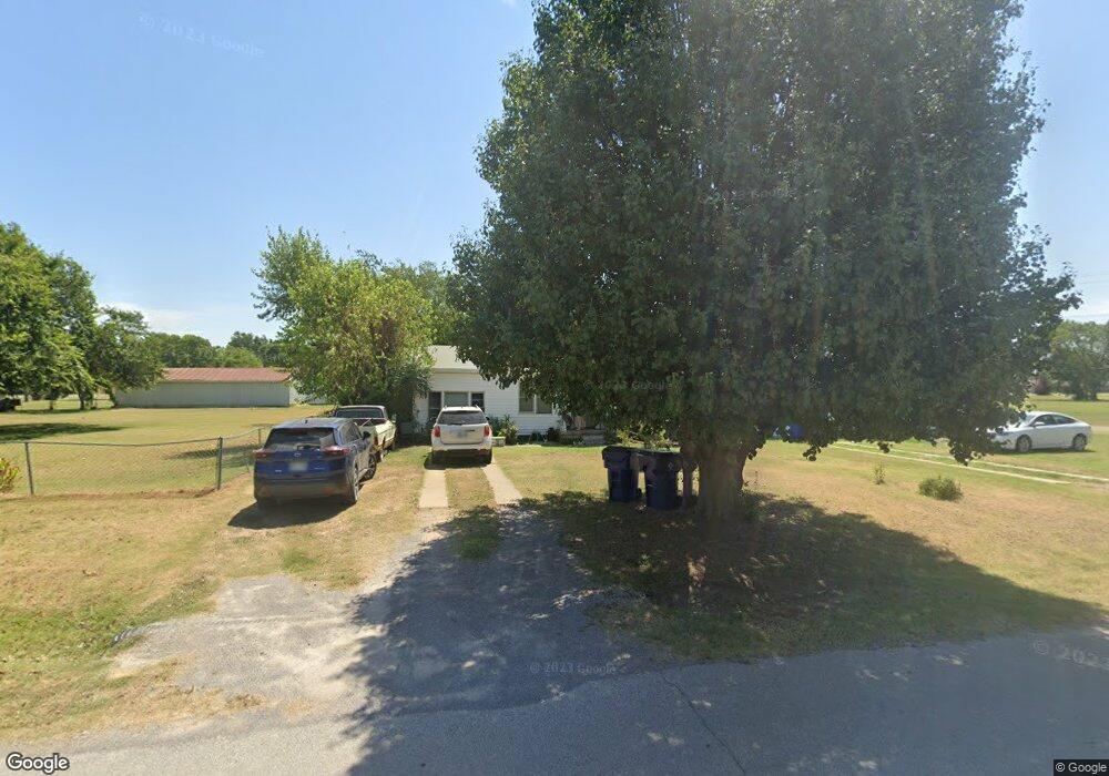
610 S 10th St Comanche, OK 73529
Estimated Value: $53,000 - $70,000
3
Beds
1
Bath
1,136
Sq Ft
$54/Sq Ft
Est. Value
About This Home
This home is located at 610 S 10th St, Comanche, OK 73529 and is currently estimated at $61,760, approximately $54 per square foot. 610 S 10th St is a home located in Stephens County with nearby schools including Comanche Elementary School, Comanche Middle School, and Comanche High School.
Ownership History
Date
Name
Owned For
Owner Type
Purchase Details
Closed on
Aug 21, 2018
Sold by
Osborne Randall J and Osborne Peggy
Bought by
Osborne Keifer
Current Estimated Value
Purchase Details
Closed on
Jan 24, 2009
Sold by
Hicks Joshua and Hicks Anndi
Bought by
Browder Tammy Lynn
Home Financials for this Owner
Home Financials are based on the most recent Mortgage that was taken out on this home.
Original Mortgage
$19,697
Interest Rate
4.84%
Mortgage Type
Purchase Money Mortgage
Purchase Details
Closed on
Aug 18, 2004
Sold by
Gorrell Brenda
Bought by
Osborne Randall J and Osborne Peggy D
Purchase Details
Closed on
Dec 12, 2003
Sold by
Wright Junior
Purchase Details
Closed on
Jul 23, 2001
Sold by
Cleary Billie Gayle Etal
Purchase Details
Closed on
Jul 5, 2001
Sold by
Cleary Billie Gayle
Purchase Details
Closed on
Apr 21, 1993
Sold by
Burk Kathryn
Create a Home Valuation Report for This Property
The Home Valuation Report is an in-depth analysis detailing your home's value as well as a comparison with similar homes in the area
Purchase History
| Date | Buyer | Sale Price | Title Company |
|---|---|---|---|
| Osborne Keifer | -- | Title 68 | |
| Browder Tammy Lynn | $20,000 | None Available | |
| Osborne Randall J | $25,000 | -- | |
| -- | -- | -- | |
| -- | $19,000 | -- | |
| -- | -- | -- | |
| -- | $1,000 | -- |
Source: Public Records
Mortgage History
| Date | Status | Borrower | Loan Amount |
|---|---|---|---|
| Previous Owner | Browder Tammy Lynn | $19,697 |
Source: Public Records
Tax History
| Year | Tax Paid | Tax Assessment Tax Assessment Total Assessment is a certain percentage of the fair market value that is determined by local assessors to be the total taxable value of land and additions on the property. | Land | Improvement |
|---|---|---|---|---|
| 2025 | $185 | $2,122 | $154 | $1,968 |
| 2024 | $203 | $2,289 | $154 | $2,135 |
| 2023 | $203 | $2,912 | $154 | $2,758 |
| 2022 | $239 | $2,774 | $154 | $2,620 |
| 2021 | $243 | $2,642 | $154 | $2,488 |
| 2020 | $220 | $2,396 | $154 | $2,242 |
| 2019 | $234 | $2,430 | $154 | $2,276 |
| 2018 | $153 | $2,599 | $154 | $2,445 |
| 2017 | $134 | $2,599 | $154 | $2,445 |
| 2016 | $149 | $2,771 | $154 | $2,617 |
| 2015 | $195 | $3,259 | $130 | $3,129 |
| 2014 | $195 | $3,259 | $130 | $3,129 |
Source: Public Records
Map
Nearby Homes
- 311 S 6th St
- 117 Seminole Dr
- 303 N 8th St
- 0 Oklahoma 53
- 703 Wilson Ave
- 508 Wilson Ave
- 620 Clark Ave
- 281477 Doctor Pepper Rd
- TBD E 1840 Rd
- Rt Rt 2
- 181259 N 2590 Rd
- ? N 2800 Rd
- 282752 E 1800 Rd
- 182248 N 2790 Rd
- 180163 Larue Dr
- 282096 Andrews Dr
- 179712 Ledford Ln
- 181473 N 2850 Rd
- 280350 E 1780 Rd
- 181307 N 2770 Rd
Your Personal Tour Guide
Ask me questions while you tour the home.