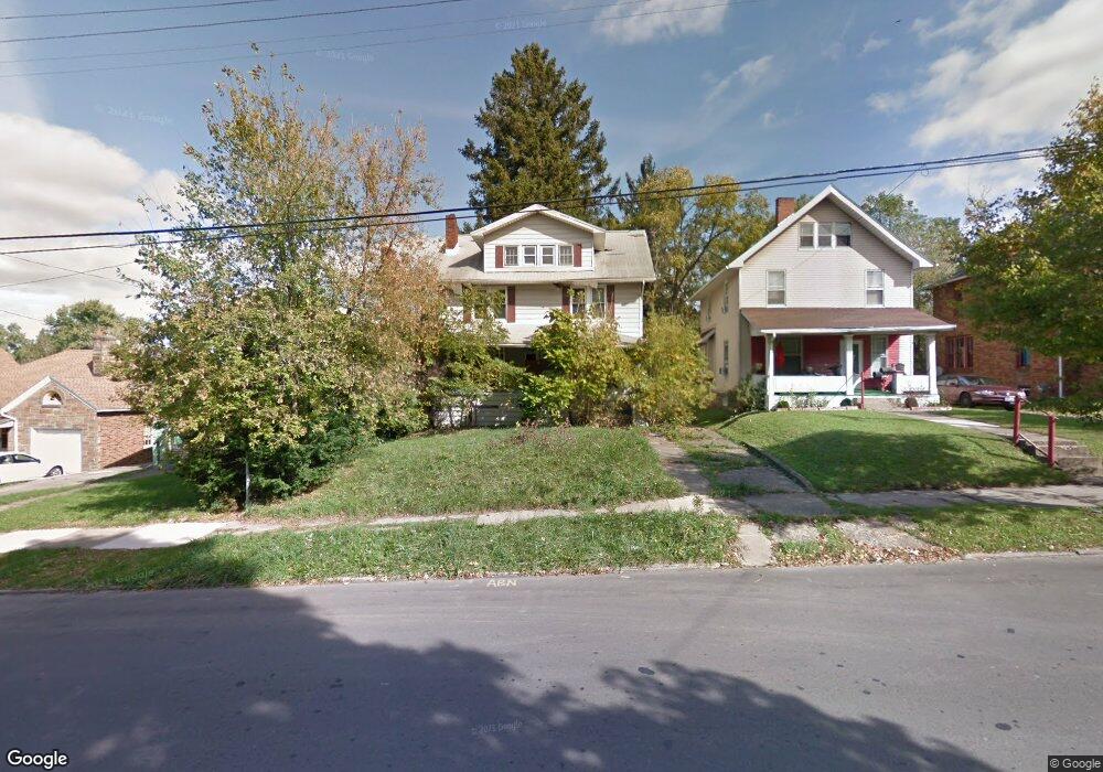
610 W 4th St Mansfield, OH 44906
Estimated Value: $97,524 - $106,000
3
Beds
2
Baths
1,848
Sq Ft
$56/Sq Ft
Est. Value
About This Home
This home is located at 610 W 4th St, Mansfield, OH 44906 and is currently estimated at $102,841, approximately $55 per square foot. 610 W 4th St is a home located in Richland County with nearby schools including Goal Digital Academy, Mansfield Elective Academy, and Interactive Media & Construction (IMAC) Academy.
Ownership History
Date
Name
Owned For
Owner Type
Purchase Details
Closed on
Jul 18, 2025
Sold by
Richland County Land Reutilization Corpo
Bought by
Lindsay Douglas
Current Estimated Value
Purchase Details
Closed on
Mar 31, 2011
Sold by
Cameron Stanley and Hamilton Bart
Bought by
Dennis Diane J
Purchase Details
Closed on
Oct 7, 2005
Sold by
The Richland Trust Co Trust Department
Bought by
Cameron Stanley
Purchase Details
Closed on
Apr 18, 2005
Sold by
Williams Vernessa L and Case #04-546H
Bought by
The Richland Trust Co and Joe Doris Corey Ira
Purchase Details
Closed on
Aug 1, 1985
Create a Home Valuation Report for This Property
The Home Valuation Report is an in-depth analysis detailing your home's value as well as a comparison with similar homes in the area
Home Values in the Area
Average Home Value in this Area
Purchase History
| Date | Buyer | Sale Price | Title Company |
|---|---|---|---|
| Lindsay Douglas | -- | None Listed On Document | |
| Lindsay Douglas | -- | None Listed On Document | |
| Dennis Diane J | $26,042 | Chicago Title Agency Of Nort | |
| Cameron Stanley | $37,000 | Chicago Title | |
| The Richland Trust Co | $24,000 | -- | |
| -- | $30,700 | -- |
Source: Public Records
Tax History Compared to Growth
Tax History
| Year | Tax Paid | Tax Assessment Tax Assessment Total Assessment is a certain percentage of the fair market value that is determined by local assessors to be the total taxable value of land and additions on the property. | Land | Improvement |
|---|---|---|---|---|
| 2024 | $1,059 | $21,070 | $1,630 | $19,440 |
| 2023 | $1,009 | $21,070 | $1,630 | $19,440 |
| 2022 | $1,154 | $18,390 | $1,580 | $16,810 |
| 2021 | $1,161 | $18,390 | $1,580 | $16,810 |
| 2020 | $1,082 | $18,390 | $1,580 | $16,810 |
| 2019 | $1,405 | $18,390 | $1,580 | $16,810 |
| 2018 | $1,286 | $18,390 | $1,580 | $16,810 |
| 2017 | $1,526 | $18,390 | $1,580 | $16,810 |
| 2016 | $1,900 | $23,850 | $3,320 | $20,530 |
| 2015 | $1,471 | $23,850 | $3,320 | $20,530 |
| 2014 | $1,452 | $23,850 | $3,320 | $20,530 |
| 2012 | $1,113 | $23,860 | $3,500 | $20,360 |
Source: Public Records
Map
Nearby Homes
- 237 Helen Ave
- 96 Helen Ave
- 120 Gettings Place
- 80 Rowland Ave
- 406 Sherman Place
- 611 Park Ave W
- 21 Glenwood Blvd
- 24 Stewart Ave S
- 132 Sycamore St
- 41 Parkwood Blvd
- 0 State Route 314 Unit 9067316
- 0 State Route 314 Unit 225021979
- 688 Mcpherson St
- 38 Baldwin Ave
- 71 Glenwood Blvd
- 37 Baldwin Ave
- 914 W 4th St
- 426 Mcpherson St
- 88 Sherman Ave
- 76 Bartley Ave