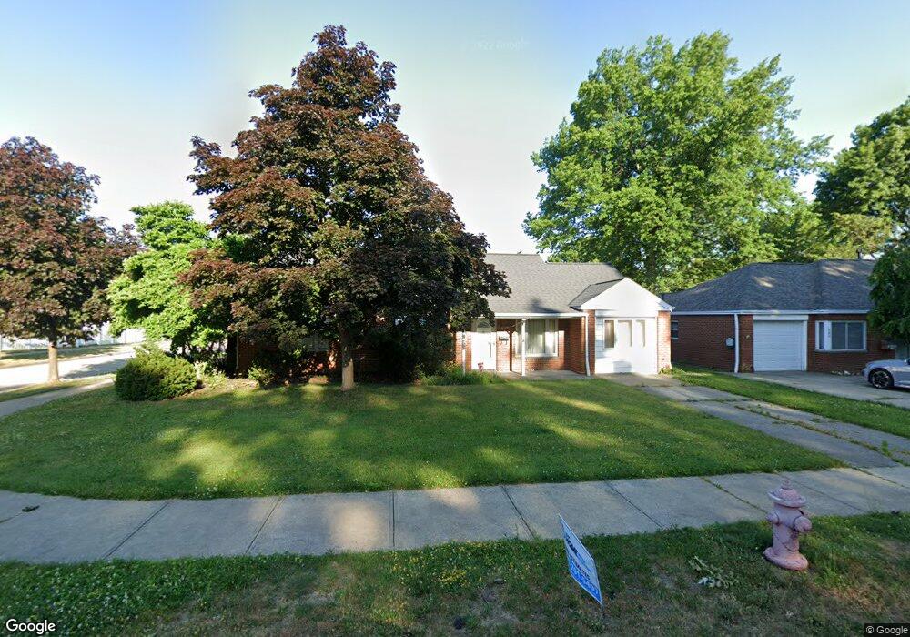
610 Walnut Dr Euclid, OH 44132
Estimated Value: $164,000 - $180,000
About This Home
This home is located at 610 Walnut Dr, Euclid, OH 44132 and is currently estimated at $169,911, approximately $121 per square foot. 610 Walnut Dr is a home located in Cuyahoga County with nearby schools including Shoreview Elementary School, Euclid High School, and Mater Dei Academy.
Ownership History
We collect this data history from publicly available records. To have your information removed, we recommend requesting removal directly through your county’s website.
Purchase Details
Home Financials for this Owner
Home Financials are based on the most recent Mortgage that was taken out on this home.Purchase Details
Purchase Details
Purchase Details
Purchase Details
Home Values in the Area
Average Home Value in this Area
Purchase History
We collect this data history from publicly available records. To have your information removed, we recommend requesting removal directly through your county’s website.
| Date | Buyer | Sale Price | Title Company |
|---|---|---|---|
| $72,000 | Progressive Land Title Ag | ||
| -- | Attorney | ||
| -- | -- | ||
| -- | -- | ||
| -- | -- |
Mortgage History
We collect this data history from publicly available records. To have your information removed, we recommend requesting removal directly through your county’s website.
| Date | Status | Borrower | Loan Amount |
|---|---|---|---|
| Open | $70,174 |
Tax History
We collect this data history from publicly available records. To have your information removed, we recommend requesting removal directly through your county’s website.
| Year | Tax Paid | Tax Assessment Tax Assessment Total Assessment is a certain percentage of the fair market value that is determined by local assessors to be the total taxable value of land and additions on the property. | Land | Improvement |
|---|---|---|---|---|
| 2025 | $2,584 | $49,455 | $10,045 | $39,410 |
| 2024 | $2,765 | $49,455 | $10,045 | $39,410 |
| 2023 | $2,553 | $38,330 | $8,860 | $29,470 |
| 2022 | $2,529 | $38,330 | $8,860 | $29,470 |
| 2021 | $2,806 | $38,330 | $8,860 | $29,470 |
| 2020 | $2,155 | $29,050 | $6,720 | $22,330 |
| 2019 | $1,936 | $83,000 | $19,200 | $63,800 |
| 2018 | $1,855 | $29,050 | $6,720 | $22,330 |
| 2017 | $1,903 | $25,200 | $5,390 | $19,810 |
| 2016 | $1,907 | $25,200 | $5,390 | $19,810 |
| 2015 | $1,740 | $25,200 | $5,390 | $19,810 |
| 2014 | $1,740 | $25,200 | $5,390 | $19,810 |
Map
- 29023 Weber Ave
- 29107 Fuller Ave
- 670 Walnut Dr
- 754 Hemlock Dr
- 27182 Oriole Ave
- 29234 Grand Blvd
- 27030 Farringdon Ave
- 29468 Woodway Dr
- 26831 Shoreview Ave
- 26890 Drakefield Ave
- 420 E 271st St
- 610 E 266th St
- 26530 Shoreview Ave
- 746 N Elmwood Ave
- 26361 Elinore Ave
- 311 E 262nd St
- 26200 Parklane Dr
- 355 E 257th St
- 25671 Farringdon Ave
- 325 E 257th St
- 603 Walnut Dr
- 607 Walnut Dr
- 597 Walnut Dr
- 29016 Fuller Ave
- 29009 Norman Ave
- 611 Walnut Dr
- 29020 Fuller Ave
- 600 Walnut Dr
- 29017 Norman Ave
- 596 Walnut Dr
- 606 Walnut Dr
- 585 Walnut Dr
- 29019 Norman Ave
- 29024 Fuller Ave
- 590 Walnut Dr
- 29023 Norman Ave
- 29028 Fuller Ave
- 29021 Fuller Ave
- 586 Walnut Dr
- 641 Walnut Dr
Ask me questions while you tour the home.