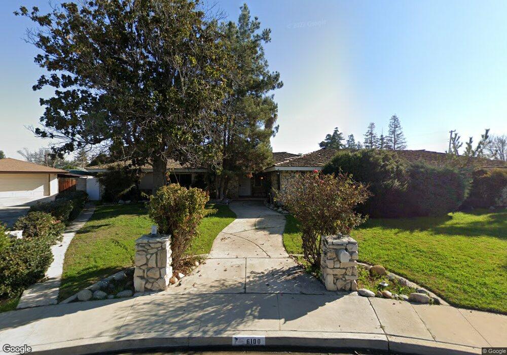
6100 Lori Way Bakersfield, CA 93308
Olive Drive Area NeighborhoodEstimated Value: $483,860 - $569,000
4
Beds
3
Baths
2,811
Sq Ft
$183/Sq Ft
Est. Value
About This Home
This home is located at 6100 Lori Way, Bakersfield, CA 93308 and is currently estimated at $513,215, approximately $182 per square foot. 6100 Lori Way is a home located in Kern County with nearby schools including Olive Drive Elementary School, Norris Middle School, and Centennial High School.
Ownership History
Date
Name
Owned For
Owner Type
Purchase Details
Closed on
May 7, 2020
Sold by
Ellis John A and Ellis Family Living Trust
Bought by
Ellis John A and Michael C Ellis Family Living
Current Estimated Value
Purchase Details
Closed on
Mar 3, 2004
Sold by
Ellis Clayton E and Ellis Deena E
Bought by
Ellis Clayton L and Ellis Deena E
Purchase Details
Closed on
Jun 10, 2003
Sold by
Smith Iris W and The Iris W Smith Trust
Bought by
Ellis Clayton E and Ellis Deena E
Home Financials for this Owner
Home Financials are based on the most recent Mortgage that was taken out on this home.
Original Mortgage
$160,000
Interest Rate
5.12%
Mortgage Type
Purchase Money Mortgage
Purchase Details
Closed on
Jun 16, 1994
Sold by
Smith Iris W
Bought by
Smith Iris W
Create a Home Valuation Report for This Property
The Home Valuation Report is an in-depth analysis detailing your home's value as well as a comparison with similar homes in the area
Home Values in the Area
Average Home Value in this Area
Purchase History
| Date | Buyer | Sale Price | Title Company |
|---|---|---|---|
| Ellis John A | -- | None Available | |
| Ellis Clayton L | -- | -- | |
| Ellis Clayton E | $200,000 | First American Title | |
| Smith Iris W | -- | -- | |
| Smith Iris W | -- | -- |
Source: Public Records
Mortgage History
| Date | Status | Borrower | Loan Amount |
|---|---|---|---|
| Previous Owner | Ellis Clayton E | $160,000 |
Source: Public Records
Tax History Compared to Growth
Tax History
| Year | Tax Paid | Tax Assessment Tax Assessment Total Assessment is a certain percentage of the fair market value that is determined by local assessors to be the total taxable value of land and additions on the property. | Land | Improvement |
|---|---|---|---|---|
| 2025 | $4,332 | $324,491 | $84,124 | $240,367 |
| 2024 | $4,332 | $318,129 | $82,475 | $235,654 |
| 2023 | $4,251 | $311,892 | $80,858 | $231,034 |
| 2022 | $4,178 | $305,777 | $79,273 | $226,504 |
| 2021 | $4,092 | $299,782 | $77,719 | $222,063 |
| 2020 | $3,978 | $296,710 | $76,923 | $219,787 |
| 2019 | $3,922 | $296,710 | $76,923 | $219,787 |
| 2018 | $4,568 | $349,866 | $87,462 | $262,404 |
| 2017 | $4,589 | $343,007 | $85,748 | $257,259 |
| 2016 | $4,265 | $336,282 | $84,067 | $252,215 |
| 2015 | $4,175 | $331,232 | $82,805 | $248,427 |
| 2014 | $4,082 | $324,744 | $81,183 | $243,561 |
Source: Public Records
Map
Nearby Homes
- 6000 Eugene Place
- 6300 Mignonette St
- 6619 Desmond Ct
- 6710 Pinecone Ave
- 7309 Angela Ave
- 6709 Cedarcrest Ave
- 6701 Hooper Ave
- 6600 Cedarcrest Ave
- 7601 Darrin Ave
- 6100 Carter Ave
- 6338 Bama Rose Ct
- 7513 Terry John Ave
- 6801 Mignonette St
- 7001 Eloy Ave
- 6708 Cranbrook Ave
- 6007 Pembroke Ave
- 6008 Carter Ave
- 7112 Brookshire Ave
- 7357 Hooper Ave
- 6418 Abby Rose Ave
- 6107 Crestmore St
- 6106 Lori Way
- 6030 Lori Way
- 6113 Crestmore St
- 6107 Lori Way
- 6037 Crestmore St
- 6119 Crestmore St
- 6101 Lori Way
- 6035 Lori Way
- 6024 Lori Way
- 6031 Crestmore St
- 6125 Crestmore St
- 6131 Crestmore St
- 6025 Crestmore St
- 6724 Jetta Ave
- 6023 Lori Way
- 6018 Lori Way
- 6040 Eugene Place
- 6032 Eugene Place
- 6901 Lucille Ave