

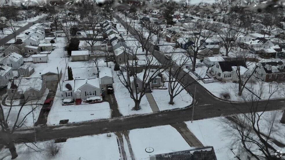


6101 College Ave Des Moines, IA 50322
Merle Hay NeighborhoodEstimated payment $1,984/month
Total Views
7,852
3
Beds
2
Baths
1,538
Sq Ft
$191
Price per Sq Ft
Highlights
- Deck
- Wood Flooring
- Shades
- Ranch Style House
- No HOA
- Outdoor Storage
About This Home
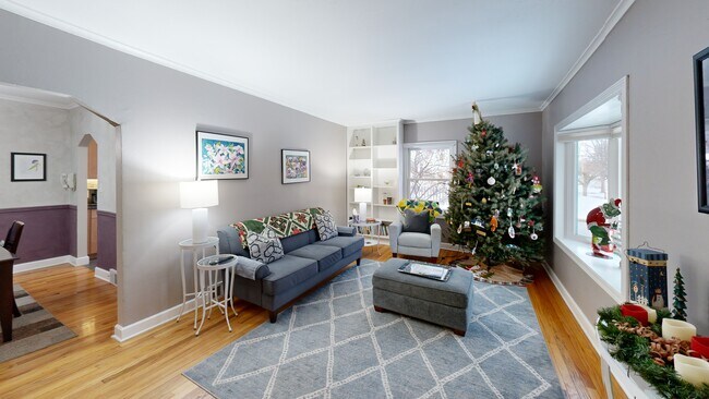
Lovingly maintained 3-bedroom, 2-bath ranch, with a finished attic and partially finished basement, offers tons of extra living space. Step inside to gorgeous hardwood floors and a beautifully updated kitchen featuring maple cabinetry, granite counters, timeless tile backsplash, and storage galore. Main-level bath has been tastefully refreshed, plus a convenient 3⁄4 bath in the basement. Cozy up in the family room with its inviting wood-burning fireplace — perfect for snowy Iowa nights. And once the snow melts, the spacious composite deck, off the family room, is perfect for entertaining. The basement has been professionally waterproofed (transferable warranty), sewer line has been replaced, gutter guards are in place for easy maintenance, and the 2-car attached garage plus extra-wide driveway means parking is never a hassle – no shuffling those cars! Storage shed is another plus. All this in a fantastic Merle Hay/Urbandale location — walk to Simon’s Restaurant and minutes to shopping, dining, and everything you need. Schedule your private showing today!
Home Details
Home Type
- Single Family
Est. Annual Taxes
- $5,280
Year Built
- Built in 1947
Lot Details
- 7,200 Sq Ft Lot
- Lot Dimensions are 60x120
Home Design
- Ranch Style House
- Block Foundation
- Asphalt Shingled Roof
- Vinyl Siding
Interior Spaces
- 1,538 Sq Ft Home
- Wood Burning Fireplace
- Screen For Fireplace
- Shades
- Fire and Smoke Detector
- Basement
Kitchen
- Stove
- Microwave
- Dishwasher
Flooring
- Wood
- Carpet
- Tile
Bedrooms and Bathrooms
Laundry
- Dryer
- Washer
Parking
- 2 Car Detached Garage
- Driveway
Outdoor Features
- Deck
- Outdoor Storage
Utilities
- Forced Air Heating and Cooling System
Community Details
- No Home Owners Association
Listing and Financial Details
- Assessor Parcel Number 10004963000000
3D Interior and Exterior Tours
Floorplans
Map
Create a Home Valuation Report for This Property
The Home Valuation Report is an in-depth analysis detailing your home's value as well as a comparison with similar homes in the area
Home Values in the Area
Average Home Value in this Area
Tax History
| Year | Tax Paid | Tax Assessment Tax Assessment Total Assessment is a certain percentage of the fair market value that is determined by local assessors to be the total taxable value of land and additions on the property. | Land | Improvement |
|---|---|---|---|---|
| 2025 | $4,734 | $280,600 | $44,300 | $236,300 |
| 2024 | $4,734 | $251,100 | $39,100 | $212,000 |
| 2023 | $4,908 | $251,100 | $39,100 | $212,000 |
| 2022 | $4,868 | $217,100 | $35,300 | $181,800 |
| 2021 | $4,634 | $217,100 | $35,300 | $181,800 |
| 2020 | $4,808 | $194,300 | $31,400 | $162,900 |
| 2019 | $4,426 | $194,300 | $31,400 | $162,900 |
| 2018 | $4,376 | $173,200 | $27,400 | $145,800 |
| 2017 | $3,914 | $173,200 | $27,400 | $145,800 |
| 2016 | $3,808 | $153,200 | $23,900 | $129,300 |
| 2015 | $3,808 | $153,200 | $23,900 | $129,300 |
| 2014 | $3,314 | $147,400 | $22,600 | $124,800 |
Source: Public Records
Property History
| Date | Event | Price | List to Sale | Price per Sq Ft |
|---|---|---|---|---|
| 12/13/2025 12/13/25 | Pending | -- | -- | -- |
| 12/10/2025 12/10/25 | For Sale | $293,500 | -- | $191 / Sq Ft |
Source: Des Moines Area Association of REALTORS®
Purchase History
| Date | Type | Sale Price | Title Company |
|---|---|---|---|
| Warranty Deed | $119,000 | -- |
Source: Public Records
Mortgage History
| Date | Status | Loan Amount | Loan Type |
|---|---|---|---|
| Open | $95,200 | No Value Available |
Source: Public Records
About the Listing Agent
As a dedicated realtor with 9 years of experience, I understand your home is a significant asset. I’m committed to helping you achieve your real estate goals through expert marketing, skilled negotiations, and seamless transaction management. With over 20 years in client services at ADP, I bring excellent communication and negotiation skills to the table, along with a robust network of lenders, inspectors, and vendors to ensure a smooth process and successful outcome. Outside of real estate, I
Angela's Other Listings
-
$183,000 Sold Jul 07, 2025
- 2 Beds
- 1.5 Baths
- 1,100 Sq Ft
- 8302 Westown Pkwy
- Unit 10001
- West Des Moines, IA
Source: Des Moines Area Association of REALTORS®
MLS Number: 731480
APN: 100-04963000000
Disclaimer: Certain information contained herein is derived from information provided by parties other than Homes.com. All information provided is deemed reliable, but is not guaranteed to be accurate and should be independently verified.
![]() IDX information is provided exclusively for personal, non-commercial use, and may not be used for any purpose other than to identify prospective properties consumers may be interested in purchasing. Information is deemed reliable but not guaranteed.
IDX information is provided exclusively for personal, non-commercial use, and may not be used for any purpose other than to identify prospective properties consumers may be interested in purchasing. Information is deemed reliable but not guaranteed.
Nearby Homes