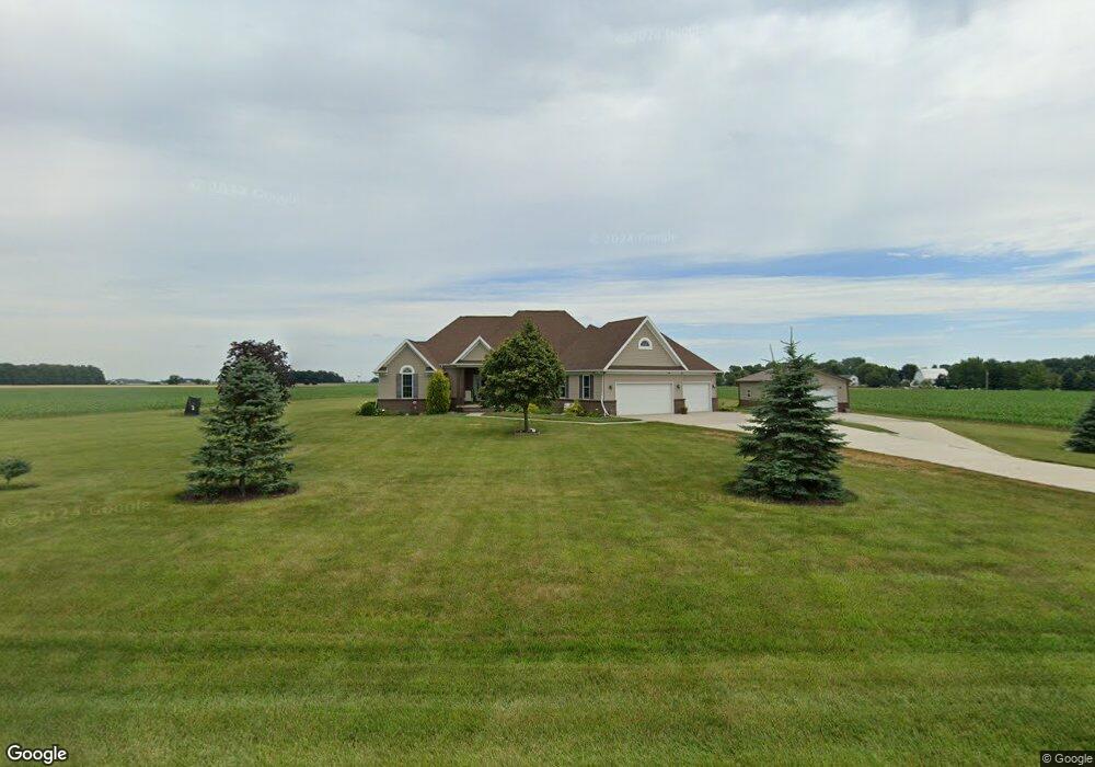
6106 County Road 12 Wauseon, OH 43567
Estimated Value: $363,000 - $419,226
3
Beds
2
Baths
2,169
Sq Ft
$184/Sq Ft
Est. Value
About This Home
This home is located at 6106 County Road 12, Wauseon, OH 43567 and is currently estimated at $399,307, approximately $184 per square foot. 6106 County Road 12 is a home with nearby schools including Wauseon Primary School, Wauseon Elementary School, and Wauseon Middle School.
Ownership History
Date
Name
Owned For
Owner Type
Purchase Details
Closed on
Mar 28, 2014
Sold by
Crawford Sue and Ayers Crossgrove Kristen
Bought by
Chittenden Kevin D and Elizabeth A Ayers C
Current Estimated Value
Home Financials for this Owner
Home Financials are based on the most recent Mortgage that was taken out on this home.
Original Mortgage
$192,000
Outstanding Balance
$148,122
Interest Rate
4.41%
Mortgage Type
New Conventional
Estimated Equity
$251,185
Create a Home Valuation Report for This Property
The Home Valuation Report is an in-depth analysis detailing your home's value as well as a comparison with similar homes in the area
Home Values in the Area
Average Home Value in this Area
Purchase History
| Date | Buyer | Sale Price | Title Company |
|---|---|---|---|
| Chittenden Kevin D | $7,200 | Attorney |
Source: Public Records
Mortgage History
| Date | Status | Borrower | Loan Amount |
|---|---|---|---|
| Open | Chittenden Kevin D | $192,000 |
Source: Public Records
Tax History Compared to Growth
Tax History
| Year | Tax Paid | Tax Assessment Tax Assessment Total Assessment is a certain percentage of the fair market value that is determined by local assessors to be the total taxable value of land and additions on the property. | Land | Improvement |
|---|---|---|---|---|
| 2024 | $5,550 | $119,500 | $11,590 | $107,910 |
| 2023 | $5,551 | $119,500 | $11,590 | $107,910 |
| 2022 | $5,223 | $95,970 | $9,660 | $86,310 |
| 2021 | $5,483 | $95,970 | $9,660 | $86,310 |
| 2020 | $5,113 | $95,970 | $9,660 | $86,310 |
| 2019 | $5,231 | $98,220 | $9,000 | $89,220 |
| 2018 | $4,673 | $98,220 | $9,000 | $89,220 |
| 2017 | $4,475 | $95,280 | $9,000 | $86,280 |
| 2016 | $4,235 | $82,120 | $9,000 | $73,120 |
| 2015 | $4,171 | $82,120 | $9,000 | $73,120 |
| 2014 | $113 | $3,080 | $3,080 | $0 |
Source: Public Records
Map
Nearby Homes
- 1090 Seneca Dr
- 1058 Seneca Dr
- Integrity 1830 Plan at Arrowhead Trails
- integrity 2280 Plan at Arrowhead Trails
- Integrity 2080 Plan at Arrowhead Trails
- 1066 Seneca Dr
- 1062 Seneca Dr
- 7373 County Road 12
- 1209 Apache Dr
- 7620 County Road 12
- 13242 Us Highway 20a
- 13354 U S 20a
- 911 Doris Dr
- 00 Glenwood
- 0 Glenwood Unit 6124946
- 303 Eastwood St
- 801 N Shoop Ave
- 527 E Elm St
- 0 County Road H
- 351 E Walnut St
- 0 County Road 12 Unit 4617703
- 0 County Road 12 Unit 4630951
- 0 County Road 12 Unit 4642279
- 6232 County Road 12
- 11921 County Road F
- 11859 County Road F
- 11831 County Road F
- 11951 County Road F
- 11773 County Road F
- 11704 County Road F
- ON County Road 12
- LOT County Road 12
- 12240 County Road F
- 11685 County Road F
- 6444 County Road 12
- 12300 County Road F
- 11647 County Road F
- 12293 County Road F
- 6490 County Road 12
- 12340 County Road F