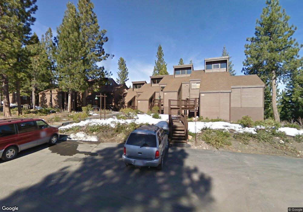
6108 Rocky Point Cir Truckee, CA 96161
South Truckee NeighborhoodEstimated Value: $719,192 - $766,000
2
Beds
2
Baths
1,000
Sq Ft
$740/Sq Ft
Est. Value
About This Home
This home is located at 6108 Rocky Point Cir, Truckee, CA 96161 and is currently estimated at $740,298, approximately $740 per square foot. 6108 Rocky Point Cir is a home located in Placer County with nearby schools including Truckee Elementary School, Alder Creek Middle School, and Tahoe Truckee High School.
Ownership History
Date
Name
Owned For
Owner Type
Purchase Details
Closed on
Feb 23, 2010
Sold by
Crosariol David and Crosariol Gina
Bought by
6108 Rocky Point Circle Llc
Current Estimated Value
Purchase Details
Closed on
Oct 9, 2003
Sold by
Godfrey Ralph B and Godfrey Lynda H
Bought by
Crosariol David and Crosariol Gina
Home Financials for this Owner
Home Financials are based on the most recent Mortgage that was taken out on this home.
Original Mortgage
$319,200
Interest Rate
6.4%
Mortgage Type
Unknown
Purchase Details
Closed on
Jan 26, 1994
Sold by
Silver William R and Silver Joan E
Bought by
Godfrey Ralph B and Godfrey Lynda H
Home Financials for this Owner
Home Financials are based on the most recent Mortgage that was taken out on this home.
Original Mortgage
$125,000
Interest Rate
7.19%
Create a Home Valuation Report for This Property
The Home Valuation Report is an in-depth analysis detailing your home's value as well as a comparison with similar homes in the area
Home Values in the Area
Average Home Value in this Area
Purchase History
| Date | Buyer | Sale Price | Title Company |
|---|---|---|---|
| 6108 Rocky Point Circle Llc | $388,000 | First American Title Company | |
| Crosariol David | $399,000 | Fidelity Title | |
| Godfrey Ralph B | $167,000 | Fidelity National Title Co |
Source: Public Records
Mortgage History
| Date | Status | Borrower | Loan Amount |
|---|---|---|---|
| Previous Owner | Crosariol David | $319,200 | |
| Previous Owner | Godfrey Ralph B | $125,000 | |
| Closed | Crosariol David | $39,900 |
Source: Public Records
Tax History Compared to Growth
Tax History
| Year | Tax Paid | Tax Assessment Tax Assessment Total Assessment is a certain percentage of the fair market value that is determined by local assessors to be the total taxable value of land and additions on the property. | Land | Improvement |
|---|---|---|---|---|
| 2025 | $7,800 | $497,597 | $175,545 | $322,052 |
| 2023 | $7,800 | $478,277 | $168,729 | $309,548 |
| 2022 | $7,499 | $468,900 | $165,421 | $303,479 |
| 2021 | $6,976 | $459,707 | $162,178 | $297,529 |
| 2020 | $6,435 | $405,000 | $143,000 | $262,000 |
| 2019 | $6,357 | $390,000 | $138,000 | $252,000 |
| 2018 | $6,077 | $380,000 | $134,000 | $246,000 |
| 2017 | $5,981 | $375,000 | $132,000 | $243,000 |
| 2016 | $6,012 | $375,000 | $132,300 | $242,700 |
| 2015 | $5,976 | $380,000 | $134,100 | $245,900 |
| 2014 | $6,814 | $405,926 | $143,206 | $262,720 |
Source: Public Records
Map
Nearby Homes
- 6070 Rocky Point Cir
- 6133 Feather Ridge
- 6138 Feather Ridge
- 1055 Martis Landing Unit B
- 2790 Cross Cut Ct
- 2785 Cross Cut Ct
- 2640 Mill Site Rd
- 1723 Grouse Ridge Rd Unit 4
- 5107 Gold Bend
- 5053 Gold Bend
- 5080 Gold Bend
- 5030 Gold Bend
- 253 Basque Dr Unit Share 2
- 1937 Gray Wolf
- 237 Basque Dr Unit 2
- 229 Basque Dr
- 2344 Overlook Place
- 1750 Grouse Ridge Rd
- 2301 Overlook Place
- 7201 Larkspur Ln Unit 4
- 6109 Rocky Point Cir
- 6107 Rocky Point Cir
- 6110 Rocky Point Cir
- 6111 Rocky Point Cir
- 6112 Rocky Point Cir
- 6106 Rocky Point Cir
- 6105 Rocky Point Cir
- 6104 Rocky Point Cir
- 6103 Rocky Point Cir
- 6113 Rocky Point Cir
- 6102 Rocky Point Cir
- 6114 Rocky Point Cir
- 6115 Rocky Point Cir
- 6087 Rocky Point Cir
- 6116 Rocky Point Cir
- 6118 Rocky Point Cir
- 6088 Rocky Point Cir
- 6101 Rocky Point Cir
- 6117 Rocky Point Cir
- 6085 Rocky Point Cir