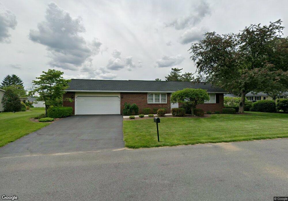
6109 Lone Pond Ln Allentown, PA 18104
Upper Macungie Township NeighborhoodEstimated Value: $254,000 - $392,000
3
Beds
1
Bath
1,000
Sq Ft
$316/Sq Ft
Est. Value
About This Home
This home is located at 6109 Lone Pond Ln, Allentown, PA 18104 and is currently estimated at $316,095, approximately $316 per square foot. 6109 Lone Pond Ln is a home located in Lehigh County with nearby schools including Highland Elementary School, Tussing Elementary School, and Cetronia Elementary School.
Ownership History
Date
Name
Owned For
Owner Type
Purchase Details
Closed on
Sep 16, 1996
Sold by
Reichard David D and Reichard Lynnette
Bought by
Reichard David D
Current Estimated Value
Purchase Details
Closed on
Sep 1, 1973
Bought by
Reichard David D and Reichard Lynnette
Create a Home Valuation Report for This Property
The Home Valuation Report is an in-depth analysis detailing your home's value as well as a comparison with similar homes in the area
Home Values in the Area
Average Home Value in this Area
Purchase History
| Date | Buyer | Sale Price | Title Company |
|---|---|---|---|
| Reichard David D | -- | -- | |
| Reichard David D | $32,000 | -- |
Source: Public Records
Tax History Compared to Growth
Tax History
| Year | Tax Paid | Tax Assessment Tax Assessment Total Assessment is a certain percentage of the fair market value that is determined by local assessors to be the total taxable value of land and additions on the property. | Land | Improvement |
|---|---|---|---|---|
| 2025 | $3,183 | $147,100 | $42,500 | $104,600 |
| 2024 | $3,063 | $147,100 | $42,500 | $104,600 |
| 2023 | $2,989 | $147,100 | $42,500 | $104,600 |
| 2022 | $2,976 | $147,100 | $104,600 | $42,500 |
| 2021 | $2,976 | $147,100 | $42,500 | $104,600 |
| 2020 | $2,976 | $147,100 | $42,500 | $104,600 |
| 2019 | $2,913 | $147,100 | $42,500 | $104,600 |
| 2018 | $2,855 | $147,100 | $42,500 | $104,600 |
| 2017 | $2,814 | $147,100 | $42,500 | $104,600 |
| 2016 | -- | $147,100 | $42,500 | $104,600 |
| 2015 | -- | $147,100 | $42,500 | $104,600 |
| 2014 | -- | $147,100 | $42,500 | $104,600 |
Source: Public Records
Map
Nearby Homes
- 5821 Daniel St
- 6126 Palomino Dr
- 5926 Holiday Dr
- 280 Susquehanna Trail
- 172 Wyndham Dr
- 5619 Stonecroft Ln
- 5475 Hamilton Blvd Unit 7
- 5137 Schantz Rd Unit The Jackson
- The Kennedy Plan at The Reserve at Surrey Court
- The Jefferson - Front Entry Plan at The Reserve at Surrey Court
- 5137 Schantz Rd Unit The Kennedy
- 5137 Schantz Rd Unit The Roosevelt
- The Jackson - Front Entry Plan at The Reserve at Surrey Court
- 5137 Schantz Rd Unit The Madison
- The Monroe Plan at The Reserve at Surrey Court
- 5137 Schantz Rd Unit The Monroe
- The Roosevelt - Front Entry Plan at The Reserve at Surrey Court
- The Madison Plan at The Reserve at Surrey Court
- 5137 Schantz Rd Unit The Jefferson
- 5524 Stonecroft Ln
- 6113 Lone Pond Ln
- 6112 Daniel St
- 6108 Daniel St
- 6123 Lone Pond Ln
- 6116 Daniel St
- 6108 Lone Pond Ln
- 6112 Lone Pond Ln
- 6127 Lone Pond Ln
- 5954 Daniel St
- 6116 Lone Pond Ln
- 6120 Daniel St
- 6120 Lone Pond Ln
- 6035 Daniel St
- 6124 Lone Pond Ln
- 328 Burrell Blvd
- 6031 Daniel St
- 6124 Daniel St
- 6131 Lone Pond Ln
- 6129 Daniel St
- 6128 Lone Pond Ln