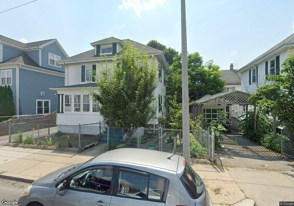
611 Adams St Dorchester, MA 02122
Ashmont NeighborhoodEstimated Value: $629,000 - $788,000
4
Beds
3
Baths
1,534
Sq Ft
$465/Sq Ft
Est. Value
About This Home
This home is located at 611 Adams St, Dorchester, MA 02122 and is currently estimated at $712,693, approximately $464 per square foot. 611 Adams St is a home located in Suffolk County with nearby schools including Neighborhood House Charter School and Epiphany School.
Ownership History
Date
Name
Owned For
Owner Type
Purchase Details
Closed on
Jan 21, 1999
Sold by
Tomlinson Mary V
Bought by
Larkin Michael F and Larkin Janet M
Current Estimated Value
Home Financials for this Owner
Home Financials are based on the most recent Mortgage that was taken out on this home.
Original Mortgage
$131,100
Interest Rate
6.7%
Mortgage Type
Purchase Money Mortgage
Create a Home Valuation Report for This Property
The Home Valuation Report is an in-depth analysis detailing your home's value as well as a comparison with similar homes in the area
Home Values in the Area
Average Home Value in this Area
Purchase History
| Date | Buyer | Sale Price | Title Company |
|---|---|---|---|
| Larkin Michael F | $139,000 | -- |
Source: Public Records
Mortgage History
| Date | Status | Borrower | Loan Amount |
|---|---|---|---|
| Open | Larkin Michael F | $175,000 | |
| Closed | Larkin Michael F | $131,100 | |
| Previous Owner | Larkin Michael F | $20,000 |
Source: Public Records
Tax History Compared to Growth
Tax History
| Year | Tax Paid | Tax Assessment Tax Assessment Total Assessment is a certain percentage of the fair market value that is determined by local assessors to be the total taxable value of land and additions on the property. | Land | Improvement |
|---|---|---|---|---|
| 2025 | $6,261 | $540,700 | $203,300 | $337,400 |
| 2024 | $5,684 | $521,500 | $199,300 | $322,200 |
| 2023 | $5,331 | $496,400 | $189,700 | $306,700 |
| 2022 | $5,401 | $496,400 | $189,700 | $306,700 |
| 2021 | $4,870 | $456,400 | $180,700 | $275,700 |
| 2020 | $4,210 | $398,700 | $171,800 | $226,900 |
| 2019 | $3,890 | $369,100 | $148,500 | $220,600 |
| 2018 | $3,850 | $367,400 | $148,500 | $218,900 |
| 2017 | $3,775 | $356,500 | $148,500 | $208,000 |
| 2016 | $3,735 | $339,500 | $148,500 | $191,000 |
| 2015 | $3,730 | $308,000 | $124,000 | $184,000 |
| 2014 | $3,460 | $275,000 | $124,000 | $151,000 |
Source: Public Records
Map
Nearby Homes
- 543 Adams St Unit 24
- 51 Florida St Unit 3
- 80-84 Shepton St Unit 80-3
- 61 Shepton St
- 54 Msgr Patrick j Lydon Way
- 701 Adams St Unit 9
- 80 Beaumont St Unit 101
- 45 Msgr Patrick j Lydon Way
- 9-11 Adanac Terrace
- 37 Msgr Patrick j Lydon Way
- 33 Westmoreland St
- 37 Westmoreland St
- 41 King St Unit 1
- 40 Westmoreland St Unit 8
- 251 Minot St Unit 6
- 107 Minot St
- 223 Neponset Ave Unit 2
- 96 King St Unit 1
- 140 Minot St
- 3 N Munroe Terrace
- 615 Adams St Unit C
- 615 Adams St Unit 615
- 615 Adams St Unit E
- 615 Adams St Unit B
- 615 Adams St Unit A
- 615 Adams St
- 615 Adams St Unit 3
- 155 Wrentham St
- 609 Adams St
- 151 Wrentham St
- 619 Adams St Unit 3
- 619 Adams St Unit 2
- 619 Adams St Unit 1
- 149 Wrentham St
- 5-7 Westglow St Unit 7-1
- 5 Westglow St Unit 2
- 5 Westglow St Unit 1
- 5-7 Westglow St Unit 5-2
- 623 Adams St
- 623 Adams St Unit 2