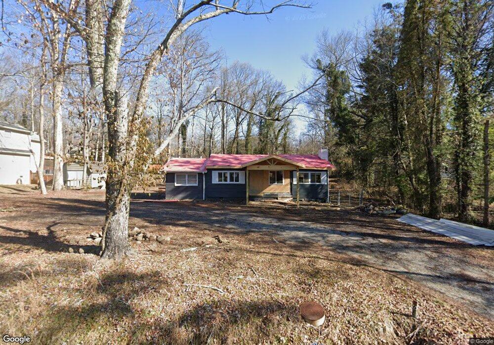
611 Albert Rd Signal Mountain, TN 37377
Estimated Value: $197,000 - $322,000
2
Beds
1
Bath
1,262
Sq Ft
$213/Sq Ft
Est. Value
About This Home
This home is located at 611 Albert Rd, Signal Mountain, TN 37377 and is currently estimated at $269,379, approximately $213 per square foot. 611 Albert Rd is a home located in Hamilton County with nearby schools including Thrasher Elementary School, Signal Mountain Middle/High School, and Signal Mountain Christian School.
Ownership History
Date
Name
Owned For
Owner Type
Purchase Details
Closed on
Nov 13, 2024
Sold by
Mcclure Joshua Robert
Bought by
Tomisek Timothy
Current Estimated Value
Purchase Details
Closed on
Sep 24, 2024
Sold by
Mcclure Susan S and Moss Joya Mcclure
Bought by
Mcclure Joshua Robert
Purchase Details
Closed on
Jun 23, 2006
Sold by
Leiper Richard Mark and Leiper Kelly Ray
Bought by
Mcclure John Robert and Mcclure Susanne A N
Home Financials for this Owner
Home Financials are based on the most recent Mortgage that was taken out on this home.
Original Mortgage
$50,000
Interest Rate
6.49%
Mortgage Type
Purchase Money Mortgage
Create a Home Valuation Report for This Property
The Home Valuation Report is an in-depth analysis detailing your home's value as well as a comparison with similar homes in the area
Home Values in the Area
Average Home Value in this Area
Purchase History
| Date | Buyer | Sale Price | Title Company |
|---|---|---|---|
| Tomisek Timothy | $190,000 | Title Guaranty & Trust | |
| Tomisek Timothy | $190,000 | Title Guaranty & Trust | |
| Mcclure Joshua Robert | -- | Title Guaranty & Trust | |
| Mcclure John Robert | $113,500 | First Title |
Source: Public Records
Mortgage History
| Date | Status | Borrower | Loan Amount |
|---|---|---|---|
| Previous Owner | Mcclure John Robert | $50,000 |
Source: Public Records
Tax History Compared to Growth
Tax History
| Year | Tax Paid | Tax Assessment Tax Assessment Total Assessment is a certain percentage of the fair market value that is determined by local assessors to be the total taxable value of land and additions on the property. | Land | Improvement |
|---|---|---|---|---|
| 2024 | $1,037 | $46,350 | $0 | $0 |
| 2023 | $1,037 | $46,350 | $0 | $0 |
| 2022 | $1,037 | $46,350 | $0 | $0 |
| 2021 | $1,037 | $46,350 | $0 | $0 |
| 2020 | $919 | $33,250 | $0 | $0 |
| 2019 | $919 | $33,250 | $0 | $0 |
| 2018 | $919 | $33,250 | $0 | $0 |
| 2017 | $919 | $33,250 | $0 | $0 |
| 2016 | $798 | $0 | $0 | $0 |
| 2015 | $798 | $28,850 | $0 | $0 |
| 2014 | $798 | $0 | $0 | $0 |
Source: Public Records
Map
Nearby Homes
- 714 Berry Spring Path
- 12 Mountain Orchard Path
- 10 Acres Majestic Oaks Dr
- 0 Majestic Oaks Dr Unit 24033570
- 10 Majestic Oaks Dr
- 1702 James Blvd
- 837 Skyline Park Dr
- 5734 U S 127
- 0 Skyline Park Dr Unit 1525124
- 848 Skyline Park Dr
- 11 Saint Nicholas Way
- 3612 Taft Hwy
- 1305 E Brow Rd
- 1301 E Brow Rd
- 185 Woodcliff Cir
- 25 Ridgerock Dr
- 1713 Timesville Rd
- 533 Fern Trail
- 16 Northfield Rd
- 1018 Ridgeway Ave
- 619 Albert Rd
- 1317 Brockton Dr
- 1317 Brockton Dr Unit 1
- 618 Miles Rd
- 624 Miles Rd
- 1316 Brockton Dr
- 1310 Aswan Dr
- 701 Albert Rd
- 616 Miles Rd
- 626 Miles Rd
- 1315 Brockton Dr
- 607 Albert Rd
- 1314 Brockton Dr
- 1308 Aswan Dr
- 614 Miles Rd
- 1403 Taft Hwy
- 1403 Taft Hwy Unit 1
- 1403 Taft Hwy Unit 11
- 1311 Brockton Dr
- 1313 Aswan Dr