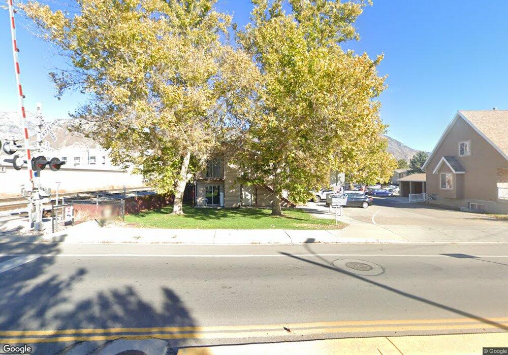
611 S 500 W Unit 27 Provo, UT 84601
Franklin NeighborhoodEstimated Value: $285,000 - $339,000
3
Beds
2
Baths
1,180
Sq Ft
$256/Sq Ft
Est. Value
About This Home
This home is located at 611 S 500 W Unit 27, Provo, UT 84601 and is currently estimated at $301,894, approximately $255 per square foot. 611 S 500 W Unit 27 is a home located in Utah County with nearby schools including Spring Creek Elementary School, Centennial Middle School, and Timpview High School.
Ownership History
Date
Name
Owned For
Owner Type
Purchase Details
Closed on
Jun 26, 2024
Sold by
Stubbs Zola
Bought by
Big Red Trust and Stubbs
Current Estimated Value
Purchase Details
Closed on
May 13, 2010
Sold by
Powell Tiffany and Gonzalez Tiffany
Bought by
Stubbs Zola
Purchase Details
Closed on
May 30, 1997
Sold by
French Jase C and French Carmen C
Bought by
Powell Tiffany
Home Financials for this Owner
Home Financials are based on the most recent Mortgage that was taken out on this home.
Original Mortgage
$83,900
Interest Rate
8.08%
Create a Home Valuation Report for This Property
The Home Valuation Report is an in-depth analysis detailing your home's value as well as a comparison with similar homes in the area
Home Values in the Area
Average Home Value in this Area
Purchase History
| Date | Buyer | Sale Price | Title Company |
|---|---|---|---|
| Big Red Trust | -- | None Listed On Document | |
| Stubbs Zola | -- | Utah First Title Insurance | |
| Powell Tiffany | -- | -- |
Source: Public Records
Mortgage History
| Date | Status | Borrower | Loan Amount |
|---|---|---|---|
| Previous Owner | Powell Tiffany | $83,900 |
Source: Public Records
Tax History Compared to Growth
Tax History
| Year | Tax Paid | Tax Assessment Tax Assessment Total Assessment is a certain percentage of the fair market value that is determined by local assessors to be the total taxable value of land and additions on the property. | Land | Improvement |
|---|---|---|---|---|
| 2025 | $1,466 | $151,580 | $30,600 | $245,000 |
| 2024 | $1,466 | $144,320 | $0 | $0 |
| 2023 | $1,522 | $147,730 | $0 | $0 |
| 2022 | $1,341 | $131,230 | $0 | $0 |
| 2021 | $1,127 | $192,400 | $23,100 | $169,300 |
| 2020 | $1,112 | $177,900 | $21,300 | $156,600 |
| 2019 | $968 | $161,000 | $21,000 | $140,000 |
| 2018 | $830 | $140,000 | $16,800 | $123,200 |
| 2017 | $716 | $66,385 | $0 | $0 |
| 2016 | $712 | $61,490 | $0 | $0 |
| 2015 | $677 | $59,125 | $0 | $0 |
| 2014 | $649 | $59,125 | $0 | $0 |
Source: Public Records
Map
Nearby Homes
- 608 S 500 W Unit 3
- 648 S 500 W Unit 4
- 389 W 500 S
- 330 W 600 S
- 751 S 400 W
- 3404 W 1500 N
- 590 S 600 W
- 461 S 400 W
- 475 S 400 W Unit D1
- 151 S Meadow Dr Unit 19
- 151 S Meadow Dr
- 516 S Freedom Blvd
- 393 W 300 S
- 761 W 600 S Unit 12
- 244 W 400 S
- 491 S Freedom Blvd Unit 104204
- 784 W Heather Ln
- 770 W 400 S
- 215 S 400 W
- 272 W 1020 S Unit B
- 611 S 500 W Unit 26
- 611 S 500 W
- 611 S 500 W Unit 28
- 617 S 500 W Unit 23
- 617 S 500 W Unit 22
- 617 S 500 W Unit 21
- 617 S 500 W Unit 24
- 617 S 500 W Unit 25
- 617 S 500 W
- 605 S 500 W
- 605 S 500 W Unit 30
- 605 S 500 W Unit 29
- 605 S 500 W Unit 32
- 605 S 500 W Unit 31
- 625 S 500 W
- 623 S 500 W Unit 19
- 623 S 500 W Unit 18
- 623 S 500 W Unit 17
- 623 S 500 W Unit 20
- 623 S 500 W