Estimated Value: $196,667 - $235,000
3
Beds
2
Baths
1,661
Sq Ft
$127/Sq Ft
Est. Value
About This Home
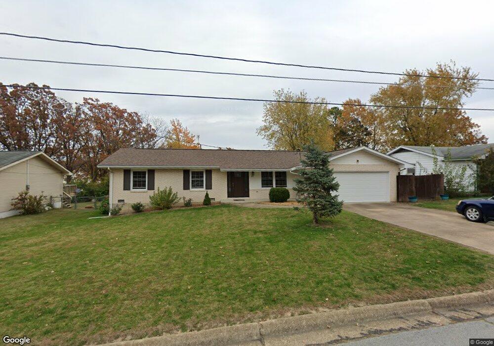
This home is located at 611 S Adrian Ave, Rolla, MO 65401 and is currently estimated at $210,667, approximately $126 per square foot. 611 S Adrian Ave is a home located in Phelps County with nearby schools including Rolla Junior High School, Rolla Senior High School, and Immanuel Lutheran School.
Ownership History
Date
Name
Owned For
Owner Type
Purchase Details
Closed on
Apr 25, 2014
Current Estimated Value
Purchase Details
Closed on
Mar 11, 2010
Purchase Details
Closed on
Aug 16, 2002
Purchase Details
Closed on
Jun 1, 1983
Purchase Details
Closed on
May 18, 1981
Purchase Details
Closed on
Aug 10, 1972
Create a Home Valuation Report for This Property
The Home Valuation Report is an in-depth analysis detailing your home's value as well as a comparison with similar homes in the area
Home Values in the Area
Average Home Value in this Area
Purchase History
| Date | Buyer | Sale Price | Title Company |
|---|---|---|---|
| -- | -- | -- | |
| -- | $96,000 | -- | |
| -- | -- | -- | |
| -- | -- | -- | |
| -- | -- | -- | |
| -- | -- | -- |
Source: Public Records
Tax History Compared to Growth
Tax History
| Year | Tax Paid | Tax Assessment Tax Assessment Total Assessment is a certain percentage of the fair market value that is determined by local assessors to be the total taxable value of land and additions on the property. | Land | Improvement |
|---|---|---|---|---|
| 2025 | $1,093 | $20,940 | $2,950 | $17,990 |
| 2024 | $1,007 | $18,740 | $2,380 | $16,360 |
| 2023 | $1,014 | $18,740 | $2,380 | $16,360 |
| 2022 | $861 | $18,740 | $2,380 | $16,360 |
| 2021 | $867 | $18,740 | $2,380 | $16,360 |
| 2020 | $787 | $16,600 | $2,380 | $14,220 |
| 2019 | $783 | $16,600 | $2,380 | $14,220 |
| 2018 | $776 | $16,600 | $2,380 | $14,220 |
| 2017 | $774 | $16,600 | $2,380 | $14,220 |
| 2016 | $735 | $16,280 | $2,380 | $13,900 |
| 2015 | -- | $16,280 | $2,380 | $13,900 |
| 2014 | -- | $16,280 | $2,380 | $13,900 |
| 2013 | -- | $16,280 | $0 | $0 |
Source: Public Records
Map
Nearby Homes
- 231 Sunny Dr
- 403 Fort Wyman Rd
- 610 Shady Acres Ct
- 0 Lanning Ln
- 1021 Morrell Ave
- 107 S Walker Ave
- 14.25 acres Cedar Grove Rd
- 1022 Lynwood Dr
- 213 Sunny Dr
- 229 Sunny Dr
- 401 W 1st St
- 604 Basswood Dr
- 585 Basswood Dr
- 588 Basswood Dr
- 305 Mossman Ln
- 106 S Elm St Unit A & B
- 1335 S Rolla St
- 35 Green Acres Dr
- 104 E 3rd St
- 503 Lariat Ln
- 609 S Adrian Ave
- 613 S Adrian Ave
- 922 Oak Lane Dr Unit 926
- 615 S Adrian Ave
- 607 S Adrian Ave
- 612 S Adrian Ave
- 610 S Adrian Ave
- 614 S Adrian Ave
- 617 S Adrian Ave
- 916 Oak Lane Dr
- 616 S Adrian Ave
- 603 S Adrian Ave
- 611 Penny Ln
- 619 S Adrian Ave
- 604 S Adrian Ave
- 618 S Adrian Ave
- 615 Penny Ln
- 607 Penny Ln
- 621 S Adrian Ave
- 602 S Adrian Ave