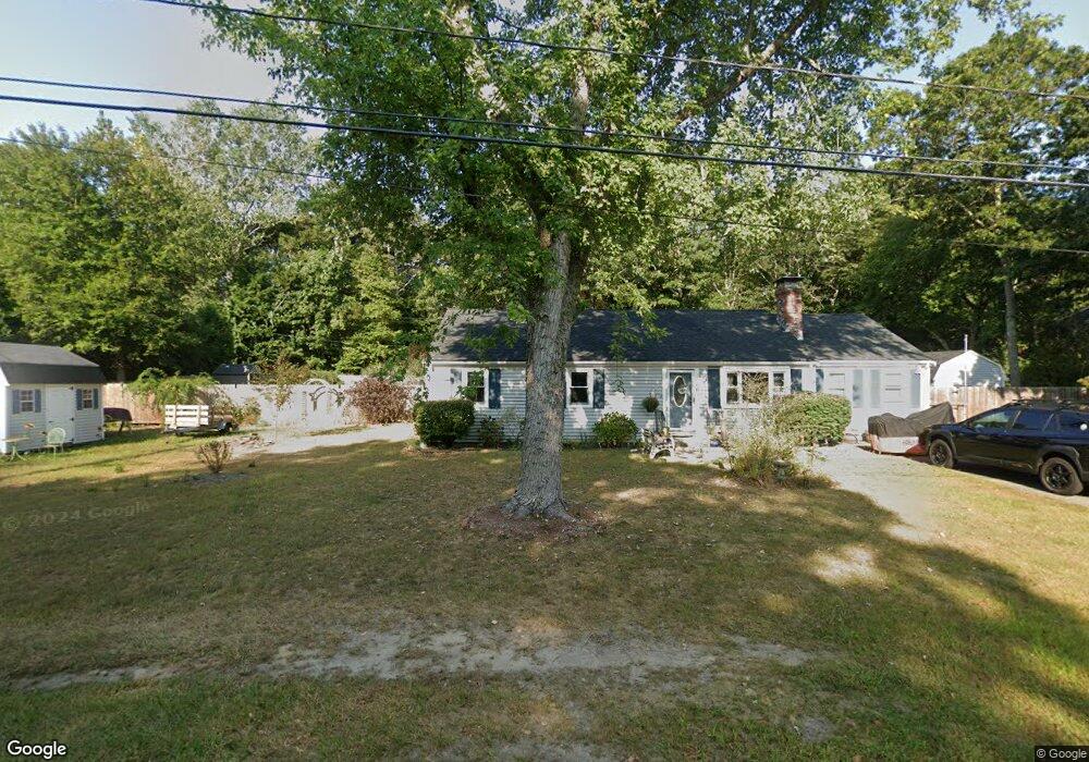
611 Skunknet Rd Centerville, MA 02632
Centerville NeighborhoodEstimated Value: $630,000 - $663,000
4
Beds
3
Baths
1,586
Sq Ft
$405/Sq Ft
Est. Value
About This Home
This home is located at 611 Skunknet Rd, Centerville, MA 02632 and is currently estimated at $642,662, approximately $405 per square foot. 611 Skunknet Rd is a home located in Barnstable County with nearby schools including West Villages Elementary School, Barnstable United Elementary School, and Barnstable Intermediate School.
Ownership History
Date
Name
Owned For
Owner Type
Purchase Details
Closed on
Jun 26, 2018
Sold by
Wallace Debra and Wallace Charles Brenda
Bought by
Edmonds Phillip L
Current Estimated Value
Home Financials for this Owner
Home Financials are based on the most recent Mortgage that was taken out on this home.
Original Mortgage
$338,318
Outstanding Balance
$292,351
Interest Rate
4.37%
Mortgage Type
FHA
Estimated Equity
$350,311
Purchase Details
Closed on
Oct 31, 1995
Sold by
Winner Ronald A and Winner Wendy M
Bought by
Wallace Debra
Home Financials for this Owner
Home Financials are based on the most recent Mortgage that was taken out on this home.
Original Mortgage
$110,400
Interest Rate
7.6%
Mortgage Type
Purchase Money Mortgage
Create a Home Valuation Report for This Property
The Home Valuation Report is an in-depth analysis detailing your home's value as well as a comparison with similar homes in the area
Home Values in the Area
Average Home Value in this Area
Purchase History
| Date | Buyer | Sale Price | Title Company |
|---|---|---|---|
| Edmonds Phillip L | $350,000 | -- | |
| Wallace Debra | $111,000 | -- |
Source: Public Records
Mortgage History
| Date | Status | Borrower | Loan Amount |
|---|---|---|---|
| Open | Edmonds Phillip L | $338,318 | |
| Previous Owner | Wallace Debra | $187,000 | |
| Previous Owner | Wallace Debra | $203,000 | |
| Previous Owner | Wallace Debra | $35,000 | |
| Previous Owner | Wallace Debra | $110,400 |
Source: Public Records
Tax History Compared to Growth
Tax History
| Year | Tax Paid | Tax Assessment Tax Assessment Total Assessment is a certain percentage of the fair market value that is determined by local assessors to be the total taxable value of land and additions on the property. | Land | Improvement |
|---|---|---|---|---|
| 2025 | $4,453 | $550,400 | $155,200 | $395,200 |
| 2024 | $4,134 | $529,300 | $155,200 | $374,100 |
| 2023 | $3,947 | $473,300 | $141,100 | $332,200 |
| 2022 | $3,702 | $384,000 | $104,500 | $279,500 |
| 2021 | $3,633 | $346,300 | $104,500 | $241,800 |
| 2020 | $3,731 | $340,400 | $104,500 | $235,900 |
| 2019 | $3,549 | $314,600 | $104,500 | $210,100 |
| 2018 | $3,224 | $287,300 | $110,000 | $177,300 |
| 2017 | $2,999 | $278,700 | $110,000 | $168,700 |
| 2016 | $3,049 | $279,700 | $111,000 | $168,700 |
| 2015 | $2,970 | $273,700 | $108,300 | $165,400 |
Source: Public Records
Map
Nearby Homes
- 16 Bridgets Path
- 205 James Otis Rd
- 21 Shannon Way
- 81 Monomoy Cir
- 53 Meadow Farm Rd
- 52 Meadow Farm Rd
- 315 Prince Hinckley Rd
- 149 Old Stage Rd
- 44 Avalon Cir
- 296 Buckskin Path
- 7 Ebenezer
- 139 Falling Leaf Ln
- 81 Falling Leaf Ln
- 435 Old Mill Rd
- 30 Deerfield Rd
- 87 Foxglove Rd
- 900 Old Stage Rd
- 369 Bumps River Rd
- 268 Bumps River Rd
- 436 S Main St