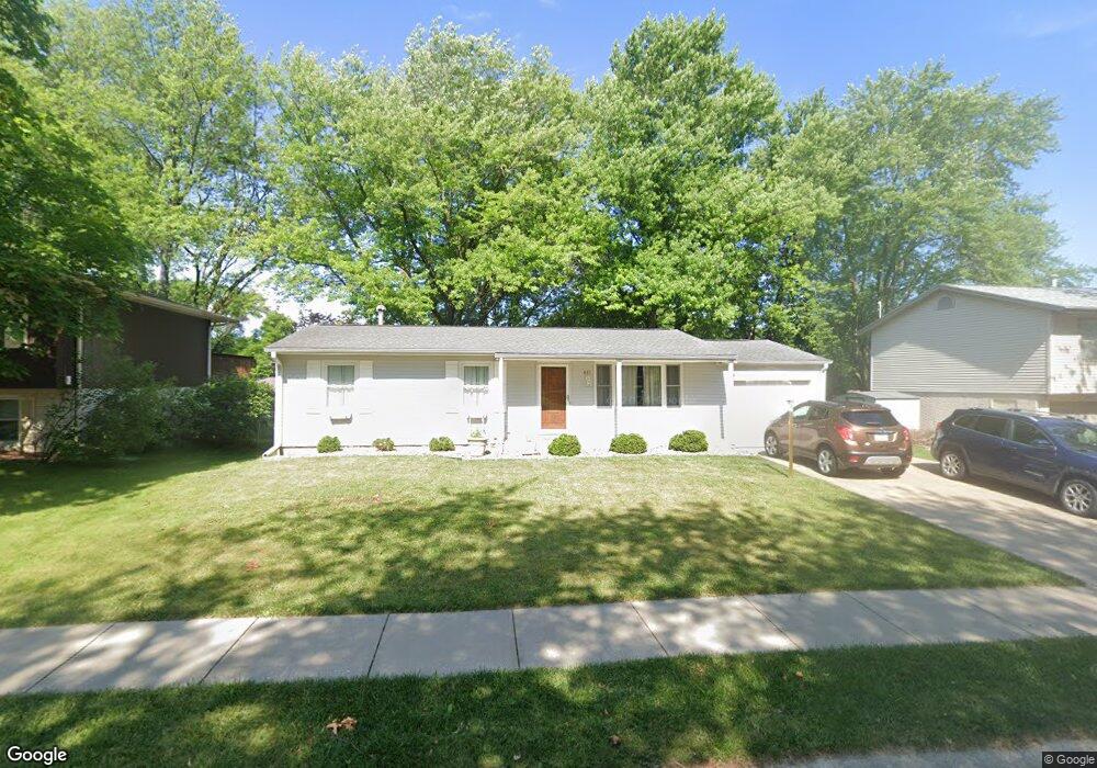
611 Wheaton Rd Iowa City, IA 52246
Estimated Value: $261,375 - $293,000
4
Beds
2
Baths
1,152
Sq Ft
$239/Sq Ft
Est. Value
About This Home
This home is located at 611 Wheaton Rd, Iowa City, IA 52246 and is currently estimated at $274,844, approximately $238 per square foot. 611 Wheaton Rd is a home located in Johnson County with nearby schools including Ernest Horn Elementary School, Northwest Junior High School, and West High School.
Ownership History
Date
Name
Owned For
Owner Type
Purchase Details
Closed on
Aug 18, 2022
Sold by
Braynard Roger C and Braynard Leslie C
Bought by
Rector Benjamin L
Current Estimated Value
Home Financials for this Owner
Home Financials are based on the most recent Mortgage that was taken out on this home.
Original Mortgage
$201,075
Outstanding Balance
$191,912
Interest Rate
5.3%
Mortgage Type
FHA
Estimated Equity
$82,932
Create a Home Valuation Report for This Property
The Home Valuation Report is an in-depth analysis detailing your home's value as well as a comparison with similar homes in the area
Home Values in the Area
Average Home Value in this Area
Purchase History
| Date | Buyer | Sale Price | Title Company |
|---|---|---|---|
| Rector Benjamin L | $230,000 | None Listed On Document |
Source: Public Records
Mortgage History
| Date | Status | Borrower | Loan Amount |
|---|---|---|---|
| Open | Rector Benjamin L | $201,075 |
Source: Public Records
Tax History Compared to Growth
Tax History
| Year | Tax Paid | Tax Assessment Tax Assessment Total Assessment is a certain percentage of the fair market value that is determined by local assessors to be the total taxable value of land and additions on the property. | Land | Improvement |
|---|---|---|---|---|
| 2025 | $4,422 | $254,130 | $60,740 | $193,390 |
| 2024 | $4,368 | $232,170 | $52,070 | $180,100 |
| 2023 | $3,856 | $232,170 | $52,070 | $180,100 |
| 2022 | $3,682 | $186,740 | $49,170 | $137,570 |
| 2021 | $3,736 | $186,740 | $49,170 | $137,570 |
| 2020 | $3,736 | $181,370 | $46,280 | $135,090 |
| 2019 | $3,506 | $181,370 | $46,280 | $135,090 |
| 2018 | $3,506 | $168,140 | $40,500 | $127,640 |
| 2017 | $3,466 | $168,140 | $40,500 | $127,640 |
| 2016 | $3,318 | $162,690 | $34,710 | $127,980 |
| 2015 | $3,318 | $162,690 | $34,710 | $127,980 |
| 2014 | $3,218 | $157,510 | $34,710 | $122,800 |
Source: Public Records
Map
Nearby Homes
- 1950 Calvin Ave
- 7 Westgate Cir
- 1848 W Benton St Unit 101
- 2314 Macbride Dr
- 1507 Oakcrest Ave
- 328 Koser Ave
- 556 Mahaska Ct
- 468 Samoa Dr Unit J4
- 500 Grandview Ct Unit 524
- 1 University Way Unit 201
- 463 Samoa Dr
- 2525 Sylvan Glen Ct
- 740 Westwinds Dr Unit 2
- 600 Grandview Ct Unit 618
- 808 Westwinds Dr Unit 5
- 1153 Cambria Ct
- 1207 Cambria Ct
- 1060 Jensen St
- 701-711 Westwinds Dr
- 2283 Cae Dr
- 617 Wheaton Rd
- 742 Keswick Dr
- 724 Keswick Dr
- 746 Keswick Dr
- 623 Wheaton Rd
- 618 Keswick Dr
- 612 Wheaton Rd
- 748 Keswick Dr
- 618 Wheaton Rd
- 629 Wheaton Rd
- 612 Keswick Dr
- 624 Wheaton Rd
- 754 Keswick Dr
- 705 Keswick Dr
- 711 Keswick Dr
- 623 Keswick Dr
- 705 Wheaton Rd
- 609 Westgate St
- 630 Wheaton Rd
- 617 Keswick Dr