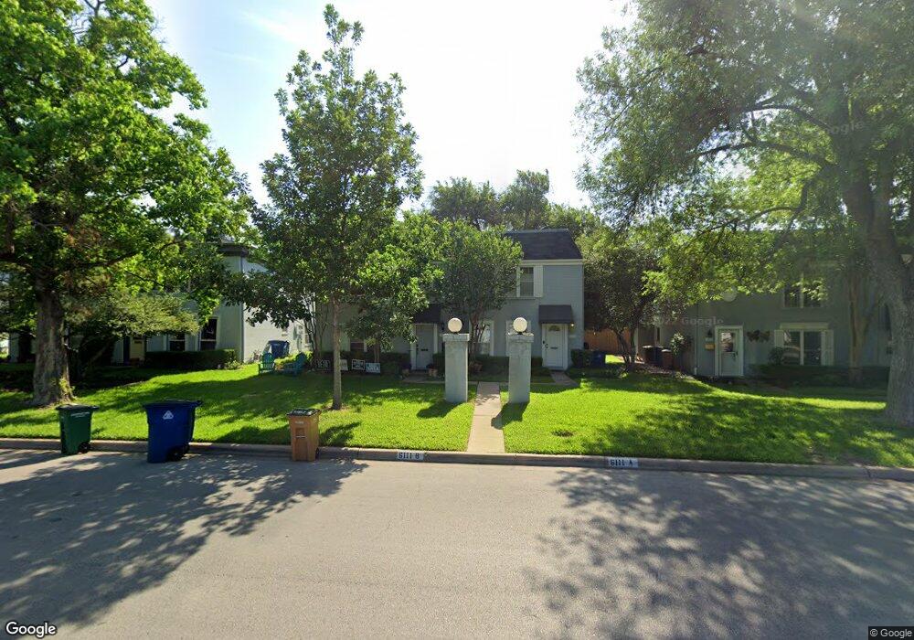
6111 Bullard Dr Unit 1 Austin, TX 78757
Allandale NeighborhoodEstimated Value: $469,317 - $659,000
--
Bed
--
Bath
1,551
Sq Ft
$349/Sq Ft
Est. Value
About This Home
This home is located at 6111 Bullard Dr Unit 1, Austin, TX 78757 and is currently estimated at $541,829, approximately $349 per square foot. 6111 Bullard Dr Unit 1 is a home located in Travis County with nearby schools including Gullett Elementary School, Lamar Middle School, and McCallum High School.
Ownership History
Date
Name
Owned For
Owner Type
Purchase Details
Closed on
Jun 23, 2014
Sold by
Ross Romie Leon and Ross Pamela Ann
Bought by
Jones Jeremy Ryan
Current Estimated Value
Home Financials for this Owner
Home Financials are based on the most recent Mortgage that was taken out on this home.
Original Mortgage
$248,000
Outstanding Balance
$189,130
Interest Rate
4.27%
Mortgage Type
New Conventional
Estimated Equity
$352,699
Purchase Details
Closed on
Jun 14, 2004
Sold by
Lindley Peggye J
Bought by
Ross Romie Leon and Ross Pamela Ann
Purchase Details
Closed on
Nov 8, 2002
Sold by
Wood Larry C and Wood Gay
Bought by
Borden Margaret
Home Financials for this Owner
Home Financials are based on the most recent Mortgage that was taken out on this home.
Original Mortgage
$95,000
Interest Rate
6%
Mortgage Type
Seller Take Back
Create a Home Valuation Report for This Property
The Home Valuation Report is an in-depth analysis detailing your home's value as well as a comparison with similar homes in the area
Home Values in the Area
Average Home Value in this Area
Purchase History
| Date | Buyer | Sale Price | Title Company |
|---|---|---|---|
| Jones Jeremy Ryan | -- | None Available | |
| Ross Romie Leon | -- | -- | |
| Borden Margaret | -- | -- |
Source: Public Records
Mortgage History
| Date | Status | Borrower | Loan Amount |
|---|---|---|---|
| Open | Jones Jeremy Ryan | $248,000 | |
| Previous Owner | Borden Margaret | $95,000 |
Source: Public Records
Tax History Compared to Growth
Tax History
| Year | Tax Paid | Tax Assessment Tax Assessment Total Assessment is a certain percentage of the fair market value that is determined by local assessors to be the total taxable value of land and additions on the property. | Land | Improvement |
|---|---|---|---|---|
| 2025 | $7,279 | $460,389 | $651 | $459,738 |
| 2023 | $5,968 | $416,833 | $0 | $0 |
| 2022 | $7,484 | $378,939 | $0 | $0 |
| 2021 | $7,498 | $344,490 | $65,080 | $279,410 |
| 2020 | $7,441 | $346,941 | $65,080 | $281,861 |
| 2018 | $6,862 | $309,923 | $65,080 | $244,843 |
| 2017 | $6,912 | $309,923 | $65,080 | $244,843 |
| 2016 | $6,498 | $291,361 | $65,080 | $226,281 |
| 2015 | $3,197 | $278,366 | $65,080 | $213,286 |
| 2014 | $3,197 | $236,500 | $0 | $0 |
Source: Public Records
Map
Nearby Homes
- 6306 Shoal Creek Dr W
- 5914 Fairlane Dr
- 6201 Cary Dr
- 6202 Nasco Dr
- 5904 Shoal Creek Blvd
- 6403 Nasco Dr
- 5908 Bull Creek Rd
- 5808 Marilyn Dr
- 5710 Marilyn Dr
- 2608 Twin Oaks Dr
- 5704 Susie Ct
- 6700 Vine St
- 2603 Park View Dr
- 5700 Louise Ln
- 2601 Park View Dr
- 5807 Woodview Ave
- 5702 Fairlane Dr
- 5903 Overlook Dr
- 6608 Jamaica Ct
- 5807 Shoalwood Ave
- 6111 Bullard Dr Unit B
- 6111 Bullard Dr Unit 2
- 6111 Bullard Dr Unit A
- 6113 Bullard Dr Unit 1
- 6113 Bullard Dr Unit 2
- 6113 Bullard Dr Unit A
- 6113 Bullard Dr Unit B
- 6109 Bullard Dr
- 6109A Bullard Dr
- 6109 Bullard Dr Unit 1
- 6109 Bullard Dr Unit 2
- 6109 Bullard Dr Unit A
- 6115 Bullard Dr Unit 1
- 6115 Bullard Dr Unit 2
- 6115 Bullard Dr Unit B
- 6115 Bullard Dr
- 6107 Bullard Dr Unit A
- 6107 Bullard Dr Unit 1
- 6107 Bullard Dr Unit 2
- 6117 Bullard Dr Unit 1