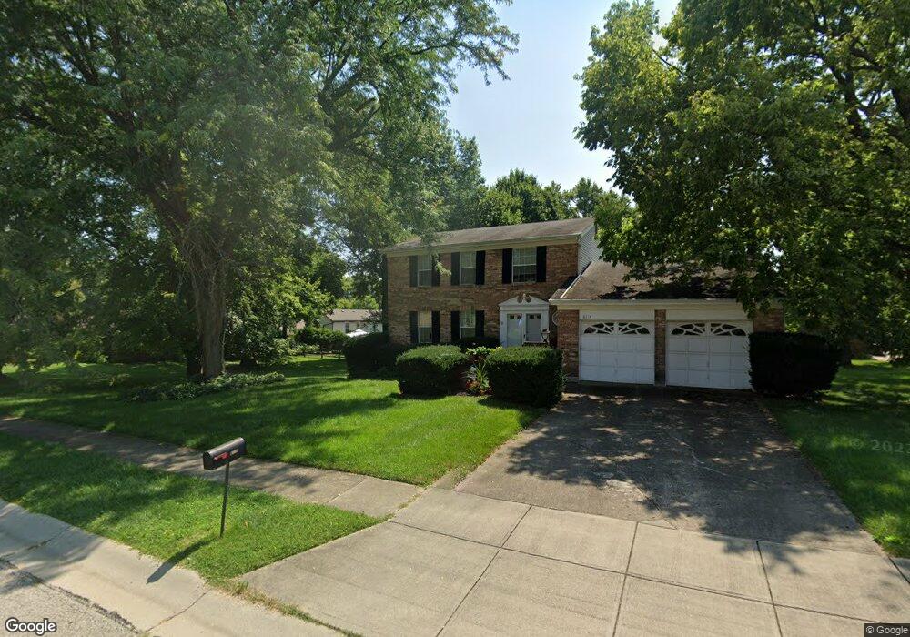
6114 Delcrest Dr Fairfield, OH 45014
Estimated Value: $339,952 - $369,000
4
Beds
3
Baths
1,966
Sq Ft
$180/Sq Ft
Est. Value
About This Home
This home is located at 6114 Delcrest Dr, Fairfield, OH 45014 and is currently estimated at $354,488, approximately $180 per square foot. 6114 Delcrest Dr is a home located in Butler County with nearby schools including Compass Elementary School, Creekside Middle School, and Fairfield Senior High School.
Ownership History
Date
Name
Owned For
Owner Type
Purchase Details
Closed on
Feb 2, 2022
Sold by
Emerick Michael B
Bought by
Emerick Michael B and Emerick Cheryl H
Current Estimated Value
Home Financials for this Owner
Home Financials are based on the most recent Mortgage that was taken out on this home.
Original Mortgage
$138,500
Outstanding Balance
$111,790
Interest Rate
3.56%
Mortgage Type
New Conventional
Estimated Equity
$242,698
Purchase Details
Closed on
Sep 30, 2005
Sold by
Arnold James G and Arnold Joyce A
Bought by
Emerick Michael
Home Financials for this Owner
Home Financials are based on the most recent Mortgage that was taken out on this home.
Original Mortgage
$180,000
Interest Rate
6.2%
Mortgage Type
Fannie Mae Freddie Mac
Create a Home Valuation Report for This Property
The Home Valuation Report is an in-depth analysis detailing your home's value as well as a comparison with similar homes in the area
Home Values in the Area
Average Home Value in this Area
Purchase History
| Date | Buyer | Sale Price | Title Company |
|---|---|---|---|
| Emerick Michael B | -- | Northwest Title Agency | |
| Emerick Michael | $180,000 | Custom Land Title Llc |
Source: Public Records
Mortgage History
| Date | Status | Borrower | Loan Amount |
|---|---|---|---|
| Open | Emerick Michael B | $138,500 | |
| Previous Owner | Emerick Michael | $180,000 |
Source: Public Records
Tax History Compared to Growth
Tax History
| Year | Tax Paid | Tax Assessment Tax Assessment Total Assessment is a certain percentage of the fair market value that is determined by local assessors to be the total taxable value of land and additions on the property. | Land | Improvement |
|---|---|---|---|---|
| 2024 | $3,297 | $91,720 | $14,400 | $77,320 |
| 2023 | $3,362 | $94,210 | $14,400 | $79,810 |
| 2022 | $3,073 | $66,140 | $14,400 | $51,740 |
| 2021 | $2,731 | $65,130 | $14,400 | $50,730 |
| 2020 | $2,841 | $65,130 | $14,400 | $50,730 |
| 2019 | $4,947 | $57,300 | $14,480 | $42,820 |
| 2018 | $2,840 | $57,300 | $14,480 | $42,820 |
| 2017 | $2,868 | $57,300 | $14,480 | $42,820 |
| 2016 | $2,781 | $52,910 | $14,480 | $38,430 |
| 2015 | $2,648 | $52,910 | $14,480 | $38,430 |
| 2014 | $2,519 | $52,910 | $14,480 | $38,430 |
| 2013 | $2,519 | $52,830 | $14,480 | $38,350 |
Source: Public Records
Map
Nearby Homes
- 3323 Devonian Dr
- 40 Applewood Dr Unit 40
- 48 Applewood Dr Unit 48
- 74 Applewood Dr
- 20 N Applewood Ct Unit 151
- 867 Yorkhaven Rd
- 12189 Kenn Rd
- 4 Old Duxbury Ct
- 19 Caribou Ct
- 58 Twin Lakes Dr
- 62 Twin Lakes Dr
- 992 Olde Station Ct
- 5890 Kay Dr
- 17 Springbok Dr
- 7 Darby Ct Unit 67
- 12069 Cantrell Dr
- 3745 Mack Rd
- 4 Shoal Meadows Ct
- 5985 Flaig Dr
- 4351 Whitmore Ln
- 6158 Delcrest Ct
- 6106 Delcrest Dr
- 6163 Stone Hill Dr
- 6166 Delcrest Ct
- 6113 Delcrest Dr
- 6119 Delcrest Dr
- 6153 Delcrest Ct
- 6107 Delcrest Dr
- 6171 Stone Hill Dr
- 6125 Delcrest Dr
- 6161 Delcrest Ct
- 6174 Delcrest Ct
- 6101 Delcrest Dr
- 6131 Delcrest Dr
- 6179 Stone Hill Dr
- 6167 Delcrest Ct
- 6135 Delcrest Dr
- 6152 Stone Hill Dr
- 6160 Stone Hill Dr
- 6142 Delcrest Dr