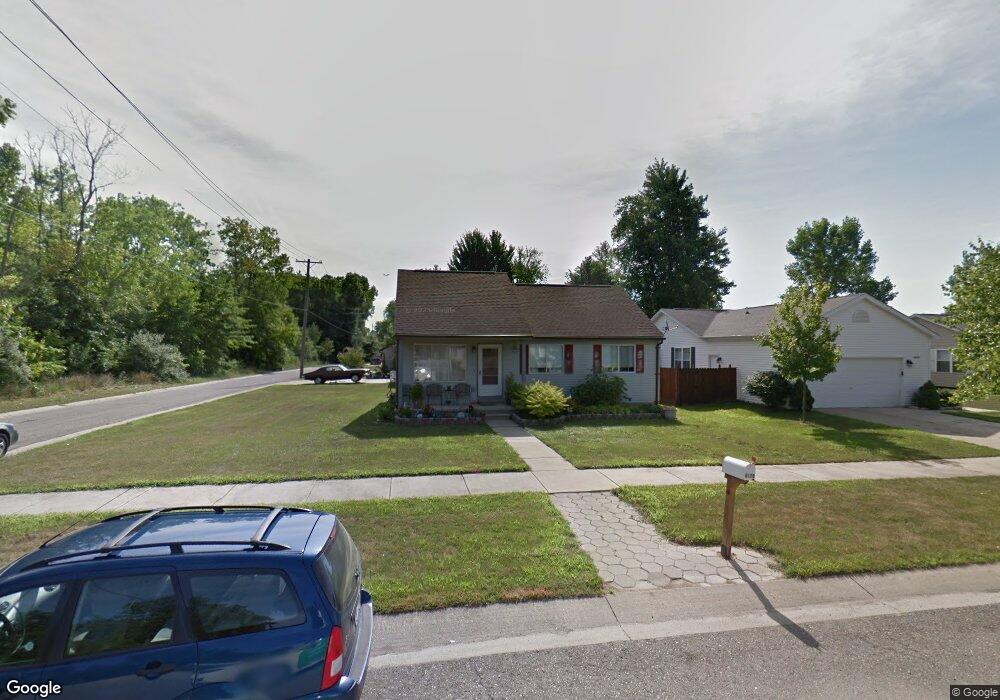
6119 Central St Romulus, MI 48174
Estimated Value: $158,000 - $257,000
3
Beds
2
Baths
1,024
Sq Ft
$211/Sq Ft
Est. Value
About This Home
This home is located at 6119 Central St, Romulus, MI 48174 and is currently estimated at $216,421, approximately $211 per square foot. 6119 Central St is a home located in Wayne County with nearby schools including Romulus Elementary School, Romulus Middle School, and Romulus Senior High School.
Ownership History
Date
Name
Owned For
Owner Type
Purchase Details
Closed on
Aug 31, 2009
Sold by
Donovan Shaun and Secretary Of Housing & Urban D
Bought by
Chambers Pamela
Current Estimated Value
Purchase Details
Closed on
Mar 20, 2007
Sold by
Countrywide Home Loans Inc
Bought by
Hud
Purchase Details
Closed on
Sep 13, 2006
Sold by
Jones Beverly
Bought by
Countrywide Home Loans Inc
Purchase Details
Closed on
Apr 4, 2003
Sold by
Billingslea Beverly Ann and Jones Beverly
Bought by
Billingslea Roy Leonard
Purchase Details
Closed on
Aug 6, 1996
Sold by
Lonnie Campbell
Bought by
Colman Daniel D and Colman Julie A
Create a Home Valuation Report for This Property
The Home Valuation Report is an in-depth analysis detailing your home's value as well as a comparison with similar homes in the area
Home Values in the Area
Average Home Value in this Area
Purchase History
| Date | Buyer | Sale Price | Title Company |
|---|---|---|---|
| Chambers Pamela | $14,700 | None Available | |
| Hud | -- | None Available | |
| Countrywide Home Loans Inc | $89,964 | None Available | |
| Billingslea Roy Leonard | -- | -- | |
| Colman Daniel D | $4,500 | -- |
Source: Public Records
Tax History
| Year | Tax Paid | Tax Assessment Tax Assessment Total Assessment is a certain percentage of the fair market value that is determined by local assessors to be the total taxable value of land and additions on the property. | Land | Improvement |
|---|---|---|---|---|
| 2025 | $1,969 | $123,700 | $0 | $0 |
| 2024 | $1,978 | $107,600 | $0 | $0 |
| 2023 | $1,891 | $95,700 | $0 | $0 |
| 2022 | $2,263 | $91,900 | $0 | $0 |
| 2021 | $2,187 | $83,000 | $0 | $0 |
| 2020 | $2,143 | $63,700 | $0 | $0 |
| 2019 | $2,148 | $60,900 | $0 | $0 |
| 2018 | $1,299 | $47,500 | $0 | $0 |
| 2017 | $1,031 | $47,000 | $0 | $0 |
| 2016 | $1,180 | $48,000 | $0 | $0 |
| 2015 | $2,408 | $38,600 | $0 | $0 |
| 2013 | $2,710 | $29,300 | $0 | $0 |
| 2012 | $765 | $28,800 | $5,300 | $23,500 |
Source: Public Records
Map
Nearby Homes
- 6040 Georgia Unit 225
- 5926 Esther St
- 29120 van Born Rd
- 6001 E Maple Unit 86
- 6005 Frederick St Unit 56
- 0 Hanover Blvd
- 29054 Currier Ave
- 6837 Middlebelt Rd
- 28919 Powers St
- POWERS Powers St
- 28176 Ecorse Rd
- 4675 Julius Blvd
- 29015 York St
- 27620 Newcastle St
- 6237 Inkster Rd
- 4331 Bridgeport Ct
- 30905 Beverly Rd
- 27658 Eton St
- 4332 Bridgeport Ct
- 4315 Isabelle St
- 6131 Central St
- 6153 Central St
- 6130 Loraine St
- 6114 Loraine St
- 6159 Central St
- 6120 Central St
- 6112 Central St
- 6138 Loraine St
- 6158 Loraine St
- 6140 Central St
- 6150 Central St
- 6168 Loraine St
- 6179 Central St
- 6129 Loraine St
- 6191 Central St
- 6117 Loraine St
- 6180 Central St
- 6170 Central St
- 6121 Hyde Park St
- 6190 Loraine St
Your Personal Tour Guide
Ask me questions while you tour the home.