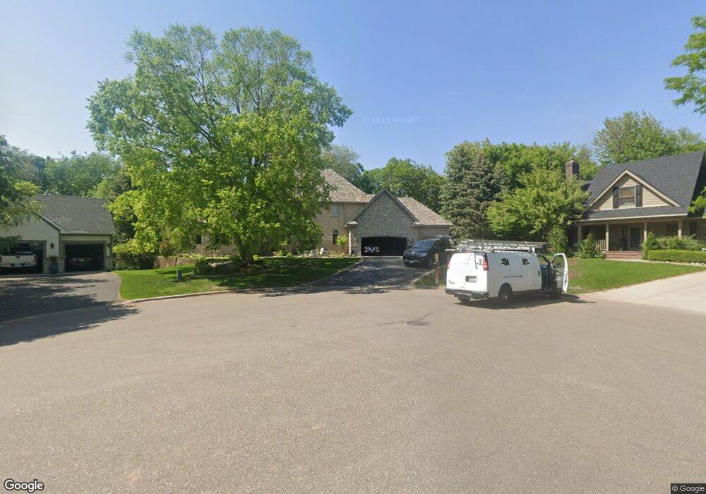
612 612 Highridge Cir Mendota Heights, MN 55118
Estimated Value: $983,000 - $1,332,000
4
Beds
5
Baths
3,770
Sq Ft
$305/Sq Ft
Est. Value
About This Home
This home is located at 612 612 Highridge Cir, Mendota Heights, MN 55118 and is currently estimated at $1,148,587, approximately $304 per square foot. 612 612 Highridge Cir is a home located in Dakota County with nearby schools including Somerset Elementary School, Heritage E-STEM Magnet School, and Two Rivers High School.
Ownership History
Date
Name
Owned For
Owner Type
Purchase Details
Closed on
Jul 23, 2010
Sold by
Mcmahon Richard A and Mcmahon Joann J
Bought by
Huntley Nathan P and Huntley Shannon M
Current Estimated Value
Home Financials for this Owner
Home Financials are based on the most recent Mortgage that was taken out on this home.
Original Mortgage
$417,000
Outstanding Balance
$276,825
Interest Rate
4.7%
Mortgage Type
New Conventional
Estimated Equity
$871,762
Create a Home Valuation Report for This Property
The Home Valuation Report is an in-depth analysis detailing your home's value as well as a comparison with similar homes in the area
Home Values in the Area
Average Home Value in this Area
Purchase History
| Date | Buyer | Sale Price | Title Company |
|---|---|---|---|
| Huntley Nathan P | $530,000 | -- |
Source: Public Records
Mortgage History
| Date | Status | Borrower | Loan Amount |
|---|---|---|---|
| Open | Huntley Nathan P | $417,000 |
Source: Public Records
Tax History Compared to Growth
Tax History
| Year | Tax Paid | Tax Assessment Tax Assessment Total Assessment is a certain percentage of the fair market value that is determined by local assessors to be the total taxable value of land and additions on the property. | Land | Improvement |
|---|---|---|---|---|
| 2024 | $12,010 | $1,125,500 | $217,200 | $908,300 |
| 2023 | $12,010 | $1,157,400 | $212,400 | $945,000 |
| 2022 | $10,878 | $1,171,000 | $211,900 | $959,100 |
| 2021 | $10,122 | $985,000 | $184,200 | $800,800 |
| 2020 | $9,412 | $911,500 | $175,500 | $736,000 |
| 2019 | $8,565 | $826,400 | $167,100 | $659,300 |
| 2018 | $8,234 | $726,000 | $156,100 | $569,900 |
| 2017 | $8,271 | $724,400 | $148,700 | $575,700 |
| 2016 | $8,380 | $705,600 | $141,600 | $564,000 |
| 2015 | $7,623 | $719,600 | $141,600 | $578,000 |
| 2014 | -- | $641,500 | $133,600 | $507,900 |
| 2013 | -- | $591,500 | $129,700 | $461,800 |
Source: Public Records
Map
Nearby Homes
- 1912 South Ln
- 485 Preserve Path
- 679 Marie Ave W
- 614 Hidden Creek Trail
- 1774 Dodd Rd
- 685 Hidden Creek Trail
- 1941 Dodd Rd
- 2122 Delaware Ave
- 600 Wentworth Ave
- 792 Hilltop Rd
- 2148 Delaware Ave
- 2194 Charlton Rd
- 795 Creek Ave
- 2222 Apache St
- 884 Marie Ave W
- 2012 Pine Ridge Dr
- 912 Crown Ct
- 1513 Smith Ave S
- 1860 Eagle Ridge Dr Unit W303
- 1620 Charlton St Unit 109
- 612 High Ridge Cir
- 608 High Ridge Cir
- 613 High Ridge Cir
- 604 High Ridge Cir
- 604 604 High Ridge Cir
- 1883 1883 Warrior Dr
- 1883 Warrior Dr
- 1910 Knob Rd
- 609 High Ridge Cir
- 605 High Ridge Cir
- 1920 Knob Rd
- 600 High Ridge Cir
- 585 High Ridge Cir
- 1875 Warrior Dr
- 1934 Knob Rd
- 1911 Knob Rd
- 596 High Ridge Cir
- 1867 Warrior Dr
- 1919 Knob Rd
- 1948 Knob Rd