Estimated Value: $136,950 - $167,000
3
Beds
1
Bath
1,000
Sq Ft
$148/Sq Ft
Est. Value
About This Home
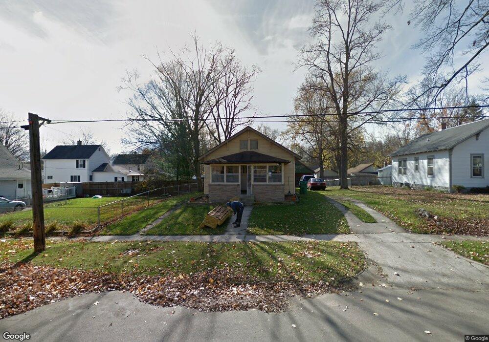
This home is located at 612 Clay St, Niles, MI 49120 and is currently estimated at $148,238, approximately $148 per square foot. 612 Clay St is a home located in Berrien County with nearby schools including Ballard Elementary School, Oak Manor Sixth Grade Center, and Ring Lardner Middle School.
Ownership History
Date
Name
Owned For
Owner Type
Purchase Details
Closed on
Jun 6, 2006
Sold by
Reed Roberta Ann and Buckle Donald Leroy
Bought by
Reed Robert
Current Estimated Value
Home Financials for this Owner
Home Financials are based on the most recent Mortgage that was taken out on this home.
Original Mortgage
$63,488
Outstanding Balance
$37,638
Interest Rate
6.72%
Mortgage Type
VA
Estimated Equity
$110,600
Purchase Details
Closed on
Jan 10, 2000
Create a Home Valuation Report for This Property
The Home Valuation Report is an in-depth analysis detailing your home's value as well as a comparison with similar homes in the area
Home Values in the Area
Average Home Value in this Area
Purchase History
| Date | Buyer | Sale Price | Title Company |
|---|---|---|---|
| Reed Robert | $62,000 | None Available | |
| -- | -- | -- |
Source: Public Records
Mortgage History
| Date | Status | Borrower | Loan Amount |
|---|---|---|---|
| Open | Reed Robert | $63,488 |
Source: Public Records
Tax History
| Year | Tax Paid | Tax Assessment Tax Assessment Total Assessment is a certain percentage of the fair market value that is determined by local assessors to be the total taxable value of land and additions on the property. | Land | Improvement |
|---|---|---|---|---|
| 2025 | $1,075 | $61,000 | $0 | $0 |
| 2024 | $835 | $56,700 | $0 | $0 |
| 2023 | $801 | $52,400 | $0 | $0 |
| 2022 | $763 | $38,700 | $0 | $0 |
| 2021 | $941 | $33,900 | $3,900 | $30,000 |
| 2020 | $931 | $35,000 | $0 | $0 |
| 2019 | $920 | $26,800 | $1,800 | $25,000 |
| 2018 | $889 | $26,800 | $0 | $0 |
| 2017 | $875 | $22,800 | $0 | $0 |
| 2016 | $975 | $25,800 | $0 | $0 |
| 2015 | $1,040 | $27,800 | $0 | $0 |
| 2014 | $810 | $27,600 | $0 | $0 |
Source: Public Records
Map
Nearby Homes
- 124 S State St
- 11 N Barrett St
- 211 S Street Joseph Ave
- 926 Birch St
- 117 N Fairview Ave
- V/L Wesaw Rd
- 220 Christiana Dr
- 319 S 5th St
- 316 N 5th St
- 1010 Tomahawk Ln
- 314 N 6th St
- 709 Regent St
- 1005 Winchester Ct
- 300 Carefree Ct
- Integrity 1610 Plan at Carefree Villas
- Integrity 1605 Plan at Carefree Villas
- Integrity 1250 Plan at Carefree Villas
- Integrity 1530 Plan at Carefree Villas
- 17 S 10th St
- 1008 Oak St