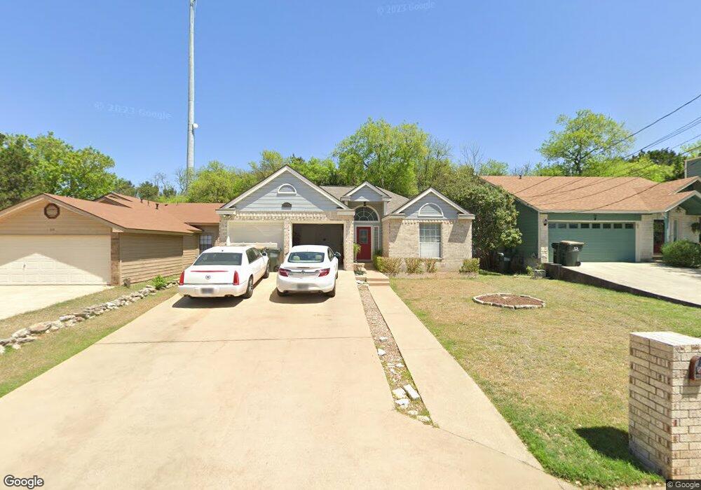
612 Clyde Ct San Marcos, TX 78666
Oak Heights NeighborhoodEstimated Value: $303,955 - $377,000
--
Bed
--
Bath
1,559
Sq Ft
$215/Sq Ft
Est. Value
About This Home
This home is located at 612 Clyde Ct, San Marcos, TX 78666 and is currently estimated at $334,489, approximately $214 per square foot. 612 Clyde Ct is a home located in Hays County with nearby schools including Crockett Elementary School, Dorris Miller Middle School, and San Marcos High School.
Ownership History
Date
Name
Owned For
Owner Type
Purchase Details
Closed on
Jan 24, 2022
Sold by
Edward Meyer Dean and Edward Ann Barbara
Bought by
Meyer Dean Edward and Meyer Dean Edward
Current Estimated Value
Purchase Details
Closed on
Jun 15, 2004
Sold by
Majors Carrie A
Bought by
Meyer Dean and Meyer Barbara
Home Financials for this Owner
Home Financials are based on the most recent Mortgage that was taken out on this home.
Original Mortgage
$109,000
Interest Rate
6.32%
Mortgage Type
Purchase Money Mortgage
Purchase Details
Closed on
Jun 5, 2000
Sold by
Majors Carrie A and Majors Gene
Bought by
Meyer Dean and Meyer Barbara
Purchase Details
Closed on
Aug 1, 1994
Sold by
Hadley James F
Bought by
Meyer Dean and Meyer Barbara
Create a Home Valuation Report for This Property
The Home Valuation Report is an in-depth analysis detailing your home's value as well as a comparison with similar homes in the area
Home Values in the Area
Average Home Value in this Area
Purchase History
| Date | Buyer | Sale Price | Title Company |
|---|---|---|---|
| Meyer Dean Edward | -- | None Listed On Document | |
| Meyer Dean | -- | -- | |
| Meyer Dean | -- | -- | |
| Meyer Dean | -- | -- |
Source: Public Records
Mortgage History
| Date | Status | Borrower | Loan Amount |
|---|---|---|---|
| Previous Owner | Meyer Dean | $109,000 |
Source: Public Records
Tax History Compared to Growth
Tax History
| Year | Tax Paid | Tax Assessment Tax Assessment Total Assessment is a certain percentage of the fair market value that is determined by local assessors to be the total taxable value of land and additions on the property. | Land | Improvement |
|---|---|---|---|---|
| 2025 | $2,365 | $344,110 | $56,450 | $287,660 |
| 2024 | $2,365 | $344,546 | $56,450 | $293,560 |
| 2023 | $5,958 | $313,224 | $56,450 | $310,570 |
| 2022 | $5,835 | $284,749 | $47,840 | $261,550 |
| 2021 | $5,706 | $258,863 | $43,240 | $215,650 |
| 2020 | $3,231 | $235,330 | $42,320 | $193,010 |
| 2019 | $5,639 | $229,070 | $42,320 | $186,750 |
| 2018 | $5,189 | $209,830 | $22,500 | $187,330 |
| 2017 | $4,710 | $195,910 | $20,000 | $179,650 |
| 2016 | $4,282 | $178,100 | $10,500 | $167,600 |
| 2015 | $2,735 | $168,240 | $10,500 | $157,740 |
Source: Public Records
Map
Nearby Homes
- 140 Coers Dr
- 1007 Earle St
- 1919 Castle Gate Cir
- 809-811 Perkins St
- 108 Dolly St
- 1108 Marlton St
- 2007 Castle Gate Cir
- 821 Old Ranch Road 12
- 1809 Pearce Ct
- 0 Old Ranch Road 12
- 1000 Advance #2 St
- 609 Chicago St
- 1000 Advance St
- 1837 Pearce Ct
- 1009 Advance St Unit 1011
- 1931 Lisa Ln
- 1102 Academy St
- 1805 Ramona Cir
- 813 Bracewood Cir
- 2003 Lisa Ln